Posts Tagged ‘sun’

Like the number 38 bus

Thursday, April 15th, 2010

You wait for years for decent winter conditions on a Wales meet, and then two come along at once. After January's excellent trip we headed back in March, this time to the Cwm Dyli hut, below Snowdon, and once again conditions were perfect.

On Saturday, several of us headed for Cwm Cneifion. Routes climbed include Clogwyn Du Right Hand Gully Direct (III 3 *), Tower Slabs (II/III *), and the magnificent Clogwyn Du Left Hand (IV 5 ***) – one of the best routes I've done this season. The others went walking in the Carneddau, intending to climb Broad Gully on Craig Lloer on the way – but due to low cloud, ended up climbing Hourglass Gully by mistake!

On Sunday, most people returned to Cwm Cneifion. Debra scared herself soloing Hidden Gully (II **) while Simon more sensibly chose Easy Route (I *). Peri and Julian did Clogwyn Du Right Hand Direct, and Rob and Will ticked the rest of the crag with Clogwyn Du Right Hand, Far Right Hand, and Farther Right Hand (what happened to farthest Right Hand?!) and finished with a descent of Hidden Gully.

Meanwhile Carmen was injured and didn't fancy hauling all the winter gear up the hill again, so we headed for Tremadog where we did Hail Bebe (VDiff **) and One Step in the Clouds (VS 4c ***) in glorious sunshine.

Our photos here.
Rob's here.
Debra's here.

New Year Meet 2009

Tuesday, January 12th, 2010

This year's new year trip was to the Alex Macintyre Hut, near Glencoe. A dozen of us made the journey north, and for once the snow didn't all melt the day before we arrived. Carmen and I drove up on Boxing Day, everyone else turned up a day or two later.

December 27. Sron na Lairig, grade II. Supposed to be an easy warm up day, but the deep snow put paid to that! The 4km walk in took a couple of hours, under grey skies with occasional snow flurries. The climb itself was trickier than expected, with no ice but loads of powder over rock with a little mostly frozen turf. A great mountaineering route, with some mildly terrifying pinnacles and an a cheval snow arete near the top, for which we roped up. The continuation to the summit took an age, as it was knee-deep snow all the way with little sign of any recent visitors, but also because the skies had cleared so we had to keep stopping to take photos. The summit too was deserted, nobody else had been that way all day despite its being a Munro. The descent was down the NE ridge, with its notorious bad step. Again, harder than expected – all possibilities looked too scary so in the end we abbed down the last section just as the last of the daylight disappeared. Luckily the full moon was bright enough to throw shadows as we continued along the ridge. We opted for an early descent into the valley, at a point where we could see there were no major crags to find a way round. It still took a good hour to cover the 1/2km to the bottom!

December 28. Definitely a short day this time, a walk up the twin Munros of Buachaille Etive Beag. We'd both done them before but not on as glorious day as this. Plenty of other people about (though most only did the main summit) so the paths were well trodden. Spectacular views in all directions, but especially of Bidean nam Bian and our previous day's route. Meanwhile, Alan and Nigel went for a long walk up Gulvain (near Glenfinnan), finishing long after dark.

December 29. Aonach Eagach (grade II/III). A winter traverse has been on my "to do" list for years, but every previous winter trip to Glencoe has been preceded by a massive thaw. Not so this year! Strong winds were forecast so it was without much optimism that Alan, Rich, Jenny, Carmen and I slogged up the hill. But somehow we managed to be sheltered along the whole ridge – Peter and Annie were on the other side of the valley and had trouble walking due to the wind (or was it the pies?), and Simon, Debra and Ben had a similar experience on Beinn an Dothaidh. It was worth the long wait for winter conditions, we had a magnificent day in clear cold conditions (between -6 and -8 along the ridge). Quick progress at first gradually slowed as we all started to tire, and the ropes came out to safe guard the pinnacled section. But we had passed the tricky bits before the sun set, all that remained was the ascent of the final Munro and the long descent in the dark back to the car we'd left at the Youth Hostel. 12 hours car-to-car, a great day.

December 30. Wild weather was forecast, and duly arrived. Ben and Nigel joined us for a short walk up Sgurr na' h-Eanchainne, a Corbett on the other side of the Corran Ferry. At least I thought it was a Corbett, but realised half way up it was actually a few metres short, so no ticks today, much to Nigel's disgust A nice little hill, with superb views across to the Glencoe hills and further north to Ben Nevis. Peter and Annie pushed their bikes round some snowy woods, I'm not sure about the others!

December 31. Expecting a sunny day, we plumped for the Ballachulish Horseshoe (Beinn a' Bheithir). The ascent up the NE ridge of Sgorr Bhan proved trickier than expected, and soon Carmen and I were on our own. Ben took a long detour round the awkward bit, hoping to meet us later, while Simon and Debra retreated to the nice warm hut. Sadly the forecast sun never arrived and we spent most of the day in the clag. We briefly considered heading back from the col between the Munros, but Ben had left his car at the far end so we pressed on. There was no sign of Ben, but not much sign of anything else either, so we decided not to wait. Navigation on the last section proved tricky, with undulating terrain and loads of identical small lochans, many not marked on the map. But eventually we emerged from the cloud, in roughly the right place. The final descent was a little more entertaining than hoped for, as we had to find a way in the dark round countless small outcrops and a couple of large cliffs, but we made it to the road and soon met Ben, who in best Annie style had bumped into an old friend on the hill and taken the descent from the col. I'm not sure what everyone else did – I think Annie and Peter went up Gulvain, but cheated by taking mountain bikes for the long approach.

New Years Eve. Preparation of the haggis supper was well under way, when suddenly we were plunged into darkness. The main fuse had blown! So we adjourned to a quiet and atmosphere-free Kings House for dinner before returning to the hut – where Nigel had nobly remained to organise an emergency electrician, so we had light in time for the customary new year falling asleep.

January 1. A return to the Beinn a' Bheithir for Carmen and me, this time for some ice climbing. Very slow going through deep powder with a hard crust which sometimes supported, and sometimes gave way. When we reached the north ridge of Sgorr Bhan we saw a small icefall and took the opportunity to stop for a rest and climb it. Nice easy climbing on fantastic ice, Carmen led straight up the middle for a good little 30m grade II. After this, some more crusty powder led to the main route of the day, Russian Roulette II/III. I say 'main' but it's only 50m high! Loads of ice, though more brittle than our first route, with lots of dinner-plating. Back to the sacks just as the last of the light disappeared, and the standard walk-out in the dark.

January 2. We decided on an easy day with a short walk in so went for a look at the Aonach Dubh cliffs on Bidean nam Bian. We didn't bother with a guidebook as we were just looking for some short easy angled ice to play on. Firstly we tried the Allt Coire nam Beithach but there was too much flowing water and not enough ice. Higher up though, there was loads of ice. A steep icy gully looked tempting but probably too hard, and there was a group of 3 just starting (we later found that this was Number 6 Gully, grade IV ***). So we went for an easy looking line of ice further right, which looked about grade II and one or two pitches. One minor epic and 3 pitches later, we reached the top – much steeper than it looked, the last pitch was vertical for a few metres! Harder than anything else we'd done, I reckoned about III/IV. Consulting the book later it turned out to be Squaddies Climb, grade II/III, only mildly humiliating – fun though.

A great week, in great weather – and it was just the beginning of a great winter!

Loads of photos here.
Peter's bike-pushing pictures here.
Debra's photos here.

RAB Mountain Marathon 2009

Wednesday, September 30th, 2009

The RAB Mountain Marathon this year was in the Howgills, probably my favourite area for running – steep-sided grass-covered hills, long flat valleys, and runnable almost everywhere. Since I'm now officially an old git, Carmen and I were in the Mixed Veterans class for the first time; Alan K has been an old git for several years, and was in the Male Veterans class again, running solo.

The event format is the same for all classes – you have a fixed time (6 hours on day 1, 5 on day 2 – the Elite have an extra hour each day) to accumulate as many points as possible, with controls worth between 5 and 40 points depending on difficulty and distance.

Saturday's weather was glorious. Mist in the valley bottoms to start the day, and clear blue skies above, sunny and warm but not too hot. Carmen and I spent a while working out a route, and decided to miss out a few low scorers near the start, to maximise the chances of having enough time to get to some of the more distant controls. And for once, it worked out well, and we managed to get one of the two 40-point controls and a couple of 30s, with enough spare time for a detour near the end to pick up an extra 15. We even managed to run for much of the day, normally we end up walking most of the time.

We finished the day with 7.5 minutes to spare, and 235 points – 3rd place in our class! (out of 27 starters). Only 5 points behind 2nd place, and another 5 behind 1st, and with a cushion of only 15 points above 4th, so it was all to play for. Alan meanwhile was 41st out of 83, much better than he'd expected.

The Saturday night camp was in a beautiful location, by the Cross Keys Temperance Inn near Cautley Spout. Those without scruples who'd brought some money with them queued for burger and chips at the inn, while those of us without scruples but less money made do with ice creams and/or coke before cracking open the pot noodles.

The next day also started with mist in the valleys, unfortunately we were in the valley, so it was chilly and damp. It soon cleared to give another dry day, but much cloudier than Saturday.

We tried to put the other teams out of our minds, and concentrated on finding another good route. We chose a high-risk option, heading away from the finish for the first couple of hours to collect a few high scorers, and hoping we'd be quick enough to get back within the 5 hours allowed. The outcome was still in doubt as we turned back south towards Sedbergh, and remained in doubt almost to the end, it was not until we left the penultimate control that we knew we'd finish in time and could start to relax. In the end, we had 12.5 minutes to spare.

190 points for the day, 425 overall. There followed a nervous wait for the final results…

And we'd finally done it! The overnight 1-2-3-4 had stayed the same, with 1 and 2 scoring 200, and 4 scoring 180 – our first (and probably last) mountain marathon podium finish! I'd like to thank my parents, Carmen's parents, my brother, his wife, their cats, the fishmonger in Wetherby <bursts into tears>…

Alan also had a good day, despite finishing 9 minutes late, and much to his surprise moved up to 35th, a good result.

Vital statistics:
Day 1. 33.5km, 1350m ascent, 5 hours 52 minutes 14 seconds
Day 2. 28km, 1100m ascent, 4 hours 47 minutes 31 seconds

More Photos

Saturday's route
Sunday's route

Results
Saturday splits
Sunday splits

Planetfear report

Missing out

Wednesday, August 12th, 2009

Once again most people apparently had better things to do. And for a while it seemed that they were all right, as we sat in the car at the top of the crag watching the rain bounce off the windscreen, while listening to the man on Radio 4 tell us that northern England was currently bright and sunny.

But we wandered down anyway, and found the crag itself remarkably dry, sheltered from the rain. Donal and Luke were already there, gearing up at the foot of Sidewinder, the best of the routes at the seldom-climbed-on left end of the crag. Everyone else was conspicuous by their absence!

I thought I'd try White Wall, an obscure Severe just to the left. Got a few metres up, retreated onto the Mod on the right to gain height to inspect what was coming up. Noted the complete lack of gear and holds on the overhanging wall, pencilled it in as a sandbag to be top-roped sometime, and wandered off to find another route now the rain had stopped and the evening brightened.

Due to a rope miscalculation (only a 45m half rope, when the shortest route is 22m and the belays mainly some way back – oops), Donal and Luke called it a day. So we climbed by ourselves in the evening sun (the rain stopped quickly), a glorious end to the day.

Photos courtesy of Donal!

Routes climbed:
Sidewinder – VDiff *
Wings – Severe **
Birdland Direct – MVS 4b *

And then there were two

Friday, August 7th, 2009

Most people were on holiday or working this week, so Carmen and I were the only two who managed to get to Wharncliffe yesterday for some evening climbing. For the first time in a few weeks, we enjoyed warm sunshine, with just about enough breeze to keep the midges in check.

Carmen started off with Himmelswillen (VS), an excellent route, and worth the drive on its own. Next I tackled Sidewinder (HS), a steep wall with small holds and not much protection. And finally, Carmen led YMCA Crack, a VDiff variation on Teufelsweg (and superior to the original).

The last route was climbed in near-darkness, and the walk back was only lit by the full moon where it managed to penetrate through the trees. As usual there was hardly anyone else at the crag – though there were a couple of teams still climbing when we walked out!

Challenging Bowland

Thursday, July 23rd, 2009

Bowland ChallengeOff to the Forest of Bowland last weekend to defend our title in the Bowland Challenge. The inspirationally named "Team YAC" (Alan K, Carmen, and me) spent 10 hours on Saturday running/walking/crawling round the hills north west of the Dales, covering about 31 miles/4600 feet ascent in the process. Amazingly it stayed dry all day, and even more amazingly, despite our best efforts in failing to find several of the controls, we managed to win.

Highlight of the day – rescuing a particularly stupid sheep who had managed to end up on its back and was waving its legs feebly in the air, unable to right itself, like a big woolly beetle.

A good fun event, open to both runners and walkers, next year I'll try to remember to circulate details in advance. Their website is here.

The view towards the lake District from Hutton RoofsThe next day Alan stuck with his plan to drive home and sit on a lounger watching golf. Meanwhile, Carmen and I abandoned our plan of climbing steep limestone at Trowbarrow, as I'd managed to strain a leg muscle. So instead we contented ourself with a bimble in the sun around Hutton Roofs – a 6/7m high limestone edge with about 80 routes, mainly below VS, we managed 15 of them. Not a crag to drive a long way for, but worthwhile if you're in the area (eg retreating from lake District rain) and fancy an easy day. UKC crag details here.

Below!

Wednesday, July 15th, 2009

Another large block joined the others at the foot of the crag. I moved up gingerly, reluctant to test the next handhold in case that too came off. "Below!" I decided to save my breath and only shout out when there wasn't any danger of rock fall. So everything went strangely silent.

Why was I here again?

After over 30 years of total neglect due to access problems (the landowners didn't want anyone climbing there, and the crag is in plain view of the farm in the valley below), Orgate Scar is finally open again. The left hand end of the crag is on Open Access land, and the BMC have managed to get agreement to climb on the rest from the start of February until the end of July each year.

The last guidebook talked of 'fine lines', and described it as a 'major crag'. So last Saturday, half a dozen intrepid explorers/gullible fools made the 90 minute journey to Marske, near Richmond. It's a 20 minute walk across sheep-grazed grassland to the crag, which is blessed with glorious views over lower Swaledale.

It took us a while to find our bearings, during which time Carmen and I climbed a loose unprotected Severe chimney, mistaking it for Chockstone Chimney (VDiff). By the time we got to the top, the others had found the real Chockstone Chimney, so we climbed that as well, finding it to be fairly solid and only Diff. The area around this route appeared to contain the greatest concentration of clean looking rock so we stayed put.

Several lines were climbed, most of them being on good quality rock, though with some vegetation and some loose sections, as you'd expect on an obscure crag that's been neglected for a few decades. In general, there was less vegetation than expected, and on the best lines probably less loose rock. But this was more than made up for on the chimney crack of Owake ('Severe')…

"Below!" I shouted again. Another head-sized rock had been dislodged by the rope, trailing uselessly below me via several pieces of imaginary protection. Luckily Carmen was belaying safely round the corner. I looked up again. The end was in sight, only a few feet above. And miracle of miracles – a short crack, both sides of which were firmly attached – some reliable protection! I carefully topped out (all the rock on the ground at the top was also unattached) and brought Carmen up.

A major crag? Well, no, not really. But a very good minor crag. Some fine lines? Certainly, the best routes could hold their own on any low-grade Yorkshire limestone crag. Some awful lines as well, but with one exception we managed to distinguish between them in advance! Grades were mostly roughly right, though a lot can change in 30 years so they shouldn't be relied on too much.

After initial misgivings as we arrived at the loosest most jungly end of the crag, I think everyone had a good time. I'd certainly go back, though I suspect that between us we did all the best routes.

Routes climbed:
Feather Light Flakes MVS 4b **
Gossamer Groove VS 4c **
Impede HS 4a *
Evel Knievel VS 5a *
Yo-Yo VD *
Chockstone Chimney HD
Jack the Gripper VDiff (VS 4c in the guide!)
Owake VS 4a bag of crumbly shite

More photos here and online guide here

Adventure with a capital 'W'

Wednesday, June 24th, 2009

It was a glorious sunny evening as a band of three intrepid explorers approached Whitestonecliffe. Abandoned by their more cautious comrades they had the entire crag to themselves, and as they abseiled down the descent gully into the jungle below, thoughts turned to which route to begin with.

Gauche perhaps – an unlikely looking VDiff up a steep wall, one of the best of its grade in the county. Or Frigg, a 2-star HS finishing on a hanging prow? Odin, a fine S 4b which supposedly contains a car jack as in situ protection? The Last Post or Clutcher, a pair of excellent VSs towards the left end of the crag? No, with the whole cliff to choose from, there could only be one choice.

er … Garbage Groove, Diff, described by the guidebook as "a serious undertaking due to loose rock … best avoided … the route’s name says it all". Yes, it was Simon's lead. A bold start led across an unprotected rock bridge above a gaping chasm, and into the bottom of a narrow chimney. The vultures circled overhead as our hero slowly made progress upwards in the full glare of the evening sun. But wait a minute – something was wrong. Where was the garbage? Where was the loose rock? Where was the general all-round grimness? The climbing was not too bad – in fact, it was actually rather good and the situations were remarkable for such a lowly grade.

The others followed. First was Carmen – verdict: "that was good, where was the loose rock?" Peter provided the answer as a crash announced the arrival of a large handhold at the foot of the crag. But that's normal for Peter, who also pronounced himself impressed by the route. Definitely one to do again.

What next? Surely it must be time for The Night Watch, either the best VS in Yorkshire, or the best HS in Yorkshire, depending on your point of view. But no, it was Peter's lead, and he wanted to do something different – he climbs The Night Watch on almost every visit to the Cliffe. So he decided on Confusion – a steep corner crack topped by an overhanging flake, which looked much harder than its published grade of Severe.

But Severe it was, as the holds kept on coming (and most of them stayed attached to the crag). With a short pause for some Epstein-leg, Peter was soon belly flopping into the undergrowth at the top of the route. The others followed, but without the belly flop. Another unsung gem.

By now the sun was low in the sky, but there was still time for another route. Rather than admitting defeat and retreating to the comfort of a familiar classic, Simon headed for Finesse, another never-climbed Severe near to Confusion. The midges were starting to come out now, and they were hungry. Very hungry. So he left the ground as quickly as possible, leaving his companions to fight off the ravenous hoard.

It would be nice to report a hat-trick of unknown high-quality lines, but it was not to be. A hard start was followed up a disintegrating crack line on some truly awful sandy rock, but with a nice bridging finish up an overhanging jamming crack. Peter was next to flee from the midges followed closely by Carmen. Not a bad route but not one to rush back to.

Overall, a tremendous evening. Sometimes ignoring guidebook advice and received wisdom can pay dividends, made all the better by its unexpectedness.

Standing Up, Falling Down

Tuesday, June 16th, 2009

Another sunny weekend, another obscure crag, though this time its one whose obscurity is entirely undeserved and hard to explain. Standing Stones, although dismissed as 'Falling Stones' some 50 years ago (before anyone had actually climbed there), is a short 15 minute walk from the road, faces south so gets all the sunshine going, and boasts many superb routes, mainly in the range Severe to E1, including possibly three of the best VSs in the Peak.

For many years you used to have to phone in advance to ask for permission to climb there. Not an issue, as permission was always granted, but I suppose it may have put people off. Otherwise, the only problem is the lack of belays at the top – they're there, but sometimes need a lot of searching for.

Anyway, after a gap of a few years (during which we tended to keep on walking past the crag, headed for the equally-good but north-facing and often-green Ravenstones), we were back. It was unusually busy when we got there – 4 other people – and there was a team on my intended warm-up route. So instead I led Guillotine, S 4b *, not a bad route though a bit vegetated at the top. Then my route was free, Smiler's Corner HS 4b, but it was Carmen's lead so she got it instead. An excellent line, worth 2 stars.

Next was Fairy Nuff (VS 4c ***), a contender for the best VS in the Peak. It didn't look too hard, but looks can be deceptive! Up to a roof, traverse left to the arete, up to a niche, big exposed step back right to a hanging arete, then up a crack in the arete to the top. Each section felt like the crux, but each was followed by another that was just as hard. Super stuff, took me ages, I was relieved when Carmen also had trouble with some of it (though of course breezed the bit that I found hardest).

Next it was Carmen's turn, Twin Crack Corner (VS 4b ***), given the 'top 50' accolade in the latest Rockfax guide. Excellent protection and sustained quality climbing, should be on every HS/VS leader's to-do list.

Now, after 4 fine routes on excellent quality rock, it was about time for some choss. So we wandered down the left end of the crag, where nobody ever goes. The intended route was covered with bits of rubble from a rockfall earlier this year, and a big rock seemed to be balanced precariously at the top. So instead, I went for Boo, a VDiff farther left, in an area which is omitted entirely from the Rockfax book. I wonder why. I'd actually intended climbing around here anyway at some point, due entirely for the fine selection of route names: Ning, Nang, Nong, Bong, and Boo.

Anyway, the bottom half of the route was vegetated rubbish. The top half turned out to be rather good, a constricted chimney pitch starting with a technical move out to a ledge on the arete, followed by either a safe tight squirm (my method on lead) or bold unprotected bridging up the outside (Carmen's method on the safe end of the rope!). Unfortunately, as I carefully avoided a large bit of rubble from the rockfall (so much for being out of the firing line) and topped out, it became clear that the pinnacle on which the route finished was in imminent danger of total collapse, the ground behind it being full of holes and ditches as the earth is gradually washed down the gully to the side. Mind you, it has been like this for at least 5 years – but it was still a little worrying and I'm not sure I'd recommend the route to anyone else!

The sun was now off the crag, and the gentle breeze dropped – result = midges. So we left.

More photos here.

Ran a LAMM A ding dong

Sunday, June 14th, 2009

This year's Lowe Alpine Mountain Marathon took place last weekend in Kintail. Several YAC members were there: Simon (jetlagged as usual) and Debra changed their minds after last year's "never again" and did the D course; Rob and Pete B tried the newly-introduced Score; James (on his first MM) with non-YACcer Chris went for C; while Carmen and I decided to put an end to 3 years of mid-table finishes on the B course, by aiming to finish 2nd-to-last in A.

Long range weather forecasts mid-week were talking about snow and gales by day, ground frosts by night, so it was with some trepidation we made our way north. Fresh snow on the Pennines by the A66 didn't bode well, nor did the torrential rain as we drove through Glencoe. But as we drew near, the clouds cleared, and we arrived in Morvich (near Shiel Bridge) on a fine evening, but cold enough to keep the midges away.

Next morning, expecting the worst, we rejected the planned shorts and T-shirts in favour of long trousers and thermal tops, but as start times approached it was still stubbornly dry. Everyone started from different places – Score from the event centre, C and D from the Cluanie Inn a few miles east, and the A from a minor road to the west.

The Elite and B classes also started to the east, so the A course was the only one to use the north and west of the map on Saturday. This meant that once the initial line of people had been spread out by different route choices and levels of fitness, we saw very few people all day, and most of those we did see were off in the distance. Our course took us over the hill and down to the end of the public road in Glen Elchaig, then a few miles up the glen before striking up the hill to the remote Corbett of Faochaig.
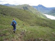
The next leg gave the option of a second Corbett, but we opted for the contouring option instead. The going was grassier and less steep than expected. "I thought we'd have loads of loose crags to negotiate," I said, no prizes for guessing what was round the next corner. We made it to the control fairly directly, a couple of other teams had descended 200m too far and were looking in the wrong place. So, feeling smug as we passed them slogging up the hill as we headed down, we made our way to the next control – down to the valley, over a small col, then an unnecessary wade over the river, crossing back again over a large bridge, working out we were in the wrong place, and getting to the control at the same time as the folk we'd sped past earlier. Oops.

Carmen was having problems at this point and couldn't go very fast. Or so she said, until we got to the last control when she did her normal trick of disappearing into the distance, sprinting to the finish and aiming (successfully) to overtake everyone in sight.
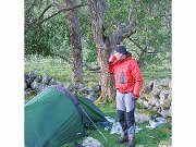
A great day out, mostly sunny with a few light rain showers, which fell as snow on Simon and Debra but not on us :). And a superb campsite at the end, totally midge-free, we even found a flat grassy area to pitch the tent on. All the other YACcers also reached the end several hours before dark, Rob and Pete even embarrassed themselves by lying 17th out of 90 (we were 29/36 in our class).

Reveille the next morning was at 5.15am courtesy of the traditional LAMM bagpiper, but for once it was neither pouring with rain nor alive with midges, so we could take our time over breakfast, sitting outside and enjoying the views.
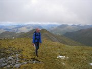
We set off at 7, and on picking up our control sheet found that today was going to be two thirds the length of Saturday, but with almost as much ascent. The route as far as the 2nd control was fairly straightforward. The next control was on the far side of Sgurr nan Ceathreanhnan, a Munro, and most people followed the ridge up all the way. We took a lower route, following a couple of streams up to a corrie below the ridge, which turned out to be quite a good choice as it followed an old stalker's path for much of the way. At one point I jumped out of my skin as there was a piercing screech from a few feet below me. It was Peri a young fawn, which made itself scarce as fast as it could – I didn't realise they could make that much noise!
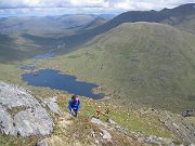
The summit of the Munro was in cloud, but we weren't going quite that high – instead we contoured below a subsidiary top, some 50m lower than the main summit – fortunately we'd already bagged it on a previous trip so were spared the choice between Munro-tick and speed!. We now got a good view of the next leg – right down to the valley bottom, then 650m up a ridge on the other side to the summit of Beinn Fhada. It seemed to go on forever, but only actually lasted an hour. A real Munro tick this time, but again, one we'd done already.

The next control was on a col low down on the NE ridge. Everyone else stayed high, following a scrambly ridge, before descending to the checkpoint. But we opted to descend immediately, following the normal walkers' route, and then contour round to the control. Based on other teams, I think our route was slightly quicker, but there wasn't a lot in it. It might have been a different matter if it was raining as the summit ridge of Beinn Fhada is notoriously slippery in the wet, but it was wall-to-wall sunshine for most of the day.

From here it was a quick descent down vertical bracken, then a run for a couple of miles along a track and a road to the finish. Unusually, we did better on the second day than the first, finishing 21st on the day, and 23rd overall so we were rather pleased. The other YACcers all did well too, though Rob and Pete failed in their bid to drop to 50th place.

A fantastic area, with perfect weather, and excellent courses. It was even fun at the time, not just in retrospect as it often is! The only thing wrong with it was the weather forecast, which (luckily) was well wide of the mark – though it was provided by David Braine of the BBC so maybe we shouldn't be too surprised 😉

Event details here, and photos here.