Posts Tagged ‘sun’

The Far North West

Friday, June 12th, 2009

Prior to the club meet in Glencoe over the Bank Holiday weekend, Carmen and I took a week off to explore the far north of Scotland.

It was pouring with horizontal rain for most of the journey, getting gradually worse the closer we got to our destination. So we decided we couldn't face camping, and stopped at the Craske Inn, a small hotel/pub/hill farm in the middle of nowhere. It's a great place, just 3 rooms, and bags of atmosphere, highly recommended. And the landlord/farmer, despite having been up there for 40 years, turns out to have been brought up in Malton!

Next day it was cloudy but expected to improve, so we went for Ben Klibreck (a Munro). The normal route seemed to have little to commend it, apart from being short, so we did a longer route from Altnaharra to the north. Altnaharra may be familiar from the weather forecasts in the middle of winter when it is often the coldest place in the UK. The sun did indeed arrive, and we had a great day with excellent views, loads of lapwings, and even more baby baa lambs. We took a detour to the east ridge where there was a surprisingly large monument to two airmen killed in a flying accident in the 1950s. Despite being a sunny Sunday we only met 3 people all day, all of them on the 'tourist route'.

After a very nice night camped by the road (the sort of road with grass up the middle), the next day we went for the other Munro in the area, Ben Hope. Again, this is usually climbed as a quick there-and-back from the road, and is often done in the same day as Klibreck, with a short drive in between. Again though we wanted to make a full day of it, so contoured round the hill to reach the north ridge. Once we'd left the tourist route behind, there was little sign that anyone else had ever been there, despite this being the finest way up the hill. A little easy scrambling and a deer-path up the fine grassy ridge was followed just below the summit by the 'bad step' , and easy-ish (about Diff) but dirty and extremely exposed 10m section. On my last visit, I was on my own, and bottled this bit in favour of a dirty gully off to the left. But this time we had a scrambling rope and a bit of gear, so were successful. Passing a handful of people on the summit we set off to the south-east (the tourist path goes south west), heading for the south ridge, but soon abandoned this plan as heavy rain arrived and sent us running down the normal route to the car.

We set up camp in the site at Durness, on the top of the cliffs overlooking sandy beaches, idyllic. Next day was forecast to be wet, so we took the ferry across to the bird sanctuary of Handa Island, where we wandered round taking photos of puffins. Not surprisingly, it was the sunniest day of the week, so when back on the mainland we took the opportunity to do a few climbs on roadside outcrops. Mostly fairly ordinary climbing in a stunning setting, but one in particular was superb, Updraught (Severe **) on Creag an Dubh Loch, overlooking Handa and the tiny port of Tarbet. There was no sign that anybody had ever been there before, let alone climbed the route.

After the usual dithering, we decided to have another mountain day after this, and went for Foinaven. This narrowly escaped being promoted to Munro status recently, but fortunately turned out to be a couple of metres too short, and so nobody ever goes there. A controversial new landrover track up the glen made for a quick if blemished approach, but it was still a couple of hours until we left the track and took to open country to approach the top of A' Ch'eir Ghorm. This is largely composed of scree, but has a series of relatively solid buttresses on one side, and our intended route was up one of these.

The guidebook offers three routes, at Mod, Diff, and VDiff, and the total description given is that there is a cairn at the foot of each route. We meant to do either the Diff or the Mod and so had left rock shoes behind in favour of climbing in walking boots. It took forever to cross the loose scree slope to reach the rock, and by this time, the increasingly threatening weather had unleashed some heavy showers, so the rock was dripping wet. We found what might have been the remains of one cairn, but there was no sign of any others – as it was probably several years since anyone else had been daft enough to come up here, they have probably merged into the scree by now. As we debated whether to head up into the unknown, another heavy shower intervened, and we headed back along the scree, where we opted for the easy-but-tortuous way up, a 300m 45-degree scree slope.

After admiring some spectacular rainbows, we headed along the shattered ridge, mostly bypassing some rather fragile pinnacles, and up into the cloud, where we stayed. We had to imagine the fine views, with steep scree falling either side of the ridge and even the vague hints of a path, as there was nowhere else to go. From the summit, we decided to miss the final top (the inside of one cloud being much the same as the inside of another), and headed down the seldom-visited NE ridge of Ganu Mor. I picked up a discarded sweet wrapper on the way, with a best before date of 25th December 2005.

After picking our way slowly down the craggy hillside to the Skye-like corrie of Glass-Choire Granda, we contoured to the next bealach before cutting across open lochan-studded moorland back to the car. A fine day on a fine hill, and plenty of failed plans to return for!

The next day we took things a bit easier, broke camp, and drove to Sheigra (near Sandwood Bay) for some sea-cliff climbing. A seriously good crag, with dozens on 3 and even 4-star routes at all grades from Diff to E-silly, but despite unbroken sunshine all day, there were no other climbers to be seen, just a handful of people walking their dogs. The need for abseil approaches limited us to just 4 routes.
Tall Paul *** Severe – fantastically exposed with huge holds
Flamingo *** Severe – a superb line up a pink ramp. Carmen led, and I narrowly missed being submerged by the incoming tide.
Shark Crack *** Hard Severe – unfeasibly overhanging for HS but with climbing-wall-sized holds in strange black crystalline rock
Blackjack ** Diff – a bit of a sandbag at the start, but a jugfest above.

Friday was our last day before the long drive south to Glencoe, and on the strength of an excellent forecast, planned on climbing the triple-Corbett mountain of Quinag. Sadly it was not to be, the rain was heavy and the cloud down to road level, but as we drove south conditions improved, and we stopped off to bag the Munro of Ben Wyvis. A newly built path was more like a staircase and took us quickly to 800m, from where a nice grassy ridge led to the summit. Everyone else we met just turned round at this point and retrace their steps, but we continued over a subsidiary top and down a pathless ridge before picking up a forestry track, and back to the car 4 hours after setting off.

We arrived at the hut half an hour before Nigel, and an hour before Margaret, in glorious sunshine – almost the last we saw until the drive home, 3 days later…

Lots more photos here

Kinder Lingers

Thursday, June 4th, 2009

A belay with a viewI've been meaning to climb at the Kinder Downfall area ever since I saw the photo of Zig Zag in On Peak Rock some 15 years ago. other than a quick scramble up the downfall itself, circumstances (normally in the form of rain) have always conspired to thwart my plans, until last weekend when we finally made the 90 minute walk from Snake Pass.

It was hot and sunny with a gentle breeze gale to keep the midges away as we eventually reached the crag. Zig Zag (VDiff ***) was out of the sun and in the wind, so extra layers were donned and Carmen quickly reached the top – the route has more jugs per metre than any other route I've done! Somehow it was both shorter and less exposed than it appears in the photos, but the climbing is all superb.

The Mermaid's Ridge pitch 2As we descended we noticed we were no longer alone – some-one was abbing down near our intended next route, Great Chimney (HS 4b ***). Bloody top-roping punters, they get everywhere, trust our luck to have to queue at a crag nobody ever goes to. It soon became clear that this particular top-roping punter was Sam Whittaker cleaning a death-on-a-stick Last Great Problem, so we had our route to ourselves. A tricky route (ie I made a fist of it) but got to the top successfully in the end, muttering about sandbags. Briefly watched the LGP (quick progress was being made, I half expected to read the UKC headlines that evening reporting a successful lead, but nothing yet) before wandering off to the next buttress.

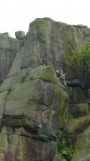
Here we did The Mermaid's Ridge, a 2-pitch HS (or VS in Rockfax) 4b, 4c *** – I led both pitches, and each was worth 3 stars in its own right. Worth the long walk just for this one route.

Final destination in our brief tour was Kinder Upper Western Buttress. Carmen led South Wall (VDiff **), likened in the guidebook to Heaven Crack at Stanage – a very pleasant route but a bit short. It was getting late by now so I abandoned thoughts of Extinguisher Chimney (VS 4c ***) and decided to have a quick look at Spike Chimney (Diff **). But as we approached, a peregrine appeared noisily from the adjacent chimney and flew round screeching wildly.

Sensing that perhaps we weren't welcome, we packed up and after a quick solo of another Diff out of harm's way, went home.

A great place to go, I'll try to arrange a club trip over the summer.

More photos here

Ilkley

Tuesday, June 2nd, 2009

The Flake ClimbKeen to make the most of the warm sunny weather before it finished, this week's plan was to head for Ilkley and the north-facing Rocky Valley. In the event only 4 of us made the trip, but were rewarded with some excellent conditions.

It's a few years since I last climbed in Rocky Valley, I've been put off by the polish and the midges. The polish was still there (once upon a time it must have been a popular venue), but a gentle breeze meant that the midges were not. Instead there was sunshine, beautiful views, the sound of birdsong, and an almost total absence of climbers. Later on we did a route in the quarry, were there was litter, no views, dozens of pigeons, and queues for routes – but despite this I'm rather fond of the place.

Routes climbed ranged from the distinctly average (Holly Tree Route, Diff, no stars) to the superb (Illegitimate Crack, VS, ***), though the baby pigeon sat in the nest half way up the latter looked distinctly unimpressed.

Hey, mister, there's a path round the backOther routes climbed:
Black Chimney, Diff, *
Long Chimney, Diff, **
Long Chimney Direct, HVD, **
Three Slabs Route, MS, **
The Flake Climb, S 4a, ***
Bogey Wall, VS 5a, **
Walker's Hangover, HVS 5a, ***

and in the quarry
Josephine Direct, HS 4b, **

GL3D Lakeland Challenge

Thursday, May 7th, 2009

The Great Lakeland 3 Day is a three-day run in the hills, covering a total of about 80 miles and a squillion feet of ascent. After 2 previous attempts (one successful, the other less so), we were back for our third go.

This year we started in Braithwaite near Keswick. After an excellent Last Meal in the Middle Ruddings Inn on Friday evening, we were up bright and early the next morning, raring to go. Ahem.

After a gentle start along a pleasant footpath, it was uphill all the way via Grisedale Pike to the first control on Hopegill Head. We rejected the undulating ridge of Whiteside due to its extra ascent and instead headed steeply downhill into the valley – possibly a mistake as we ended up wading through thick heather, but with a bit more luck/judgement we'd have found a grassy way down. This took us eventually to the second control, north of Crummock Water.

Next up the rarely visited valley of Mosedale to what looked from a quick glance at the map like a small hill, Hen Comb. Appearances can be deceptive, despite its modest 509m height, it was a long way up!

From here, a long rising traverse took us to the High Stile ridge, and a control on High Crag from where we had good views of climbers on Grey Crag – in the sun and out of the cold wind it looked like an excellent crag choice. A nice scree run into Ennerdale (not yet run out as hardly anyone goes this way) led us towards the next control on Steeple on the other side. Most people apparently followed a forestry track to pick up a footpath at the foot of the north ridge. But the map we were using didn't have the footpath marked, so we attempted to traverse up by the edge of the forestry plantation to climb onto the ridge from near Mirk Cove on its eastern flank. I say 'attempted', as we managed to miss the edge of the forest and ended up fighting through dense conifers for a couple of hundred interminable metres. Despite this, I think it was a good route choice – but could have been a lot better with more care! The corrie itself was an impressive place, and would repay a longer visit, there looked to be some good scrambling possibilities.

The rest of the day was relatively uneventful, with a final slog up Seatallan before a descent down the beautiful valley by Nether Beck to an idyllic camping spot in a field on the shores of Wastwater. A splendid sunny day, despite the cold wind at times, and with beer available courtesy of Joe, plus the luxury of a few spare hours before sunset, a perfect end to the day.

A rainy night followed, and so we were expecting a damp day to follow, but the next morning the rain stopped, the clouds thinned, and the sun appeared.

No gentle start today, with the first control on the summit of Yewbarrow, 550m above us. From here, we followed the ridge up and along to Pillar for control number 2, accompanied by patchy sunshine, a bitterly cold wind, and occasional hail showers.

The next control was a loooong way away, on the summit of Great End. But at least we had the luxury of a relatively flat few miles as we traversed round the side of Kirk Fell, followed by the climbers' traverse past Napes Needle on Great Gable – a few hardy climbers were out despite the cold wind. The flat section ended abruptly at Esk Hause, with a steep 450m ascent up The Band ridge on Great End. For some reason hardly anyone ever goes up this way, and there was not much path to speak of, but in different circumstances it would make a fine way to the top.

From the summit we had a good view of some heavy hail falling over Glaramara, where we were headed next – for once it paid to be fairly slow, the hail had disappeared by the time we arrived. As indeed had the control marker – we spent a good 20 minutes looking for it until 2 others arrived and confirmed that it wasn't there. Oh well, at least it gave us the chance to stop for a while 🙂

A descent across complex terrain (luckily with good visibility) into Langstrath, was followed by the day's sting in the tail, an unrelenting 550m slog up Ullscarth. We couldn't face losing too much height again after this, so rather than take the direct down-then-up route to the final control on Steel Fell, we went for a longer-but-gentler line, traversing the head of the valley around the aptly named "The Bog". All that remained was a pleasant (though knee-wrackingly steep) descent down the ridge to the campsite at Steel End.

Another fine site with the chance to chill out with some beers. But the forecast for the next day was poor, and the day expected to be long, so we were in our sleeping bags before dark.

Having been kept awake for half the night by the strengthening wind and rain, I managed of course to fall into a deep sleep moments before being woken by the alarm at 4.45am. One of the hardest parts of the day followed, namely getting out of a warm dry tent into a cold wet and windy outdoors. After a bit of packing and faffing we finally set off at 6.25.

The first control was a pig – the summit of Helvellyn – made worse by the fact that the second control was by the side of Thirlmere, just a couple of miles along the shore from our start point! The ascent was warm and muggy (or as warm and muggy as it gets at 7am) but the summit was very, very cold, so we ran down as fast as we could. 1 hour 35 minutes up, 35 minutes down again, and we were back where we started.

The next path was visible directly across the lake, but to get there we had to walk all way round the shore. At least it was flat! Which is more than can be said for the ensuing 300m ascent up increasingly boggy ground to High Tove and across the watershed to Watendlath. There followed another of those bits that look simple on the map, but turn out not to be. Mainly in this case due to loss of concentration, I thought that every minor knoll and bump on Brund Fell was the summit, but as ever it turned out to be the steep craggy bit in the distance after all.

All the while the rain continued – it hardly stopped all day – while the wind gradually grew stronger.

Next down to Rosthwaite by a good direct line; feeling pleased with myself for finding it, I then let the side down with one of those brain waves that might work well, but rarely do.

The next control was on Robinson, on the other side of Dale Head. Instead of taking the obvious steep path straight up to Dale Head, we decided instead to head for Honister Pass, and then contour up the apparently grassy hillside to the col just before Robinson. The reasoning being that the weather was pretty foul so staying as low as possible for as long as possible could only be a good thing, even though the route was quite a mile or two longer.

The first part of the plan went well, though Honister Pass looked like it had the potential to become a morgue (OMM joke). However, the hillside that the map showed as grassy turned out to be an unbroken slate slag heap, and it quickly became obvious that it would be slow or impossible to find a way across. So we headed up Dale Head anyway, and then compounded my mistake as I attempted to traverse round the top of the hill instead of going to the summit; unfortunately I'd mis-set my altimeter and we ended up trying to traverse some 50 metres too low. At least we weren't competing against anyone else, just against ourselves – if our aim was to beat other people then we'd have given in before we started!

As expected, the weather on the ridge was 'exciting', and we had to fight to make any progress at all. So as soon as we reached the summit we fled as fast as possible down to the next control being at Newlands Hause. The end now started to feel close (even though it was still 6 miles away), as the last major ascent was out the way. A long traverse on sheep tracks above Sail Beck, up-and-over Sail Pass, then a final quick pull to the summit of Outerside was followed by a gentle descent back to Braithwaite and the finish.

All in all a truly excellent weekend (though it didn't always feel that way at the time!). Thanks as ever to Joe Faulkner and everyone else involved. As we battled through the rain on Monday morning I promised myself this would be the last time. But maybe I'll keep the May Day weekend free next year, just in case…

My photos are here.
Maps of our routes:
Day 1
Day 2
Day 3

Results and GL3D details

Vital Statistics. Distances were probably slightly longer than shown, and ascent figures slightly less:
Day 1. 24 miles, 8500 feet ascent, 8 hours 40 mins
Day 2. 21 miles, 8850 feet ascent, 9 hours 57 mins
Day 3. 27 miles, 9000 feet ascent, 9 hours 50 mins

Yet more sunshine

Sunday, April 26th, 2009

Luckily the rain will return tomorrow and put a stop to all this outdoor enjoyment nonsense.

Carmen races off at the startToday's sun was in the unlikely setting of some woodland east of Scunthorpe. The event was the Lincolnshire Bomber Long O, a 20km orienteering course, which was to serve as the final (and, indeed, the first) training for next weekend's GL3D.

Almost caught upWe were taken to the start by minibus, and made our way back via a long dog-leg of woodland. And very nice it all was too. Mostly native trees with their associated birdlife, and a complete lack of the brambles so often found in orienteering woods. It was all pretty runnable, the limiting factor being a lack of fitness and ability, but somehow we kept going. The water and (more important) banana provided at the last road crossing were vital in getting us to the end, I for one was running on empty for the last 20 minutes.

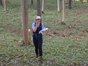
Always please to be photographedCarmen started 10 minutes before me, and it wasn't until the 10th control (out of 30) that I eventually passed and pulled away from her. I finished in 2 hours 22 minutes, which I was rather pleased with, despite being well down the field – the winner took an impossible 87 minutes! Carmen did rather better, taking 3 hours 12 minutes, which was only 15 minutes or so behind the fastest female.

Details/results/pictures can be found here.

more brimham sunshine

Wednesday, April 22nd, 2009

Simon Carmen Gordon Dave D me and Clare Usher all headed off to Brimham.  Spotted Gordon and Dave on the way in half way up Lovers Leap Chimney. Me and Clare headed for Pig Traverse which was good fun as always, however getting over there ate up time so after that we had just enough time left to run up Cracked Corner on the way back to the car.  Meanwhile Simon and Carmen, being iconoclasts as usual, had headed over towards Kangeroo Wall to do Bilberry Groove then followed up with a couple of routes on Turtle Rock and Dancing Bear. Felt great to be out on sunny grit again!

brimham sunshine

Wednesday, April 22nd, 2009

Donal and I made a (I'd like to say quick dash, but it took us ages to get there) trip to Brimham in the sunshine for our first outdoor grit experience tonight. Headed for a very dry and quiet Fag Slab and did the 4 easy classics in great conditions. Back to the car for 8.30 and still light.

roll on summer 🙂

The Raeburn Hut – New Year Meet 2008/9

Friday, January 16th, 2009

The raeburn HutWe did far too much for a detailed report (cue audible sighs of relief all round) so here's a summary. 

There was not much snow about, but temperatures were around freezing all week (usually well below) so the ground was frozen hard, with quite a bit of water ice, especially on paths and in the glens. A high pressure system was sat over us for the whole trip, giving mostly light winds and sunny skies. The main occasional problem was the low cloud that often came in from the east, except when it came from the west, so predicting the best direction to head in was largely down to luck. So we travelled east, west, north, and south, and occasionally stayed close to the hut. Overview on Google Maps.

Beinn a\' Chlachair from Geal CharnSaturday 27/12. Wall-to-wall sunshine for a round of the three Munros south of Loch Laggan – Creag Pitridh, Geal Charn, and Beinn a' Chlachair – with Rob. Good views of the clouds that obscured all hills east of Ben Alder, so a lucky choice of hills. Descended by the rarely visited SW ridge of Beinn a' Chlachair in order to stay in the sun for as long as possible. Route Map.

Ben AlderSunday 28/12. A big day. Cycled 8 miles from Dalwhinnie to Loch Pattack, then abandoned bikes for a walk up Ben Alder (via a scramble on the Long Leachas) and Beinn Bheoil (where we unexpectedly met 2 other walkers), before a long cycle out in the dark. Rather overcast for most of the day with the summits mainly in cloud, which made navigation across the Ben Alder plateau quite interesting. Route Map.

Beinn UdlamainMonday 29/12. A shorter day round the Munros west of Drumochter Pass. In the clag all day, with a bitterly cold wind.  Carmen only needed the first summit (Sgairneach Mhor), and I'd done them all before, but we made more of a day of it by carrying on to the next two (Beinn Udlamain and A' Mharconaich) before leaving Rob to add the fourth (another Geal Charn). Route Map.

The Lairig GhruTuesday 30/01. The forecast was for sun, and it didn't disappoint. We left the Whitewell carpark (near Aviemore) at 8.25, just before sunrise, and walked down Glen Einich with the intention of climbing just Braeriach. Conditions were so good when we reached the plateau that we added on Cairn Toul and Sgor an Lochain Uaine for good measure (narrowly missing heading south towards Monadh Mor by mistake!), finally reaching the summit of Braeriach at sunset. All that remained was a 7.5 mile walk out via the Lairig Ghru, most of it in the dark, arriving at the car at about 7.10. Total distance 22 miles. Arrived back at the hut to find that the water supply (ie burn) had frozen so there were no showers for the rest of the week. Joined the others in the pub. Route Map.

Brocken SpectreWednesday 31/01. Another forecast of sunshine. A 6.30 alarm call got us to Tulloch Station in time for the first train to Corrour, to do the 2 Munros SE of Loch Ossian (Sgor Gaibhre and Carn Dearg). Disappointingly cloudy for the long walk by the loch, with the hills obscured. But we walked up through the clag for the most magnificient inversion I can recall, peaks in all directions emerging from a sea of cloud. And it got even better on the last summit, with a series of Brocken Spectres added to the mix. It was a shame we had to descend back into the gloom to get the last train back. Route Map.

Crossing Markie BurnThursday 01/01. A late start after a late night, we set off to do Geal Charn (the one in the Monadhliath this time). We left Ben's car at Garva Bridge, and started walking from the Spey Dam. We walked up via Glen Markie (interesting river crossing, luckily the ice held!) and descended via Beinn Sgiath and the SW ridge. More clouds today, and no inversion. But we did find ourselves in a gap between layers, with clouds below us, and above us, and a view of cloud-draped summits in between. Route Map.

A\' ChailleachFriday 02/01. Carmen's final Monadhliath Munro, Sgurr Dearg. A cold mist in the valley, but sadly no inversion. However the clouds did clear gradually, giving superb views of the Cairngorms which were completely clear of cloud, and then the hills to the northwest, similarly bathed in sunshine. Our hills took a little longer to clear, but did so in time to decide to extend the day, following the old fence posts for a few miles to add the two easterly Munros (Carn Sgulain and A' Chailleach). Route Map.

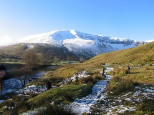
Loch QuoichSaturday 03/01. Decided to head northwest to get some of the sunshine they'd been enjoying for most of the week, so drove for 90 minutes to Loch Quoich, just south of Glen Shiel to climb Gleouraich and Spidean Mialach. Unfortunately this seemed to be just about the only part of Scotland that didn't get sunshine that day. But at least the cloud base was above the summits, so we got good views of the sunny hills elsewhere! The view up Loch Quoich towards Sgurr na Ciste is a contender for the finest in the country. Route Map.

Sunday 04/01. Cloudy with light snow. Drove home.

A tiring week, we kept waiting for the weather to break so we could have a rest day, but it stayed stubbornly fine. A total of 19 Munros in 8 days, and I even managed 6 that were new to me!

Lots more photos can be found here.

A short run in the Peak

Monday, December 8th, 2008

Today we got up at a stupid hour, not for once to race to the Lakes for the privilege of queuing to climb some falling down ice, but instead, to get to Bakewell in time for the final round of the Dark & White Mini Mountain Marathon league. We missed the first round, but won our class (mixed pairs) in the 2nd – and since the event is the best 2 scores out of 3, we had to win today to be certain of at least a share of the prize.

The event was moved at the last minute from Eyam to Bakewell, due to the loss of water supply to the original event centre. The revised area was all at a relatively low level with no access land involved, which meant sticking to rights of way and roads throughout. Nevertheless, there were many route options available, and though we stuck more-or-less to our original rough plan, we changed the details several times through the run.

The weather was fantastic once again – cloudless skies and frosty valleys, very cold in the shade or in any slight breeze, but pleasantly warm when in the sun. Unfortunately there were hardly any hills, which meant few excuses to slow our pace, so we ran far more than we'd intended (or are used to). One poor route choice at 2 hours in lost us a possible 15 points, but we made these up with 2 short detours later on, and finished in just 3 minutes over our alloted 3 hours 15 minutes, with a score of 207.

One young whippet had managed an incredible 305 points, only 15 short of the maximum possible (even with hindsight I can't work out a route to achieve this), but luckily he wasn't in our class. At the time we left, we were lying 2nd – the leaders got 240 points, but they hadn't entered the previous 2 events, so we were lying 1st overall. But the pair who'd won the first event were still out on the hill – would they beat 207? A nervous wait until the results are published early in the week…

Vital statistics: 25km, 550m ascent, 3 hours 18 minutes. This morning's challenge was walking downstairs.

Howgill stroll

Sunday, December 7th, 2008

great veiw to end the daySat was due to be a fine day with clear skies and reasonable temps, but Friday night was set for mucho wine so no hope of getting an alpine start for the Lakes. Much to our surprise Simon C suggested a civilised 9am start, and picking up Jules and I we headed into the snowy Dales. The drive to Cautley Spout is spectacular when the hills, though small, are snow capped.

Setting off on an icy path we sprinted across the bridge to beat the farmer driving his sheep in our direction. sheep  misbehaving

We needn't have hurried as the sheep were going through the river not over it! Well eventually they would, not before some serious water avoidance and many harsh words from the farmer and a few nips from the dogs.

A long pull up right eventually brings us (stripped down a bit) to the summit of Yarlside, and some indecision as to where to head. We choose to drop down into the valley then slog up towards Hazel Gill Knot.
The descent proves a tad faster for Jules as she slips then slides about 60m or so down the icy slope. Quite some feat as I couldn't slide more than a foot. Spreadeagled and head first seems to be the most effective for those interested in repeating the feat! down we go

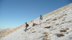
Once on top we scoffed cake in the windless sunshine with great views to the Lakes (picking out all the fells from Sharp Edge, Blea Water and High St, the Langdales, Bowfell, Scafell and Coniston hills).

A long slow trudge through the snow, thin crust and 6 inches of powder made it harder than it should have been, but the hordes had dissipated by the time we summited the Calf. The way down was to follow a fell runner's tracks in quite a level traverse across Bram Rigg Top and Calders and Great Drummocks before running down the snow fields and back to the car with a warm pink glow and great sunset.

What use is a temperance pub, especially when it's closed and it wasn't yet dark!

MAP:

View Larger Map

Streetmap / OS

Simon's Pictures

Rob's Pictures