Archive for the ‘Running’ Category

HPM Recce 3 – The Dark Side

Saturday, February 28th, 2009

Alan had a cunning plan. Take 2 cars, drop one off at Cut Throat Bridge, drive to Edale, and then do the first 12 miles of the HPM. An excellent idea, we all agreed.

One other minor detail – this was to happen after work on a Friday, so it wouldn't affect any other weekend plans. A good theory.

Will was one step ahead of us and arranged a prior engagement. So it was just Alan, Carmen and I who set off from Edale in the dark at 5 to 7 last night.

It was actually quite fun, though the fun abated slightly as we waded through the oozing "mud" thoughtfully provided by a field of cows on the approach to the first hill. The skies were clear though, and it was lighter than I'd expected, courtesy mainly of the City of Sheffield.

Hollins Cross and Lose Hill were fun (though a few tumbles left Alan reconsidering his decision to wear walking boots), and the going easy enough to allow some half-hearted running. It was made a bit trickier by the portable hill fog, as every breath was illuminated by our head torches. The ascent of Win Hill was brutally steep but fairly short, the descent from there to Yorkshire Bridge was steep, muddy, and unending.

Avoiding the temptation of a pint or 3 in the pub, it was up the road to Stanage. The path to High Neb is easier to follow in the daylight, and the climbs easier to identify! We missed High Neb slightly, but consulting the climbing guide later I'm fairly confident we'll find it on the night (I'll probably live to regret that statement). All that remained was a boggy yomp along the edge to Moscar, and back down the road to Cut Throat Bridge.

Last year's race times for this section were between 2 hours 10 minutes, and 4 hours 15. We had hoped to take about 3 hours, but took 4 hours 13 minutes. Oops. We consoled ourselves with the knowledge that we could have been faster if we'd run more, but on the event we'll need to conserve as much energy as possible for later on.

Got back home about 1.30am. So much for not affecting weekend plans, it's 6pm and I'm off for a snooze.

Less than a week to go…

Vital statistics: 11.5 miles, 980m ascent, 4 hours 13 minutes

Trial by name…

Monday, February 2nd, 2009

Yesterday at some stupid early hour, Carmen and I set off to Hayfield for the Kinder Trial, a fell runner's version of orienteering – lots of running with a bit of navigation.

We had to visit 10 controls in any order, though in practice the main choice was just whether to do the circuit clockwise or anti-clockwise. I went for the anti-clockwise option, as it would hopefully leave a long downhill run from the last control to the finish. Coincidentally, Carmen made the same choice, but I soon managed to shake her off so she had to make her own mistakes for most of the race rather than copying mine!

The weather stayed cold and cloudy, with regular snow flurries, but the clouds were well clear of the tops all day. Which was a shame, as it gave less advantage to those of us who can navigate OK but can't run for toffee (it's a well known fact that 98% of fell runners don't know what a map is). At least most of the boggy bits were well frozen.

It was mostly great fun (in an exhausting sort of way), and visited some parts of the Kinder area that people wouldn't normally see. The main exception to the 'great fun' rule being the planned easy run down from the last control, which by the route I choose mainly consisted for the first mile or so of deep exhausting heather. I'm told that there was a runnable route available if you looked in the run place. Arse.

There's a map of the route here.

And some photos here and here

Vital statistics:
about 11 miles/2600 feet ascent.
153 started, 136 finished.
The winning time was an amazing 1:49:28, the final finisher took 4:55:59. I was 67th in 2:46:17 and Carmen was 108th (20th female) in 3:34:12

HPM Episode 2 – Attack of the Bog Monster

Thursday, January 22nd, 2009

Another Saturday, another HPM recce. This time Alan couldn't come because his house had blown down (or something like that), but Will wasn't quick enough with the excuses. We dropped Will's car off at Snake Pass and drove back to Cut Throat Bridge to do the 17 mile section in between. We were having second thoughts as we drove up towards the pass in driving rain and hail, but somehow by the time we left the car, the clouds had gone and the sun was shining.

Conditions were very different from the week before, with the ice replaced by mud, but the sunshine made it feel like Spring, and we made good progress as far as Cut Gate. I even worked out where we'd gone wrong the previous week.

After that though it all went horribly wrong. We'd been up here before, in the Grin 'n' Bear It 2007, and I had memories of bogs. But it was all so much worse than I'd remembered, and any attempt to wade led to retreat through knee-deep quagmire, followed by lengthy detours to get round the boggy bits. And it didn't relent. Every time we began to think we might be past the worst, one of us inevitably started sinking. To make matters worse, the sun had gone behind threatening clouds and a cold winds had picked up. It took us about 3 hours to do the next 5 or 6 miles, but felt like eternity, as we collectively lost the will to live. Navigation up here is going to be a nightmare in the dark.

So bad were the bogs that the 2 miles of peat hags we encountered when we finally reached Bleaklow Stones came as a blessed relief. We even managed to find a path through this area (or at least, an almost continuous channel with a few cairns, footprints, and bleached bones of previous visitors). An hour later we reached the Pennine Way, just below the Wain Stones. A unanimous decision that we couldn't be bothered to go up the hill to find the location of the checkpoint, and we all ran down the PW flagstones towards Snake Pass.

17 miles, 6 hours 10 minutes. If we get through this bit in one piece on the night then we'll almost certainly get to the end! At least the rain held off until 10 minutes after we finally started the drive home.

High Peak Recce

Sunday, January 11th, 2009

Derwent EdgeLast November, a few of us (Alan, Will, Carmen and I) put a team together and applied for this year's High Peak Marathon, on the mistaken belief that we stood no chance of getting a place (it is always oversubscribed by at least 300%). Sadly our hopes were cruelly dashed last December when we were told that we were in. 40 miles of the finest peat hags our country can offer, starting at 11.30pm on a Friday night in March – should be a doddle.

This weekend, we'd hoped to head for the Lakes for some winter fun before the ice melted, but having established that we were a day too late, we switched at the last minute and decided to investigate part of the HPM route. Will and Alan were both busy due to the complete lack of notice, so it was just the two of us. After a lazy start, we parked at Cut Throat Bridge at about 12.30.

We took a cross-country route to get onto the Edge, to check whether it would be feasible in the dark (it should be). Progress was then rapid for a few miles, courtesy of a paved path for most of the way. After Lost Lad the route leads down to a checkpoint by Abbey Brook (not sure why the route doesn't follow the watershed here, possibly conservation problems, or a vastly increased chance of getting totally lost!)

The next section heads back uphill and regains the watershed. We managed to lose the path at this point, which doesn't bode well for doing it in the dark! A short flat and featureless section follows before we picked up a good path again towards Margery Hill and then Cut Gate, and since it was by now almost 3pm we decided to call it a day and descend to the valley, where we followed a forestry/water board track back. This was rather further than it looks, and hard on the joints as it's effectively road running for most of its length, luckily we won't have to do this on the day.

Got back to Cut Throat Bridge just before 5.30. About 17 miles round trip, and quite fun (except for the valley bit) despite the bitterly cold wind.

Here's the route we took.

A short run in the Peak

Monday, December 8th, 2008

Today we got up at a stupid hour, not for once to race to the Lakes for the privilege of queuing to climb some falling down ice, but instead, to get to Bakewell in time for the final round of the Dark & White Mini Mountain Marathon league. We missed the first round, but won our class (mixed pairs) in the 2nd – and since the event is the best 2 scores out of 3, we had to win today to be certain of at least a share of the prize.

The event was moved at the last minute from Eyam to Bakewell, due to the loss of water supply to the original event centre. The revised area was all at a relatively low level with no access land involved, which meant sticking to rights of way and roads throughout. Nevertheless, there were many route options available, and though we stuck more-or-less to our original rough plan, we changed the details several times through the run.

The weather was fantastic once again – cloudless skies and frosty valleys, very cold in the shade or in any slight breeze, but pleasantly warm when in the sun. Unfortunately there were hardly any hills, which meant few excuses to slow our pace, so we ran far more than we'd intended (or are used to). One poor route choice at 2 hours in lost us a possible 15 points, but we made these up with 2 short detours later on, and finished in just 3 minutes over our alloted 3 hours 15 minutes, with a score of 207.

One young whippet had managed an incredible 305 points, only 15 short of the maximum possible (even with hindsight I can't work out a route to achieve this), but luckily he wasn't in our class. At the time we left, we were lying 2nd – the leaders got 240 points, but they hadn't entered the previous 2 events, so we were lying 1st overall. But the pair who'd won the first event were still out on the hill – would they beat 207? A nervous wait until the results are published early in the week…

Vital statistics: 25km, 550m ascent, 3 hours 18 minutes. This morning's challenge was walking downstairs.

The Langdale Horseshoe

Monday, November 24th, 2008

Ascending Lingmoor FellThe forecast was for clear blue skies with excellent visiblility, so Carmen and I decided to make the most of it with a 'run' (of the 95% walking variety) round the Langdale Horseshoe. The classic fell race covers 14 miles with about 5000 feet of ascent, with the record standing at a few minutes short of 2 hours. We wanted a longer day than that though, so added in a couple of extra summits to give a round of 19 miles/7300 feet ascent (I didn't measure this until afterwards or it's likely we'd have thought better of it!).

Pike o\' Blisco and Crinkle Crags from Silver HoweSo, we were up at the crack of dawn (7.05), and a mere hour and 20 minutes of faffing later, we set off. The promised clear blue skies were hidden behind high cloud, which lowered occasionally over the highest tops to leave a light covering of snow. The ascent started over the road from the hut, and 1000 feet of steep climbing later we reached the summit of Lingmoor Fell. From here, an easy path down into Elterwater was duly missed, and instead we opted for a slow steep route down scree and short vegetated crags to the valley.

Jack\'s RakeOver the road and time for another steep climb up to Silver Howe. From here the route undulated a lot, with much descent and reascent, but spread out over a few miles so it never felt too hard. An hour later we reached the foot of Pavey Ark, and the first people of the day, a nose-to-tail line of red and blue jackets leading off up Jack's Rake. After a short food stop (very short due to frozen toes), we followed up the rake, pausing for a few words with Peri and David who had taken the direct route from the hut.

Langdale Pikes and Bowfell from the ascent of Esk PikeOnwards over all the Langdale Pikes, then a long marshy descent to Stake Pass – the constant sub-zero temperatures had not been enough to solidify the bogs – and on to Angle Tarn in an increasingly bitter northerly wind (temperatures falling below -5). This section was one of the few that we actually ran rather than walked, icy water is slightly less unpleasant if negotiated quickly.

From here it was a choice between Plan A – Esk Hause and back over Esk Pike to Ore Gap – or Plan B – a shorter but steeper route straight up to Ore Gap. "Plan A" said Carmen, who was using a different naming convention and thought she was voting for the shorter route, but by the time she realised it was too late.

Descent from Crinkle CragsAs we crossed Bowfell the crowds reappeared, but they were mostly headed down to the valley again as we started the ascent of Crinkle Crags. Just before the Bad Step we met Rob, Cef, Simon & Debra, who had been doing various scrambly walky things on Bowfell. Another short run down to Red Tarn was followed by a long crawl up Pike o' Blisco, from where we again avoided the obvious track and followed instead the pathless ridge down to the north, emerging near Blea Tarn before a final short section of road back to the hut. Where we found ourselves in the unusually situation of being first back. Note to self: in future, find out where the key is going to be left before setting off…

Sunday morning view from the hutSunday dawned snowy and blowy, and after the standard dithering, we opted for a short walk from the top of Wrynose Pass up Great Carrs, Swirl How, and Wetherlam.  About 4 miles, and 3000 feet of ascent, but Saturday had taken its toll and we limped round in 4 1/4 hours.

Lots more photos here

Armchair orienteering

Tuesday, November 4th, 2008

With the prospect of bad weather and a poor night's sleep on the Friday night before the OMM, Rob secured us a room at Chez Julie over near Cockermouth, along with John Byrne and Pete Wright. Friday morning dawned too early for the drive over to the site. All went well until the queuing traffic at Seatoller. A quick repack of gear (more substantial tent) and we arrived at the start with 2 minutes to spare (to be honest, this is the most time we've spent at an OMM start line!).

There wasn't really a lot of route choice for us 'not so fast' teams, so we planned for some early points up above the start, then a route through the no-mans-land in middle to bag some controls on the way to the finish. Rob stormed ahead on the first hill and we both quickly realised my legs weren't up to the job this year. The first 3 controls went without too much trouble and with 90 points to our name we descended into Stonethwaite to take the quicker paths and lanes over the  valley and up to the Dalehead region to bag some more controls and head on in.

As the gradient increased, my legs slowed down once again and I was playing catch up. Once out of the valley we were confronted with the real weather of the day. Initially a tail wind to the next control, but when we turned around things became much more difficult. By this point my overtrousers had given up the ghost and with cold wet legs they started cramping up. I was moving at about the same pace as I was being pushed back by the wind, occasionally being knocked over by the gusts. Rob couldn't walk this slowly as he'd get too cold so kept up a good pace ahead, then walked back to re-group and stuff some food in. The noise of the rain on the waterproofs was immense.

The control eventually arrived and we pressed on with more of the same, finally coming to a small knoll to shelter behind. Once food was stuffed in, we made a hasty retreat down to Honister pass to get out of the weather and get a fast route into the finish. The view across the valley was amazing, as every stream was a huge white streak down the hillside.

We arrived outside the Honister slate mine cafe for a bit of shelter to find the place rammed with runners. Someone informed us the event had been cancelled, and it didn't take long to head inside to change clothes and get a brew. Luckily we bumped into Julie, who'd abandoned their course and was getting a lift back home, so we were soon in a car heading to the finish to check in, then out of the hills to chill out.

An hour or so later we were back on dry land with dry clothes, tea and biscuits thanks to Julies team mate Geoff. Occasional checks on Sleepmonsters for any event news revealed it had made News 24, and the reports that followed were astoundingly factualess. At one point it was charity fun run that had gone wrong, but however they described it there was still 100s lost and needed rescuing. The ones that had made it down and were sheltering in the slate mines cafe were preventing paying customers from using the via ferrata – how inconsiderate. It was very bizarre hearing this in the media, having been out there during the day, but all things considered this was probably the most comfortable OMM we've every done! Shame we didn’t finish it, but there’s always next year…

Please sir, I want some more…

Sunday, November 2nd, 2008

One weekend running around in foul weather wasn't enough, so at the crack of dawn on Sunday morning, Carmen and I headed off to Edale for the Dark & White Mini Mountain Marathon – a 3 hour score event. As forecast, the cloud was low, it was drizzling, and it was windy – ideal conditions in fact.

After a 5 minute warm up running through the village and fields, and it was steeply uphill to the first control, on the lower slopes of Kinder, where we reached the cloud base. An easy run on paths for a mile or so, then it was north west into the uncharted peat fields, heading for a control on the far side of the plateau. My navigation was spot on as usual, so we only wasted 15 minutes trying to work out where on earth we were once we reached the edge. Luckily, I guessed right, and we soon found the control.

Down the other side towards Snake Pass, steep heather slopes finally giving way to a good path. After following this to the next side valley, we gave up hope of another 30-pointer further down, and it was back up and over the top, this time without going wrong. A control near Nether Edge, then down towards civilisation, and a mad dash along public footpaths to pick up an extra control, arriving back in Edale with 90 seconds to spare.

150 points, which was enough to put us in 1st place out of 11 teams in the mixed pairs class, three cheers for us! The leader in the men's class somehow managed 268 points or so, which can't have been far off every control.

Somewhat disappointingly, there were no TV crews waiting at the finish, despite the biblical weather, and the fact that at that time almost half the competitors were unaccounted for.

The next event in the Dark and White league is on 7th December, somewhere in the northern Peak District.

Unaccounted for ? AK's OMM

Friday, October 31st, 2008

A brief OMM report. Alan Kitchener. Long Score.

Spent Friday night at Seathwaite in Will’s campervan..luxury!

8.20 start..very windy but not raining…yet!!

Big up from the start to our first control near Glaramara summit. Then sw to Esk Hause avoiding the very tops and getting two more controls on the way. Then ne to a control near Sprinkling tarn and on down to Styhead. Conditions now atrocious, both of us blown off our feet.. North and a rising traverse to a control near Base Brown then ne along high ground past Brandreth. Had to link arms to make any progress. Two more controls and an exciting waist deep crossing of Warnscale beck. Avoid the temptation of getting more points on Haystacks and decend the path/torrent to the campsite at Gatescarth.

Pleased with our efforts (175 points) but disappointed to find event cancelled.
Set off to walk over Honister but almost immediately managed to thumb a lift to the top of the pass. Passed some amazing sights along the road. Walked down into Borrowdale and along to the campsite through waist deep water. Another relatively luxurious night in the campervan followed by a push off the field and an uneventful drive home.

Much concern from family on return home following crazy reporting by media. I have written to the BBC to complain about their coverage.
AK

Definitely not a day for the hills

Tuesday, October 28th, 2008

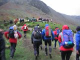
Approaching the startSo said Andy Mayhew's excellent Mountain Weather Forecast for last weekend, at ukweatherworld.co.uk. And in most people's view, he'd have been absolutely right.

But we and over 2000 others begged to differ, and so Alan, Rob, Pete B, Carmen, and I headed for Borrowdale to take part in this year's Original Mountain Marathon (OMM). The weather earlier in the week had been poor to say the least, with heavy rain and widespread flooding in the Lakes, and apparently on Thursday it was touch and go whether the event would go ahead, but in the end the all clear was issued.  

Saturday morningCarmen and I camped overnight at the event centre, Seathwaite Farm at the head of Borrowdale. The winds were strong, but not as strong as they were due to get later, when torrential rain and 110mph gusts were predicted. Our start time was 9.01, when the winds were picking up but the rain not yet falling. Carrying slightly more than usual due to the weather, we opted for a cautious route choice; we were doing the Long Score course, which gave us 6 hours (7 in a normal year) to visit as many controls as we could. Rather than doing as usual (getting over-optimistic, and ending up with a mad dash to finish in time), we decided to get a couple of high level controls to start, and then take the lowest route possible towards the mid camp (at Gatesgarth Farm near Buttermere) leaving plenty of time spare.
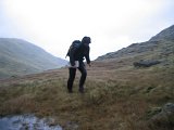
Near Styhead PassSetting off towards our first control, near Sprinkling Tarn, the winds soon asserted themselves, and making progress towards Styhead Pass became increasingly slow and tiring. After this, we quickly abandoned plans to head uphill to a high scoring control above the Corridor Route, and instead headed down towards Wasdale Head. A couple of good but easy controls on the lowest slopes of Kirkfell, and we headed up the path towards Black Sail Pass.

The 'missing' controlBy now, the rain was falling heavily and the winds increasing yet further, even when the wind was behind us it was sometimes hard to make much progress due to the effort needed to stay upright! After a brief detour at the pass where I started to lead us uphill instead of down (oops), we picked up another control before descending towards the upper reaches of Ennerdale. Or rather, we would have picked up another control, but it wasn't there! There was a marker post to show where it should be, and it matched the map, so we're convinced we were in the right place. Perhaps it had been blown or washed away.

The next problem was crossing the stream in the valley bottom, which by now was a raging torrent. We watched 2 people ahead of us link arms and cross together, the water was at waist height and they struggled before finally making it across, so we took about 1 nano-second to decide on a half mile detour to cross a bridge downstream. Even this was tricky, requiring a thigh-deep crossing of a side stream to reach the bridge.

We then followed another stream up to reach the col between Haystacks and Brandreth. This was another torrent, completely uncrossable until we got to the col, which was a shame as the path was on the other side! So we had to go up scree and heather on the left, nervously eyeing the drop to the water below. Uphill again, into the teeth of the storm, walking was by now becoming virtually impossible but we managed it somehow, and at lastmanaged to find a tricky control relatively easily.

Bridge crossing From here it should have been an easy descent down the old mine track to Buttermere. But first we had another river to cross, this one looked unfordable (2 people in front turned back), so another long detour up stream until it was shallow enough to wade – only thigh deep at this point, and 50 feet wide. Even following the mine track back down was slow and difficult, it was like walking down a river for most of the way, knee deep in places, with numerous stops to cross side-streams/waterfalls joining from the right.

We thought we had it bad until we passed the main bridge in the valley bottom – the bridge was deep under water with just the hand rails poking out the top, people were having to use these to haul themselves across, exciting stuff.

All that remained was a trot down to the midcamp where we arrived with 3 minutes to spare – only to be told that the event had been cancelled and we had to walk back over Honister Pass!
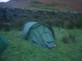
Our tent on Sunday morningTo cut a very long story short, the road was closed before we got going and so we ended up having a virtually sleepless night camped at Gatesgarth Farm in a tent that did its best to collapse, but somehow just about stayed up. The next morning we joined the procession of people walking over Honister Pass back to Seathwaite.
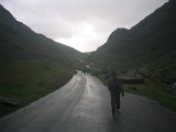
Approaching Honister PassSo in summary – definitely not a day for the hills, but it nevertheless managed to be one of the best, and certainly most memorable, days I've ever had in the mountains. My only regret is that the event was cancelled – Sunday was relatively dry and sunny, with only light gales!

Postscript.  Apparently there was another mountain marathon in the area at the same time, but it was very different. The one we were on, everybody was self-sufficient, and ran round in pairs, carrying tents, sleeping bags, spare clothes, and food for 2 days. Almost everyone got off the hill OK on Saturday, and the few who didn't spent a safe (but probably thoroughly unpleasant!) night camping in the hills before descending the next morning. A dozen or so had to be helped off by mountain rescue, mostly with minor injuries or mild hypothermia, everyone else got themselves down safely.
Descent from HonisterIn this other event, by contrast, 1700 ill-equipped runners were unaccounted for, and hundreds were trapped on the hills overnight. They were lucky to still be alive when they were finally rescued the next day. But you've probably heard about that one already…

Sorry about the poor quality of the pictures, it's hard to take good photos when you're being blown off your feet!

An appeal has been set up to collect money for the local mountain rescue teams – the majority of us didn't need them, but it's always good to know they're there!
http://www.justgiving.com/theomm08-mrtdonation