The Great Lakeland 3 Day is a three-day run in the hills, covering a total of about 80 miles and a squillion feet of ascent. After 2 previous attempts (one successful, the other less so), we were back for our third go.
This year we started in Braithwaite near Keswick. After an excellent Last Meal in the Middle Ruddings Inn on Friday evening, we were up bright and early the next morning, raring to go. Ahem.
 After a gentle start along a pleasant footpath, it was uphill all the way via Grisedale Pike to the first control on Hopegill Head. We rejected the undulating ridge of Whiteside due to its extra ascent and instead headed steeply downhill into the valley – possibly a mistake as we ended up wading through thick heather, but with a bit more luck/judgement we'd have found a grassy way down. This took us eventually to the second control, north of Crummock Water.
Next up the rarely visited valley of Mosedale to what looked from a quick glance at the map like a small hill, Hen Comb. Appearances can be deceptive, despite its modest 509m height, it was a long way up!
 From here, a long rising traverse took us to the High Stile ridge, and a control on High Crag from where we had good views of climbers on Grey Crag – in the sun and out of the cold wind it looked like an excellent crag choice. A nice scree run into Ennerdale (not yet run out as hardly anyone goes this way) led us towards the next control on Steeple on the other side. Most people apparently followed a forestry track to pick up a footpath at the foot of the north ridge. But the map we were using didn't have the footpath marked, so we attempted to traverse up by the edge of the forestry plantation to climb onto the ridge from near Mirk Cove on its eastern flank. I say 'attempted', as we managed to miss the edge of the forest and ended up fighting through dense conifers for a couple of hundred interminable metres. Despite this, I think it was a good route choice – but could have been a lot better with more care! The corrie itself was an impressive place, and would repay a longer visit, there looked to be some good scrambling possibilities.
 The rest of the day was relatively uneventful, with a final slog up Seatallan before a descent down the beautiful valley by Nether Beck to an idyllic camping spot in a field on the shores of Wastwater. A splendid sunny day, despite the cold wind at times, and with beer available courtesy of Joe, plus the luxury of a few spare hours before sunset, a perfect end to the day.
A rainy night followed, and so we were expecting a damp day to follow, but the next morning the rain stopped, the clouds thinned, and the sun appeared.
 No gentle start today, with the first control on the summit of Yewbarrow, 550m above us. From here, we followed the ridge up and along to Pillar for control number 2, accompanied by patchy sunshine, a bitterly cold wind, and occasional hail showers.
The next control was a loooong way away, on the summit of Great End. But at least we had the luxury of a relatively flat few miles as we traversed round the side of Kirk Fell, followed by the climbers' traverse past Napes Needle on Great Gable – a few hardy climbers were out despite the cold wind. The flat section ended abruptly at Esk Hause, with a steep 450m ascent up The Band ridge on Great End. For some reason hardly anyone ever goes up this way, and there was not much path to speak of, but in different circumstances it would make a fine way to the top.
From the summit we had a good view of some heavy hail falling over Glaramara, where we were headed next – for once it paid to be fairly slow, the hail had disappeared by the time we arrived. As indeed had the control marker – we spent a good 20 minutes looking for it until 2 others arrived and confirmed that it wasn't there. Oh well, at least it gave us the chance to stop for a while 🙂
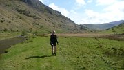 A descent across complex terrain (luckily with good visibility) into Langstrath, was followed by the day's sting in the tail, an unrelenting 550m slog up Ullscarth. We couldn't face losing too much height again after this, so rather than take the direct down-then-up route to the final control on Steel Fell, we went for a longer-but-gentler line, traversing the head of the valley around the aptly named "The Bog". All that remained was a pleasant (though knee-wrackingly steep) descent down the ridge to the campsite at Steel End.
Another fine site with the chance to chill out with some beers. But the forecast for the next day was poor, and the day expected to be long, so we were in our sleeping bags before dark.
Having been kept awake for half the night by the strengthening wind and rain, I managed of course to fall into a deep sleep moments before being woken by the alarm at 4.45am. One of the hardest parts of the day followed, namely getting out of a warm dry tent into a cold wet and windy outdoors. After a bit of packing and faffing we finally set off at 6.25.
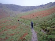 The first control was a pig – the summit of Helvellyn – made worse by the fact that the second control was by the side of Thirlmere, just a couple of miles along the shore from our start point! The ascent was warm and muggy (or as warm and muggy as it gets at 7am) but the summit was very, very cold, so we ran down as fast as we could. 1 hour 35 minutes up, 35 minutes down again, and we were back where we started.
The next path was visible directly across the lake, but to get there we had to walk all way round the shore. At least it was flat! Which is more than can be said for the ensuing 300m ascent up increasingly boggy ground to High Tove and across the watershed to Watendlath. There followed another of those bits that look simple on the map, but turn out not to be. Mainly in this case due to loss of concentration, I thought that every minor knoll and bump on Brund Fell was the summit, but as ever it turned out to be the steep craggy bit in the distance after all.
All the while the rain continued – it hardly stopped all day – while the wind gradually grew stronger.
Next down to Rosthwaite by a good direct line; feeling pleased with myself for finding it, I then let the side down with one of those brain waves that might work well, but rarely do.
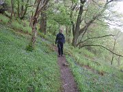 The next control was on Robinson, on the other side of Dale Head. Instead of taking the obvious steep path straight up to Dale Head, we decided instead to head for Honister Pass, and then contour up the apparently grassy hillside to the col just before Robinson. The reasoning being that the weather was pretty foul so staying as low as possible for as long as possible could only be a good thing, even though the route was quite a mile or two longer.
The first part of the plan went well, though Honister Pass looked like it had the potential to become a morgue (OMM joke). However, the hillside that the map showed as grassy turned out to be an unbroken slate slag heap, and it quickly became obvious that it would be slow or impossible to find a way across. So we headed up Dale Head anyway, and then compounded my mistake as I attempted to traverse round the top of the hill instead of going to the summit; unfortunately I'd mis-set my altimeter and we ended up trying to traverse some 50 metres too low. At least we weren't competing against anyone else, just against ourselves – if our aim was to beat other people then we'd have given in before we started!
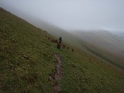 As expected, the weather on the ridge was 'exciting', and we had to fight to make any progress at all. So as soon as we reached the summit we fled as fast as possible down to the next control being at Newlands Hause. The end now started to feel close (even though it was still 6 miles away), as the last major ascent was out the way. A long traverse on sheep tracks above Sail Beck, up-and-over Sail Pass, then a final quick pull to the summit of Outerside was followed by a gentle descent back to Braithwaite and the finish.
All in all a truly excellent weekend (though it didn't always feel that way at the time!). Thanks as ever to Joe Faulkner and everyone else involved. As we battled through the rain on Monday morning I promised myself this would be the last time. But maybe I'll keep the May Day weekend free next year, just in case…
My photos are here.
Maps of our routes:
Day 1
Day 2
Day 3
Results and GL3D details
Vital Statistics. Distances were probably slightly longer than shown, and ascent figures slightly less:
Day 1. 24 miles, 8500 feet ascent, 8 hours 40 mins
Day 2. 21 miles, 8850 feet ascent, 9 hours 57 mins
Day 3. 27 miles, 9000 feet ascent, 9 hours 50 mins
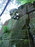 Simon C and I had a top day out at Eavestones, just past Brimham, a crag in a most beautiful setting with lakes and trees and rhodies and wildlife a plenty – luckily no midges !
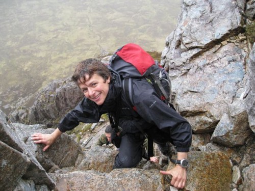 o the Mamores he went. Simon & Carmen had a rapid rethink of their planned rock routes and Peri, Ben, Margaret and myself stuck to Plan A – Buchaille Etive Mor.
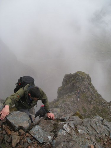 Curved Ridge really is a great route – a fantastic (and easy) line on a great mountain – what more could you want? Peri and Ben certainly seemed to be enjoying it! And despite the rather murky looking sky, the rain was holding off. The swirling cloud just making the whole thing feel more atmospheric.
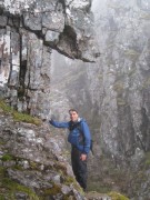 Before long we were at the top, and after a quick (and soggy) sandwich, the only way was down. A warm hut and copious amounts of tea beckoned. Who needs to be out in the rain? (Ben seemingly, who passed on tea to continue along the ridge).
 By the time we got to the ridge proper, the rain had truly kicked in. Looking on the bright side, as we slithered up and down the pinnacles, we saw only four other people (two of whom appeared to have turned back in horror, and the other two of whom were practising moving together with remarkable efficiency) – how often could you expect to get the Aonach Eagach almost to yourself on a Bank Holiday Sunday?!
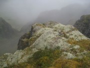 dropped out of the cloud, the weather looked as though it was trying to clear…. and by the time we got down into the valley, we were dry enough to wander into the Clachaig for a pint or several (taking the opportunity to feel superior as, with approx three exceptions, the nearest anyone had been to a hill that day was the step up into the toilet).

 Having opted to start from the A628, at the northerly end of the route, we parked up in a glass and beer can strewn strewn layby and waved goodbye to the car stereos. A good path took us up onto Bleaklow and then it was the Pennine Way down to Snake Pass, over to Mill Hill and a very busy Kinder.
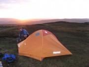 The last few climbers of the day were making their way down and, finally, after 12 hours on the go we clambered over the Edge and pitched the tent.
