Archive for the ‘Mountain Marathons’ Category

Newlands Valley August Bank Holiday

Sunday, September 2nd, 2018

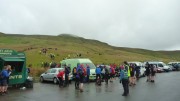
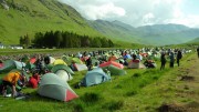
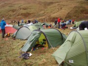
For the August bank holiday we headed to the Newlands valley (Stair) to avoid the crowds in the Lakes.  Good turnout for the trip – 15 of us present at some point over the weekend.

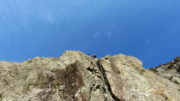
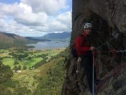
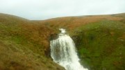
Saturday – Simon & myself walked from the hut up towards the head of Newlands Valley to climb Direct route with bolt finish (allegedly S **)  on waterfall buttress and then grey slab (VS 4b **) on grey buttress.  The first route wasn't worth any stars (damp/wet, mossy & vegetated) second one was though (clean, solid rock, variety of moves).
Mike & Rob  set off just before us and were a little further up the valley on Miners crag – words from Rob.  "Miners Grooves, horrible approach pitch, pretty good P2 & P3,  Jezebel , terrible P1 and start or P2, with 10m of good climbing  and Tahulah – great clean climb on good rock !  I actually quite liked the crag (remote, quiet, easy to get to, sunny after 11)  but the starts of these ** routes are wet, mossy, sh!te.  I will certainly be more circumspect about belaying well out of fall line with this sort of route.. obvious in retrospect but maybe a reminder for others".  I hope Rob's foot improves soon!
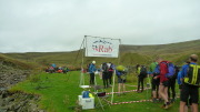
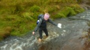
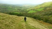
Meanwhile Natalie and Russ went for the classis of Troutdale pinnacle on black crag followed by Little Chamonix at Shepherds- somehow managing to time things right and avoid queuing.   Peri, Adam and Andrew also went to black crag in the hope it would be dry enough to do The Shroud and The Mortician. Arriving there they found The Shroud was absolutely soaking. The Mortician looked as if it might be dry after the first pitch so we started up that, but bailed when they found the second pitch was a river. So like everyone else on the crag they defaulted to Troutdale Pinnacle which was lovely.  "A really enjoyable day out even if we had to change our plans".  Annie and Donal went for a mountain bike ride  around Blencathra and Skiddaw – which they seemed to enjoy a lot.  Dave D having reclaimed his car keys from M&S (don't ask!) arrived at the hut after a walk up Helvellyn (apparently that's where the crowds were).  Unfortunately Saturday turned out to be by far the best day.  Sunday and Mon am were wet.  There were 2 walking groups up Newlands valley on Sunday – taking in Cat bells and the ridge along Newland valley.  Natalie extended the walk somewhat by running back to Keswick and meeting Emma for a session at the wall.  Meanwhile Simon, myself and Alan took part in the 3rd race of the Kong mini-mountain marathon series, which started off from the outskirts of Ambleside – cloud was down in places, windy in places and rather wet, especially when wading through bracken – all good fun. Monday am most people left decided to leave the Lakes as it was still wet.  But some stopped somewhere en route for a bit of exercise – Annie did a walk from Arnside, Donal cycled round Dalby forest, Natalie, Russ and Mike went bouldering sans mat at Roundhill, Simon & I stayed in the Lakes for a trip to Leighton Moss.  C3 and Karl were heading to the Keswick show – but opted for Netflix instead.
Good weekend – despite the weather, good curries and cake.


Another 24 hours

Monday, August 3rd, 2015

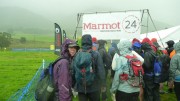
Lowther HillsThe Marmot24 is a 24-hour mountain marathon, though with a 12-hour option available. Open to pairs, solo runners, or teams of 4, this year both courses started together at noon on Saturday, with the 12-hour finishing at midnight and the 24-hour at noon Sunday. It's a score course, so you can visit as many controls as we wanted, each one scoring the same, 10 points. Finishing late incurred minor penalties at first, ratcheting up to a loss of all points if half an hour late!

It was possible to return to the event centre for a sleep, food, dry clothes, etc, and the position of the event centre made it quite easy to plan a route to do this. Some people carried tents with a view to camping out on the hill; others bivvied to save weight. There were even tales of people stopping for a pub meal in the evening. But the truly certifiable stayed out and on the move for the whole 24 hours.
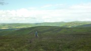
Before the rainAfter last year's inaugural event, my blog entry concluded "I'm really glad we did it, but next time I think the 12 hour course may be a better choice, I wouldn't do the 24-hour again." And so, 12 months on, we drove up to Durisdeer in the Southern Uplands to compete in the 24 hour class. Inevitable really. We'd been to the Lowther Hills for the 2007 OMM, but couldn't remember it at all, so it was to all intents a new area for us.

After a leisurely start (we had our big tent, so plenty of room to cook a bacon, egg and bean breakfast) we picked the map up at 9am, giving just under 3 hours to plan.

OrchidThe southern half of the map contained what appeared to be relatively gentle hills, though with a lot of the controls looking potentially difficult to find (re-entrants, isolated crags, etc), and a few long gaps between them. The northern half was a lot steeper, with controls closer together and on more obvious features (stream functions and summits). We guessed that this meant that the running was easier in the south, rougher in the north.

Like last year, we decided to go for the harder navigation first, while we were fresh, and so worked out a route looping south to start, with various options for a smaller loop back north at the end. We intended staying out all night (last year's return to the event centre for a rest didn't work out very well).

It was slightly disconcerting at the mass midday start to see the clear majority of people heading off north! But we had a plan we were confident in. Last year we played cat and mouse with another team for the first few hours, but this year we found ourselves on our own after only 5 minutes. Despite occasionally seeing a few people in the distance, and crossing paths a few times with some, we pretty much stayed on our own for the whole event.
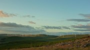
Evening sunThe first half dozen controls went smoothly though mostly without paths, until after a couple of ours the rain started. No problem we thought, the forecast was for dry conditions with occasional scattered showers. It didn't stop raining for about 6 hours! Apparently the northern part of the course stayed dry. So it goes.

What looked like a good track up the valley in the south east corner turned out to be a bog, slower going than it should have been and getting quite chilly in the rain. We stopped briefly at Burleywhag Bothy to escape the rain, dry off a bit, and have some food – if we'd known about the bothy in advance we might have planned a nap!

Last year I felt sick after about 10 hours and had trouble eating for the rest of the event; I put this down to not having eaten or drunk properly earlier on. So this year we'd supplied ourselves with plenty of food, including lots of home-made coconut ice, a packet of jaffa cakes, some bombay mix, 2 pasties, and a pizza! No, really.
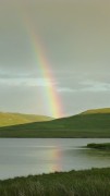
RainbowsA couple of hours and 3 controls later it finally stopped raining, the sun came out, and gave us a series of rainbows. Missing an outlying control as it looked to be over the other side of a tussocky hill, we found ourselves with a bit of spare time before dark, so added in a spur-of-the-moment dogleg for 20 points. Unfortunately one of these involved a there-and-back knee-deep stream crossing, which didn't start the night off well.

By now dark, we headed for the Southern Upland Way, which we'd planned to follow through the night on the assumption that it would be easy to follow and it took us to some simple-looking controls on obvious features. It quickly became obvious that this was no Pennine Way – a narrow boggy path kept disappearing and reappearing, and gave us some of the hardest going of the event! At least it followed a fence line all the way up making navigation easy.
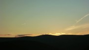
Sunset over Green LowtherNearing the top of Lowther Hill, the SUW path took an unexpected detour away from the fence. Not sure exactly where it went (it's not marked on any map) but it seemed to involve rather too much height loss that we then had to regain. Perhaps it actually stuck to the fence, and I was hallucinating.

Unfortunately the cunning food plan had made no difference and my stomach was suffering, but I battled on, groaning bravely throughout.

We eventually reached the summit, with its incongruous golf ball, tarmac road, and street lights, all part of the national air traffic control system. We followed the road to a control on the trig point of Green Lowther, unable to run even the downhills. The last 4km, that looked easy on the map, took us an hour and three quarters, and it was getting cold. I'm sure there was some frost among the dew.

DawnAfter a couple more controls, it was at last light, and the head torches went away. It didn't take long until the sun came out, the best weather of the event, though a chilly breeze meant the waterproofs stayed on. At last we could start thinking about the route to take back to the finish.

A brief scare when Carmen thought it was 8.00am was quickly resolved when it turned out to be 6.00 after all – we're not used to being up this early! So we had plenty of time to pick off a group of 5 controls close to the event centre. In fact we had so much time left that we were forced to add in two more as well, adding a steep 200m climb just at the point we didn't want it. All that remained was to sprint quickly/stagger slowly (delete as applicable) back to the finish.
6.20 amWe'd scored 300 points in 23 hours, 36 minutes, and 35 seconds. First mixed team, and 5th overall (on the same score as 4th place, but 10 minutes slower). The winner scored 360 so we were at least in touch.

Yet another really great event, and one that I'd urge anyone else to try (if you like mountain marathons of course!). Don't be put off by the epicness of the 24 hour event, most people take the sensible option of either the 12 hour course, or stopping for a break somewhere on the 24 hour version. They need numbers to increase if it's to remain viable in the future, so don't puit it off too long or you'll miss the chance!

Finally, thanks again to Shane (organiser), Gary (course planner), and everyone else involved.

More photos here

Results here
In the dark

Thursday, January 29th, 2015

We didn't have the best of preparation for this year's Dark Mountains. First Carmen went down with her annual cold/cough, then I duly caught it and turned it into full blown man flu. A week off work was followed by another week wishing I was off work, then the morning of the race I was so tired I thought about pulling out.

But it's become my favourite event of the year (OK, equal favourite with the LAMM), and this year was held in my favourite running area, the Howgills. So I had no choice.

After a brief kip on the drive over I was feeling a lot better, but our aim as we started will still just to get round in one piece, and not to repeat last year's miscalculation which left us in joint last place. Of course this resolution lasted until we were given the maps, at which point I immediately checked where the highest scoring controls were and worked out if it was feasible to get to them! (We were were doing Long Score – 10 hours to get as many points as possible).

We spent a good 10 minutes planning a route, and decided on a vague line to get to the east of the map for a line of high scoring controls. We'd then pick up whatever we had time for before heading for home where there was a concentrated group of controls near the finish.

This plan lasted approximately 2 minutes. There seemed to be more tracks leading away from the start than were marked on the map, and we weren't sure which to take. And we also decided that it would be better to pick up the grouped controls at the beginning, to be sure of getting them all. So that's what we did.

I'd like to say that we found them all first go, but we didn't. However, we found most of the more elusive ones 2nd or 3rd try, without losing more than a few minutes. A couple more changes of mind followed, and we soon found ourselves on the summit of The Calf, with about 4 hours 15 minutes gone.

I was tempted to leg it down the path to pick up a 50-pointer to the south, but Carmen was more cautious (ie sensible). Instead, a 30-pointer loomed in a re-entrant a couple of km away. This looked quite tricky, with no obvious attack point from above so we decided to miss it out – then changed our minds, and were soon counting paces as we traversed the hill before a diagonal descent to the check point. Of course once we reached the re-entrant and got to the right altitude, there was no control. Wrong re-entrant.

A study of the map suggested showed 2 possibilities for where we might be – one slightly too far east, the other slightly too far west. At this point Carmen mentioned some other possibilities, chiefly about what would happen to me if we were late back and lost all our points again. Luckily I made the right choice and we traversed west into the control.

Up and over the hill again, and down to a control inside the Andy Goldsworthy sheepfold above Cautley Spout. We'd been there before on the 2012 OMM, but that didn't stop us running straight past it and having to retrace our footsteps. From here, if we'd been feeling more optimistic then we might have headed north east to pick up a line of good scoring controls. But this would have left us with a long way to the finish over trackless terrain, and I was starting to feel sick, so we decided to play it safe and headed north along the ridge instead.

The downside of this was that we ended up running out of controls to visit, and after a series of climbs and descents to pick up every available checkpoint between us and the end, we finished with some 35 minutes spare. With hindsight we'd probably have had time for that 50-pointer, but better 35 minutes early than 35 minutes late like last year!

Much to our surprise we finished 4th in the long score, and first veterans team (at last, an advantage of middle age!)

Another excellent event, brilliantly organised as usual and with some well designed courses (I might not be feeling the same if we'd done Elite and been faced with a 14km leg to the first control!). Plenty of choices were available on our course – though pretty much everyone did a variation on the same thing. In some ways I wish we'd gone with our initial plan – just to see how it would have compared (almost certainly worse!). The only disappointment was the weather – far too benign! And the lovely snow that had covered the hills a couple of days earlier had pretty much all melted, leaving just a couple of large snow fields and some water ice on the odd occasion that we ended up following footpaths.

Our route here – about 32km and 2000m ascent.

Results here

RAB Mountain Marathon 2014

Thursday, October 2nd, 2014

The start in CrookdaleThis year's RAB was based just off the A6 a few miles south of Shap. As usual in this event we were doing Short Score – 6 hours on day 1 and 5 on day 2 to score as many points as possible.

Our preparation was sub-optimal, as I went down with a stomach bug a week before, but it would take more than that to prevent me at least starting!

The start was a short walk up the road at the foot of Crookdale. The competition area stretched as far as Kentmere in the west and the southern slopes of High Street in the north. A quick glance at the map showed the greatest concentration of high scoring controls was in the north and west, so that's where we decided to head.

Near Wren GillMost people seemed to be starting up Crookdale to pick up a few controls on the hills to the north, but we went south west to Borrowdale (not the famous one!) and Bannisdale, planning to descend into Long Sleddale before following paths west to Kentmere and the start of the high scorers. It wasn't long before the scale of our over-optimism became apparent! By the time we reached the head of Bannisdale we'd already curtailed our plans drastically, abandoning the trek west in favour of a circuit of Long Sleddale. So we traversed the head of Crookdale to pick up another 15-pointer before the descent into the valley, where we ran past the mid camp before a steep 300m ascent up the side of the valley.

Unfortunately it was now clear that our revised route had been miscalculated as well. We were going to descend almost to Kentmere and back (with some 300m of reascent) for a 25 pointer – but there wasn't going to be time. And having decided to miss this out, there weren't any other controls to add in before we finished. We might have had time to get to Lingmell End and back for another 20, but that would have been touch and go, and with lateness penalties this year becoming draconian after only 5 minutes we decided not to risk it. So we got back with some 40 minutes spare (ie wasted).

At the top of Long Sleddale140 points put us in 53rd place, one behind Alan K who had planned his day much better, finishing just a few seconds late with 144. Peter had been doing well, amassing 125 points, but unfortunately a knee injury slowed him dramatically and he was 45 minutes late back, losing all his points in the process.

The mid camp in Long Sleddale was the same one we'd used for the Saunders in 2010, in a superb location beneath the crags of Buckbarrow. The weather (low cloud and clag with a chilly wind on the summits) wasn't quite as good as the unbroken sunshine of that event, but at least it stayed dry and mild. And on the Saunders, the Sunday's weather was foul, with persistent rain and wind – this year, it was just more of the same, cloudy and dry, though a little too warm with no wind.

Sunday's map gave us two main options – either east to the hills above Borrowdale and Crookdale, or south towards Sleddale Forest. We opted for the latter as there was a group of closely spaced controls, and it also seemed to give more scope for adding/subtracting controls depending on progress.

Ascending Brunt KnottThings went pretty much according to plan at first. A few controls in tricky terrain were followed by a descent to the valley near Hall Beck and a stiff climb back up to the summit of Brunt Knott (despite its trig point and fine views this apparently doesn't feature on any tick lists of summits, Charles please note!), then a there-and-back trip to pick up a 30-pointer, helped by an unmapped track. In order to find a way around the out-of-bounds areas, we now had to descend into Long Sleddale and go a mile in the wrong direction before picking up a lung-bustingly steep track back up onto the fell for 15 more points.

The original idea from here had been to descend to Borrowdale and go up the other side to pick up between 1 and 3 10-pointers. But time was running out, so we had to miss these out and take footpaths round the foot of the fell instead. Carmen led the way and I struggled to follow! Just over 4 minutes late, a total of 135 points – 34th on the day, 42nd overall.

Alan arrived shortly afterwards, having opted for the Borrowdale and Crookdale circuit, picking up all controls bar one to arrive a few seconds early with 130 points – just 1 point behind us (woo hoo!). Peter meanwhile had decided not to drop out, but instead limped over the hills collecting 70 points on the way.

The icing on the cake – at the prize giving we discovered we were 2nd mixed veterans in the short score and won a prize!

This was the first time that Ourea Events had organised the RAB, taking it over after several successful years from Dark & White. They had a hard act to follow, but managed to pull it off. Looking forward to more of the same next year, but first we've got the 2014 Dark Mountains to contend with…

Our routes: Saturday here Sunday here

Results here

More details about the event here

Sleep is overrated

Sunday, August 10th, 2014

The start
It's a week after the event, and I'm just about rested enough to string a few vaguely intelligible sentences together, so here goes.

Marmot24, the UK's first 24 hour mountain marathon, was launched a few months ago. The principle is simple – you've got 24 hours to score as many points as you can by visiting controls spread out across an alarmingly large area. You can return to the event centre to eat and/or sleep, or you can keep going for the whole time. As well as the 24 hour option, there are 12 and 6 hour classes, each timed to finish at the same time.

Adopting my usual plan of "try anything once and regret it later" I was keen to give it a go. Carmen didn't take much persuasion, and so last Saturday morning found us in a wet field near Threlkeld with over 80 other like-minded people. Maps were issued at registration, giving us 3 hours or so in which to plan our day. The competition area was huge, about 300 square km, and the route choices limitless. Each control was worth the same, 10 points, but with a few small clusters of relatively close controls.

There were 2 main areas. To the north were Skiddaw, Blencathra, and the hills Back o' Skidda'. To the south were the Dodds and the northern slopes of Helvellyn, with a scattering across St Johns in the Vale, and even some west of Thirlmere; and east to Gowbarrow and Great/Little Mell Fells.

After a lot of staring at the map, we came up with a vague plan. The area to the south had more controls, with a few nice clusters, but many of them looked like they'd involve some tricky technical navigation with lots of knolls, spurs, re-entrants and the like. So we decided to head this way first, while we were still fresh and it was light.

Controls on the two Mell Fell summits were followed by straight paths/roads back to the event centre, and we hoped this would give us an easier night time section. From the  centre, another line of easy-looking options headed back north. By the time we were on to complex terrain again, we hoped we'd be back in daylight. Depending on fitness levels, there were a few options available taking in some or all of the controls at the top of the map.

So much for theory.

Clough Head in the rainSlightly after midday and in heavy rain, we were off, in a mass start. But it wasn't long at all before we were almost alone, with just one other pair choosing the same first control as us; we had no idea if this was a good sign or a bad one! After 3 controls on Clough Head, we dropped back down to the valley, slightly surprised to find the other pair do the same, as it wasn't an obvious route choice! Four controls on Low and High Rigg proved just as tricky as they looked, but we were pleased to get them all right. A few other teams arrived from various directions, and soon disappeared in some more different directions.
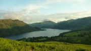
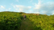
A quick up-and-down through the woods of Great How was followed by a long ascent just west of Castle Rock (nobody was climbing today!) then a rising traverse to the upper slopes of Stybarrow Dodd, by which time the rain had stopped and the sun was out. Here the other team who we'd been leap frogging all afternoon, headed south for a control near Brown Cove and we were alone. We crossed to the east side of the Dodds followed by a not-as-hard-as-it-looked ascent back to the ridge NE of Great Dodd.

Control on Middle TongueHere we decided to miss out one of our planned controls in order to get to easy ground by dark, and so a descent to the east was followed by a short road section through Dockray (the pub was extremely hard to resist). The rain returned briefly, but soon disappeared, and we climbed up Gowbarrow Fell in fantastic evening sunshine – we even had the luxury of a good path through the bracken, at least until we left it and fought through undergrowth, tussocks, and bogs to find a couple more technical controls. The first summit tick of the day was Gowbarrow Fell, with a brilliant sunset over Blencathra, after which we followed some good unmarked tracks to reach the road below Little Mell Fell.

Evening light over UllswaterOur plan had been to get here by about 10 – we arrived at 5 past 🙂 Little Mell Fell went smoothly, but Great Mell Fell was hideous, the path for most of the way up obscured by head-high bracken and the path down the far side seeming vertical to my tired knees. But the road from here back to the event centre was at least easy, with fantastic starry skies to look at, though I didn't have enough strength to run much of it. Passing a few worryingly energetic runners going in the opposite direction – hopefully doing the 12 hour course which had started half an hour before! – we arrived back at the event centre after 13 hours, with 190 points in the bag.

We couldn't keep this up of course.

Excellent track up GowbarrowA cup of tea and a quick chat with Shane (though I doubt he understood most of the gibberish coming out of my mouth) were followed by some food. I was feeling ill and could hardly eat anything, just a couple of mouthfuls of vegetable tikka and a banana. And despite changing into dry clothing (3 layers and a new waterproof), I was cold. But forced myself to get going again, just as the rain returned. Carmen of course was doing much better.

The next control was a sheep fold well away from any paths, and head torches wandering randomly around the hillside confirmed it was going to be tricky. So we stuck to the path until the altimeter showed the right height and traversed to it – I was pleased (and surprised) that we hit it almost spot on! Back down to the valley between Blencathra and Skiddaw, here it should have been runnable but I was having trouble even walking. Another control, then past Skiddaw House to a hideous 2km there-and back tussock-and-heather-bash.

SunsetDawn had by now been and gone, obscured by incessant rain with cloud bases down to 300m at times. Our planned route further north was long abandoned, it was just a question of which route to take us back to base. The cloud base rose for a while, making an potentially difficult re-entrant easy, after which some indecision and a change of tack led to a sheepfold.

Still raining, we traversed Mungrisdale Common to the col below Bannerdale Crags, down the valley and up to a final control just south of Souther Fell. At least it was supposed to be the final control. But we had 2 hours left and the centre was half an hour away, so although neither of us wanted to we headed back up into the clouds and increasing wind on Scale Fell before descending into the corrie east of Doddick Fell. This is somewhere I've wanted to explore for years – I don't know why, and having now been there I still don't!

All that remained now was the final sprint (ha ha) back across the fields to the finish. After 190 points in the first 13 hours, the last 9 or more gave us just 70, for a grand total of 260. Some way short of my hoped-for 300, but pretty good considering how I felt for most of Sunday.  47.5 miles and 14,000 feet ascent. Much to our surprise, we found we'd finished in 6th place (out of 42 starters), and picked up the mixed team prize!

With hindsight, we made the mistake of devising two 1-day routes, but without the benefits of a good night's sleep between them, so the second part was always going to be unrealistic. And it would probably have been better to stay out all night, without the long control-free section to get back to and from the event centre – the first two teams did this and were a long way ahead of everyone else.

Another brilliant event from Shane and team, with another fantastic course from Charlie Sproson.

I'm really glad we did it, but next time I think the 12 hour course may be a better choice, I wouldn't do the 24-hour again. Definitely not. Almost certainly not. Probably not.

When do entries open for 2015?

Results here

Our route here

Even web site here

Dark Mountains 2014

Tuesday, January 28th, 2014

While the rest of the club headed north to battle the elements, we drove south instead. This year's Marmot Dark Mountains (an overnight mountain marathon) was held in the Peak District, on Kinder and Bleaklow – two areas that are notoriously difficult to navigate across in the daylight, let alone in the dark. We did well in last year's inaugural event when in appalling weather we were the first mixed team in the score class. This year score was split into long (10 hours) and short (8 hours), and we went for long (I felt we ought to, as I was one of those who'd suggested the idea!). Could we match last year's rare success?

In a word, no.

In marked contrast to last year's conditions, the weather was fairly benign. Rain earlier in the day had stopped, and apart from a little light drizzle it stayed dry until the next storm arrived shortly after 7am (many of the finishers on the line courses will have been hit by this, but the score courses were over by then). It was actually milder than forecast, no sign of the promised frost, and we ended up over-warm – but better that that too cold.

We began OK, slow and steady, as we made our way south east to the Kinder plateau. The mist came down just as we got to what we'd hoped would be a runnable track along the edge, slowing us to a walk. We opted against a couple of 25-pointers further down the hill, aiming to get a bit further for a group of 40 and 30 point controls instead.

We hit the first 30 OK (difficult to find, I was please we got it relatively easily), then a 40, and were going well enough that we added in another 40. The idea from here was initially an easy descent to the Snake Pass road for three 5-pointers and a steady return to the finish. But we spotted a better option, continuing further round the plateau, picking up another couple of controls totalling 40 points with the possibility of an extra 20 on the way back if we picked the right stream to ascend. More points, shorter, and slightly less ascent. Perfect.

We should have stuck with Plan A. Tiredness led to a loss of concentration, and we started looking for the controls too soon. After wasting half an hour wandering around swearing in entirely the wrong place, we decided to cut our losses and head for home. Unfortunately, being in the wrong place, we headed for home down the wrong valley and didn't notice until the compass started pointing the wrong direction. I worked out the mistake, uttered a few more choice words, and visibly sagged. We were going to be late back, but how late? And how many points would we lose? (the map didn't specify the penalties, and I'd forgotten).

Back in the right valley, we mopped up the 15 points we'd thought about earlier, somehow climbed the steepest hill in the world, and reached the finish a mere 35 minutes late. Not too bad, only 5% error – but enough to lose all our points.

Lessons learned: Expect tiredness and plan accordingly. If you know you're in the right place and the control isn't there, then you're probably not. And remember the downside of score courses – a mistake near the end doesn't leave any margin for error.

Must do better next year…

Once again, a fantastic event, highly recommended to anyone experienced in navigation, whether runner or walker (as we proved, speed matters much less than accuracy!)

Results here

Course details here

Our route here – see if you can spot where we went wrong!

The Great Storm of 2013?

Thursday, November 7th, 2013

"Britain is braced for a repeat of the devastating Great Storm of 1987" screamed the newspapers. It could only mean one thing – it was time for the OMM. Could we be in for a repeat of the ill-fated 2008 event? There was only one way to find out.

This year was a return to the Brecon Beacons, where it was last held in 2004, not an area I was familiar with. I'd heard horror stories of bogs and tussocks, surely they couldn't be as bad as the Elan Valley?

The weekend's weather started relatively benignly, there was even some sunshine, but the clouds had already gathered, occasionally lowering over the hills.

As usual we'd opted for the long score class, where we had 7 hours on day 1, and 6 on day 2, to collect as many points as possible. A 40 minute walk and 30 minute bus ride eventually took us to the start, and half an hour later we were off.

There were 2 obvious starting points – a loop to the south, or a loop to the north. Since the southern option seemed to have a break midway without any controls, we headed off north. We began cautiously, to allow for being slowed by the promised tussocks and bogs, but the terrain turned out to be mostly friendly. So making faster progress than expected, we changed plan completely a couple of times and ended up looping back to the south of the map. Here we met Alan and partner, also doing long score. They were running up hill so we didn't chat for long!

Undecided how many controls we had time for near the finish, we opted for a zig-zag that allowed us to visit as many or few as we could. In the event, a long there-and-back detour allowed us to mop up the whole area, finishing with a final sprint and just under 3 minutes to spare, for a score of 290 and 31st place out of 141 starters.

With impeccable timing, the heavy rain had arrived about 20 minutes before us, but we just about managed to keep the inside of the tent dry while putting it up. We'd invested in a new one for this year, a Nordisk Telemark 2. Only 880g, but a genuine 2-person tent (unlike the standard Laser series, which weigh a little less but are only really big enough for 1). Three hours later, the rain stopped and we briefly emerged from the tent to find that we'd somehow made the chasing start (the top 5 mixed teams are included) and our start time the next day brought forward by over an hour.

This was just as well, as a problem with the pegging of the tent meant that one of the pegs came out, and we woke up at 5am with wet feet. Moral – try a tent out at home before taking it on a mountain marathon!

The forecasts had apparently changed slightly, and the Great Storm was now due to arrive on Sunday afternoon, rather earlier than initially predicted. The organisers had therefore wisely opted for the bad weather courses; for us, this meant a time limit of 5 hours instead of 6. This meant that some controls were now too far away to justify.

Again, we adapted our plan as we went. The streams were swollen after the overnight rain, so we decided against a loop to the west for some high scores as this would have mean crossing a stream that was marked on the map as difficult when in spate. Also, there was a strong westerly wind with some occasionally heavy rain, and we didn't relish the thought of battling face-first into it. So instead we headed up to the top of the map, heading up and over the impressive summits of Mynydd Du on the way.

A final sprint back through the forest, already churned up into a mud bath, brought us to the finish over 20 minutes early (there were no more controls close enough to get to in that time). We were slightly disappointed by this, but turned out to have done better than the day before, finishing 26th on the day with 190 points, and also 26th over all. Alan also did well, finishing 61st overall and 7th veterans team.

All that remained was to get the car out of the camping field, a task that for most of us was only achieved with the help of the farmer and his tractor!

And what of the Great Storm? It never turned up. The storm's path stayed further south and in any case it didn't arrive until much later. The headline writers didn't seem to want to mention this though!

Some links:
photos
results
maps
a superb tent

It was a dark and stormy night…

Monday, February 11th, 2013

"A new mountain marathon", announced my Inbox.
Excellent, tell me more.
"It's in January".
No problem, keep going.
"At night".

A completely bonkers idea, so of course I was immediately hooked. Carmen didn't take much persuasion, and ignoring the warnings of others ("it's far too dangerous, you'll all die in a freezing bog") we signed up.

There were 4 linear courses – Elite, A, B, C – but we opted for Score (8 hours to visit as many controls as possible). Mostly because that's what we usually do, but also because it gave the option of cutting it short if things got too grim.

As the time got closer, things changed from mild and rainy, to cold and icy, and then a couple of weeks before the event it started snowing. We managed one night time training session, in deep powder snow across unseen (but very much felt) bogs, when we averaged a feeble 1.8 mph. Things can only get better, we thought. Ha.

A couple of days before the start, the clear blue skies disappeared and it snowed. A lot. The organisers announced bad weather courses would be used, and shortened ours to 7 hours. It duly snowed some more, and the last controls were put out on skis. If it had stayed that way, however, it would have been too easy. So they arranged for the temperatures to climb, the wind to pick up, and the rain to fall.

The event centre was at Muncaster Castle, near Ravenglass in the south west Lake District, so we stopped off at Eskdale Green on the way over for a last supper. The drive from there to the Castle took us along a road that we'd briefly follow during the event. It was under 2 inches of water.

A brief word about kit.

Obviously the normal MM kit of "as little as possible" was out of the question, so after much indecision we ended up going for the "far too much" option instead. I had 2 pairs of trousers + over-trousers, thick base layer plus fleece plus waterproof, 3 different hats and enough pairs of gloves for a Himalayan expedition. Plus 2 spare tops and even a spare waterproof (I'd just reproofed my thick one and wasn't sure how waterproof it would be). Carmen had similar (top tip – Paramo trousers are ideal).

Now for the race.

At the start we were given an extra bit of safety kit – the maps were so big they could easily serve as an emergency blanket. Luckily the scale was 1:25K, but even so it was clear that we could ignore most of it as we'd never get to the edge of the map and back in the time allowed.

My first big problem was seeing anything. Glasses were out, contacts meant I could see distance but not the map, so I took the risk and removed one lens – one eye for close up and one for route finding. It sort of worked, though next time I'll go for the naked eye option – not much distance vision needed when it's dark.

We started, along with everyone else, with a selection of controls on Muncaster Fell. Intermittent patches of ice made running too risky – first bruise to Carmen – so we walked most of it from here on. Brief loss of concentration lost us a few minutes ("it's only worth 10 points, how hard can it be"), lesson learned, nothing's easy at night.

A brief study of the map gave us a vague game plan. Almost all the closer controls were worth just 5 or 10 points, but there was a small cluster of 30-pointers that looked like it might just be achievable. So we decided to take as direct a line as we could for those, ignoring anything that involved much of a detour.

After a brief stop to change into some dry clothes (my "waterproof" jacket wasn't) we battled our way into the wind to reach the control on the summit of the aptly named Water Crag. A descent to Devoke Water was followed by a rising traverse towards the next control, interrupted briefly by a short patch of ice that left me 20 feet further down the hill with a bruised arse.

By now the snow was deep and wet. We both had waterproof socks, but even my thick merino ones had no effect on the cold – being permanently encased in slush puppies is probably a challenge too far for any sock.

The distant head torches that had kept us company up to now gradually disappeared, as their owners saw sense and headed for home. No quitting for us though – this was serious fun!

At the next control, on White Pike, the wind was so ferocious we were on our hands and knees to reach the top, even though it was just 442m above sea level (and still only worth 10 points!). The planned continuation along the watershed was obviously not going to happen, so we dropped down instead and contoured below the ridge line.

By now it was clear that we'd not be able to reach the group of 30-pointers, but we wanted to at least manage one that scored over 10, so headed south towards the 20-pointer at Holehouse Tarn. A handy fence gave us something to haul ourselves up the steep hill through knee-deep snow; we found the control but not the tarn, presumably it was buried. At last we could turn back north and have the wind behind us!

A short delay failing to find an "easy" 5-pointer at a stream junction (not so easy when the whole hillside is one big snowy stream) was followed immediately afterwards by finding the missing control a few metres further down the hill – the stream junction had become the middle of a small river. Then up into the lowering clag for a final 10-pointer, down the other side to hoover up a final clutch of 5-pointers, and all that remained was a marked route across boggy tussocks (or was it tussocky bogs) to finish with 20 minutes to spare.

We'd averaged just 1.7 mph, but despite the usual collection of "what-ifs" that could have gained a few extra points, we were happy with our meagre haul of 105 points. Even more so when we found that we were the first mixed team, and 4th overall! Over 100 points behind 3rd place, but if we'd had the fitness for an extra couple of miles then we'd have had access to another 150 points, so not as big a gap as it seemed.

But winning and losing were largely irrelevant, just finishing (or even starting!) in those conditions took some effort. As a measure of how tough things were, only half a dozen teams on the linear courses completed (none at all on B or C), everyone else missing controls and heading for home.

My toes were slightly numb for a couple of days (frost nip?). Chilblains lasted a week. Three weeks on, the bruise on my hip is finally fading. But the memories will last a life time.

Would I do it again? Just try and stop me!


Some photos here

Results here

Event website here


Midgetastic LAMM

Friday, June 15th, 2012

It was that time of the year again – time to kick start the mountain marathon season with the LAMM (Lowe Alpine Mountain Marathon) which is always held in Scotland. Last year was a Northern year – so this year we knew it wouldn't be quite so far. Simon & I were already holidaying in Scotland – so even less of a drive for us. Fortunately there was a mobile signal in the camp site at Morvich so we were able to find out the location of the event centre (always only released on the Thursday before the event) nr Ben Cruachan.

It was lovely and breezy when we arrived at the camp site in the afternoon. Unfortunately this did not last long and by evening it was getting rather midgy. The midges were even more irritating in the morning. I gave up trying to scoop the midges out of my tea – it only seemed to make more space for others to land! I ate my malties walking up and down frantically and having the occasional respite with the midge net lowered.

We had an 07:30 assembly time – so left the camp site at 07:20. At 07:45 we were on the coach and driven off to the mystery location of the start. This turned into a much longer trip than ever intended – the coach driver took a few wrong turns and took us to Victoria Bridge via Glen Coe. Hence we arrived at the start at 09:10 with at least one later bus arriving before us.

We were on the score course – planning our own route and had a number of alterations throughout the day. We didn't feel that we were choosing the best line and doubted anyone else would have chosen the same order of controls. As we headed back towards the finish time was running out fast – we were forced to run all the way from the last control to the finish, passing Rob and Pete B along the track to the finish. They thought we must be hours late given our earlier start time (unaware of our mystery coach tour) – however we made it back with 24 seconds to spare (out of 7 hours). The weather was excellent all day, with just a couple of passing showers, in stark contrast to the forecast rain and low cloud!

Rob & Pete had their own agenda for the weekend. Both had injury problems and decided to take it easy. Rob was in Munro-bagging mode and used the opportunity to visit summits which had no controls on them! They scored other points along the route and didn't do at all badly given they were not really trying.

The overnight camp site was in a lovely spot but was midge hell once the wind dropped. Most people were driven inside tents rather early due to the swarm of midges. Annie you would have loved to have been there! Things were not any better in the morning – I didn't remove my windproof and midge net until we had finished marking up the maps and were off on the move.

The cloud was rather lower today and so we decided to stick to controls that should be easier to find. Fortunately we did not get too wet until the last hour or so when the rain started and soon became rather heavy. We managed to finish with a whole 2 and a bit minutes to spare this time. Meanwhile Rob and Pete had been off bagging a couple more unnecessary Munros and sauntered in with 22 mins to spare.

Overall we finished 14/81. We were rather amazed as we felt we had chosen poor controls and I was unable to run much given the ever lasting cough and lack of training. Rob & Pete finished 47/81 without even trying and having bagged four new Munros not on the scoring route!

More photos here
Our routes Day 1 and Day 2
Results and reports here

The best OMM for years

Saturday, November 12th, 2011

This year's OMM was held in the Breadalbane area of Perthshire – little visited by walkers other than those slogging up Ben Chonzie, one of the contenders for the most boring Munro. The area had never before used for mountain marathons – too often there is a very good reason for this! But it turned out to be one of the best events for a while.

As the weekend approached the forecast was for persistent heavy rain, gale force winds, and low cloud all weekend. In other words, perfect conditions for those of us who can navigate reasonably well but aren't fit enough to do much running. The event centre was at Cultybraggan Camp, an old WW2 POW camp – very different from the traditional marquee-in-a-field! We didn't get to see much of it though, as we arrived well after dark on Friday evening, and had an alarmingly early start the next morning, catching a bus at 7.15.

The first surprise as we crossed the start line and collected our map is that other than a final compulsory 10-pointer, all controls on the long score course were worth the same, 20 points, so there was no obvious incentive to go for the outlying checkpoints. This had the effect of spreading teams out rather more than usual, there is often an obvious line of high scoring controls to take, but this time there were several equally likely-looking options.

We set off with a rough route in mind, but were going well after a couple of ours, well ahead of schedule, so added on an extra loop. This almost worked well, but after wasting 15 minutes looking for a control in the clag we were forced to miss out our final intended control. Still running short of time we made a very long sprint for the finish, covering the final 5 miles in just under an hour to finish with 30 seconds to spare out of our allotted 7 hours!

It had rained pretty much all day, but just after we'd got the tent up it got much heavier, and we ended up staying put for most of the night, glad that we'd opted for our slightly heavier but much more comfortable tent. All our clothes were either wet or damp, as was my sleeping bag (the waterproof bag wasn't). We were 45th out of 144 starters and 137 finishers (24 other teams entered but for some reason never turned up), and were one of 12 teams all on 210 points. The first 5 mixed teams were all taking part in the chasing start, luckily we were 6th so escaped the added pressure (and super-early start).

Sunday's weather was better than Saturday – still low cloud and windy, but only occasional showers and even some sunshine. The controls reverted to tradition with different scores for each, and we chose to start by a long climb up a hill behind the camp for a 30-pointer followed by a descent back almost to where we'd started. After this, all went more-or-less according to plan, until we were ambushed by a camera crew filming for a forthcoming documentary of some sort. Despite my streaming nose they decided to point the camera at me, so after muttering a few inane sentences I duly led us off in the wrong direction, and we ended up at the wrong control, a mile or so from where we'd been meaning to go. At least they didn't capture that bit on camera!

This detour meant that we didn't have time to get tempted by a final extra 10-pointer (well I was tempted anyway but luckily Carmen's caution won out). We eventually finished with 13 minutes to spare and a score of 180 – 41st on the day, and 40th over all.

We really enjoyed this event, the terrain was interesting with some difficult navigation, and the route choice extensive. Although we never got to the top on our course (some courses had a control on the summit), Ben Chonzie failed to live down to its reputation – most of those who call it 'boring' probably choose the normal ascent via a long landrover track that goes almost to the summit, missing out entirely on its cliffs and corries.

Full results here.
No more photos – although I carried a camera round all weekend, other than a handful of shots on Sunday morning I never turned it on!