Posts Tagged ‘wind’

A soggy weekend camping in Eskdale

Wednesday, November 30th, 2022

Dave was organising this one and had booked us some pitches at the Fisherground campsite in Eskdale, Lake District.  The weather forecast wasn’t looking brilliant but that didn’t put off a small select bunch from heading away for a weekend adventure in mid July.

Simon, Carmen and Dave were sorted and heading to the pub when the second car arrived, and tents were hurriedly put up trying to beat the rain which was on its way. Unfortunately the rain arrived quickly, so the waterproofs were on and dinner cooked and hurredly eaten. We then headed to the pub to join the others, warm up and plan the next day, which was ‘on paper’ the better weather although there was some talk of forecasts having changed.   

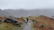
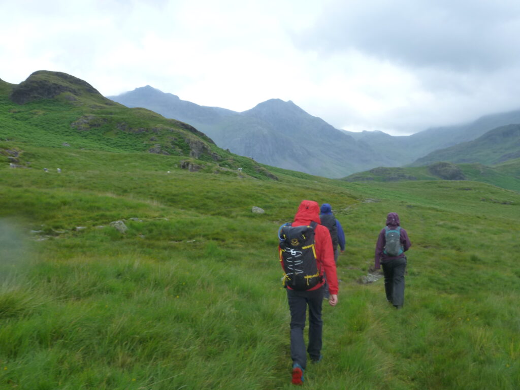
Saturday started bright and promising, so keen to make the most of it, Peter, Aoife, Marianna, Andrew, Russ and Becky headed off to hike up Scafell Pike from the East side, parking just up Eskdale at Wha House. The path up to the ‘Great Moss’ was quiet and it felt good to be exploring a new part of the Lakes we hadn’t visited before.

Heading towards Scafell Pike, enjoying some quiet Lakeland paths

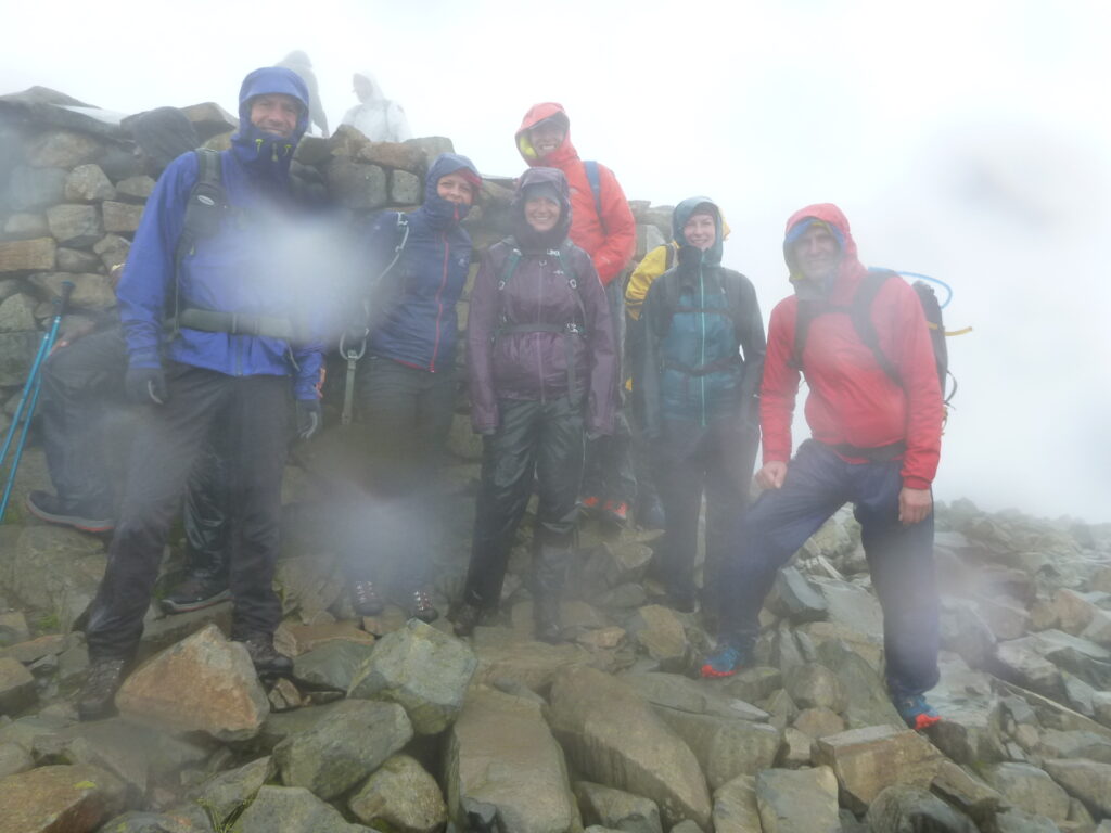
Beginning to gain height up the path by Cam Spout it was clear the weather was closing in, and by the time we reached the mountain rescue box definitely time for waterproofs, hats and gloves. We then joined the busy tourist path (overdressed compared to most!) to the summit, stopping for a quick photo before dropping down towards Broad crag to try and get out of the cold wind.

Not a day for hanging around on the top of England!

A unanimous decision to drop straight back down again was followed by a bit of searching for the correct path in the cloud to avoid some craggy ground. Then a straightforward march back the way we came, all cold, wet and thinking of the pub dinner that evening.

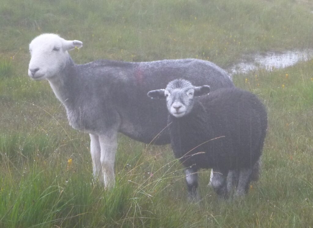
It's a rare day in the lakes when even the sheep look miserable!

Simon and Carmen meanwhile had headed west towards the coast, and managed to avoid the weather and enjoy some sunshine with a long circular walk over muncaster fell and back along the Esk valley. 

The campsite drying room was definitely getting good use that evening and after a welcome warm shower we headed to the pub to compare notes from the day. 

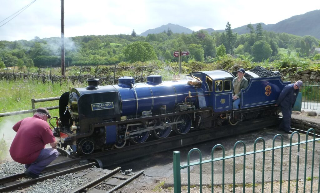
Sunday was brighter so after packing up camp, Peter, Aoife, Dave and Marianna headed to Ravenglass and took the Ravenglass and Eskdale Railway (La’al Ratty) back up to the end of the line at Dalegarth Station.

One for the steamtrain fans

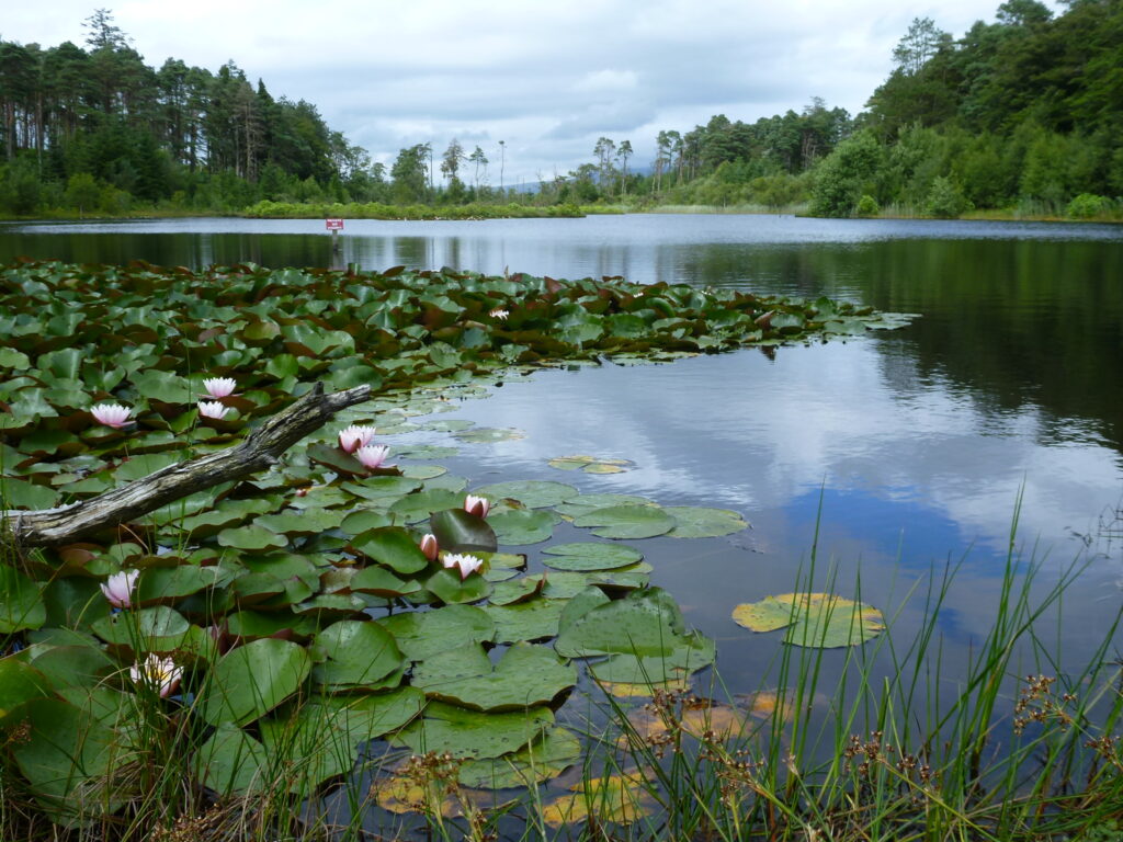
Picking up ice creams from the station before beginning a pleasant walk back to Ravenglass, over Muncaster fell and stopping for lunch at Muncaster tarn which had some great waterlillies in flower. The afternoon took us through the grounds of muncaster castle and bird of prey centre (and more ice cream!) before checking out the roman bath house ruins on the outskirts of Ravenglass. Simon and Carmen also had a great day, tackling a ’Maprun’ orienteering course near Staveley. 

Water Lilies at Muncaster Tarn

Every season except winter

Saturday, January 11th, 2020

This year we had the biggest New Year meet turn out for years, filling Blackrock Cottage and with people camping in vans and even staying at the ski centre up the road. So it shouldn't have been surprising that we also had some of the worst weather, with a massive thaw stripping pretty much all the remaining snow, and heavy rain and strong winds putting the high summits out of bounds.

Of course we didn't let this stop us getting out! Corbetts were climbed near Glen Orchy (Beinn Udlaidh was not in, unless you're into climbing unfrozen waterfalls in spate). Others did the Corbett above the Kings House before retiring to the bar. Trade at the newly rebuilt hotel certainly benefited from the bad weather, though private functions made it residents-only for the last few days. I don't think most of us will hurry back, it's lost all its old character and now feels (and looks) more like a motorway service station.

On the worst weather day an intrepid few of us did a walk over a couple of small hills on Rannoch Moor (hard to stand up in the wind even at under 500m) and back along the West Highland Way to the hut. Others went to Fort William for the local Park Run, followed by woodland walks and mountain bike trails.

Jayne led a big group in a circuit of Buachaille Etive Beag, staying low to avoid summit storms. Some fun and games were had trying and mostly failing to cross the normally narrow stream – the exception being Pete and Aiofe, who were rewarded by having to cross back again a mile or so upstream. We almost managed to stay dry until the last stretch back to the Kings House. Meanwhile others cycled down the road to Kinlochleven and back over the Devil's Staircase to the hotel.

More rain on the Monday morning led most people to the Ice Factor climbing wall, Warwick taking the opportunity for a run over the Devils Staircase. Carmen and I risked the forecast of an afternoon improvement and were rewarded by sunshine and views in the last hour before sunset.

Finally, on New Years Eve, those of us who remained were granted an exceptional day's weather – cool and clear with blue skies and light winds, fantastic conditions despite the near complete absence of snow. Peter and Ann took the train from the coast to Bridge of Orchy and cycled back through down the glen.

Carmen and I did a long walk from Ballachulish up the remote Corbett of Fraodhaidh. Pete led the others up Creise and Meall a' Bhuiridh, the two Munros behind the hut, taking in a fine scramble on the way.

The usual New Year's eve festivities followed, combined with a birthday cake for Noemi, and with far too much food courtesy of Karl who we unwisely left to do the shopping! We even all managed to stay up beyond midnight, partly because the forecast was back to wet and windy so there was no incentive for an early start. In the event it wasn't too bad, but the previous day could hardly have been bettered, and we all headed home.

A load more photos here

The end of winter

Thursday, May 19th, 2016

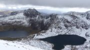
Snowdon HorseshoeThe May Day bank holiday meet returned to Bryn Brethynau near Capel Curig, and hopes were high for some Spring sunshine and warm rock. The weather had other ideas however!

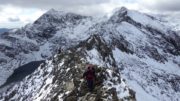
On Saturday, Dave D, Carmen and I did a clockwise circuit of the Snowdon Horseshoe, which was very much in winter condition with fresh snow from about 600m. It was sunny though, with the occasional shower, and cloud bases most above the summits with the exception of Snowdon itself.

QueuesNot that many people on our route considering it was a holiday – but looking down to the Miners Track it was a non-stop line of people throughout the day, there must have been many hundreds of them. The final pull up to the summit was under deep snow, more than a foot of it, but of course most people weren't equipped for it, slipping and sliding all over the place. No reports of accidents though so presumably they all lived to tell the tale.

13092150_1164685633555223_2947748059213386847_nThe weather saved its best for the final traverse of Crib Goch, we even had good views of the summit.

While it was still winter on the tops, things were a bit more like Spring in the valleys. Justine Gav and Pete B climbed a 7 pitch Severe, Canyon Rib, in Aberglaslyn Gorge – so obscure that even I've never heard of it, but by all accounts it's worth doing so now on my list!

For DebraRuss and Mike went to the ever-dependable Tremadog where they did 4 routes including One Step in the Clouds with its new first pitch following a recent rock fall. Apparently it was quite hard!

Meanwhile Donal went mountain biking, and Annie did a nice sunny walk over to the Crafnant Valley, calling in at the oldest church in Wales on the way.

Crafnant ValleyThe next day was wet and windy. Carmen and I went on a run, a variation of Annie's walk from the day before, where as well as the church we found a ridiculously overhanging bolt line, presumably someone's project, and returned via Swallow Falls.

The others went on a variety of walks, both low and high level, the common feature being getting wet.

Monday dawned even worse, with just as much winds and even more run. Most people cut their losses and went straight home.

World's EndCarmen and I waited for the promised improvement for the afternoon, and drove east to World's End , one of the limestone crags near Llangollen. We stuck it lucky, as by the time we got there the sun was out. We managed 4 routes before a sudden heavy shower put an end to proceedings.

Justine and Gav headed for Tremadog, where the weather turned even better, and they stayed for another 2 days to make the most of it.

All in all, a pretty good weekend despite the mixed weather, but next time we'll be due our fair share of warm sun!

Some more photos here


Making the most of the sun

Thursday, May 12th, 2016

Ladhar BheinnWith warm summer's weather forecast for the weekend, Carmen and I took the opportunity of a quick trip to Knoydart to finish off one of our last remaining Munros, Ladhar Bheinn (which as you'd expect is pronounced "Lar-venn"). After a short 7.5 hour drive on Friday evening we camped at Kinloch-hourn.

TribblesAn early rise on Saturday morning to beat possible late-afternoon rain saw us walking by 7.30. Cloudy and cool but dry, it took us a little under 3 hours (with a brief pause to photograph some tribbles) to cover the 7 miles or so to the bothy at Barrisdale. We pitched our tent outside the bothy. No time to delay so we set off for Ladhar Bheinn.

Stob a' ChearcaillFar from burning off as expected, the early cloud seemed to be thickening, and it wasn't long before the rain started. The cloud base was high though, well above the summits, so we had good views despite the rain. A short but steep and vegetated scramble up Stob a' Chearcaill was made more exciting by the damp. Then a traverse over a couple of small tops and another steep climb led to the short summit ridge.

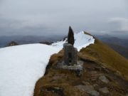
Ladhar BheinnThe rain stopped at last, and as we walked out and back to first the high point and then the trig point 300m beyond, the sun even made a weak appearance. The trig point appeared candle-like with the recent addition of a large rock. I expect someone got a large Arts Council grant for it.

Ladhar Bheinn trig pointWe descended over the Top of Stob a' Choire Odhair and into the fine corrie of Coire Dhorrcail before picking up an old stalkers' path back to the bothy. Another 7 hours or so making a 10 hour day, 16 miles and 2200m ascent, rather more than expected from a glance at the map!

The promised rain held off long enough for us to eat in the dry, but it then set in for much of the night, so thoughts of an evening stroll by the sea were quickly abandoned.

Sunday's weather forecast was for a little low cloud first thing, swiftly lifting to give a warm or even hot, sunny day. So we were disappointed (though not surprised) when we emerged from the tent to find the cloud even lower that Saturday, the temperatures the same, but with the addition of a strong wind.

Glen BarrisdaleOur plan had been to walk out up Glen Barrisdale then via a grade 3 scramble up An Caisteal, a traverse of Graham Meall nan Eun and Corbett Sgurr nan Eugallt before descending to the glen just a mile or so from the car. But the wind was strong enough to make walking a fight at times, so with a lot of the rock still damp after the night's rain we quickly abandoned the idea of a scramble, missed out the Graham, and instead slogged up the steep hillside to the low col SW of the Corbett.

Still cloudy and windy with no sign of the sun, we were at least dry, and again the cloud base had lifted high enough to clear the tops – though a thick haze prevented much in the way of views.

Stalkers pathA false summit (Sgurr Sgiath Airigh) with a fine cairn was followed by the real summit with a tiny cairn, and then a few hundred metres away by a 3rd top where the trig point was found (did they always put the trig somewhere other than the high point round here?). Well worth having the Harvey map for this hill, as the OS maps still show the trig point as being the highest. A descent of the NE ridge led to a very old stalkers' path, becoming boggy and hard to follow in places after years of neglect but a delightful route nevertheless. Even better, the sun finally deigned to make an appearance, and by the time we reached the car at about 2pm the temperatures had soared to a massive 15C.

So where was the heatwave we were promised? We met it at Fort William, just 20 miles to the south, where the temperature was 25C!

Despite the disappointing weather we had a great weekend, it's hard to go wrong in Knoydart! Just a shame about the long drive.

6 Munroes to go and still on course for completion later this month…

Some more photos here


Christmas/New Year Meet

Tuesday, January 19th, 2016

This year we stayed at the Raeburn hut. A great hut which we hadn't stayed in for a few years.

It offered a sheltered location from the driving wind and rain which occurred at times. Whilst no hills are on the door step, there are lots of hills, climbing and mountain biking available within a short drive (and a distillery).

Attendees (for varying length of stays between 2-8 days) Simon C, Carmen, Simon F, Debra, Annie, Peter E, Peri, Mike S, Stuart M, Peter W and Sarah W.P1000539

27th December – gave us the best day of the week. Plenty of fresh snow, blue sky and light winds until later in the day. With the best forecast for the next few days Simon and I chose a long walk to Creag Mhor (a Corbett behind Bynack More) which took 5 hrs to the summit. We would never have made it without snow shoes! Meanwhile Simon F, Debra and Peri went munro bagging with a cycle up Glen Tilt to approach an ascent of Carn A' Chlamain. The evening was rounded off nicely with Peri's poached pears and Welsh cakes (which she had prepared the night before just to keep Simon F happy).

P100056428th December – Annie, Pete E, Simon and I headed up another Corbett – The Fara. Annie cheated and hitched a lift to the start of the walk. It would have been good to do the whole ridge – but not in the very strong winds we battled against on top today. Peri enjoyed an exploratory cycle ride from the hut (especially enjoying the downhill sections). Debra cycled whilst Simon F ran around Loch Laggan (about 14 miles) and took him over his target of 1000 miles run in 2015 – so he was reasonably happy yet again.

29th December – Pete E, Annie, Mike, Simon and myself cycled up Glen Garry. While the others carried on cycling to Kinloch Rannoch and back, Simon and I dumped the bikes for a quick ascent of the Corbett Beinn P1030946Mholach. Simon and Debra went bird watching/walking around Rothiemurchus forest – finding that the birds only seem to reside in the car park.  Peri headed back to York to check the extent of the flooding.

30th December – S & D decided they would head off back to the Dales.  As forecast it was very wet and very windy so the rest of us were content with a trip to the Dalwhinnie distillery (unfortunately no tours available – but we were given a free small dram), food shopping in Aviemore followed by a stop in the Laggan cafe (the old store has now re-opened as a cafe and with a few basic shopping supplies) – a nice cafe with a proper fire and much more relaxed than Aviemore.P1000579

31st – After several failed attempts in the past Peter E and Annie enjoyed an ascent of Meall a'Bhuachaille (a Corbett behind Glen More lodge). Simon and I went up Meall na h-Aisre (a Monadhliath Corbett) from Garva Bridge. We extended the walk as conditions were really good in the morning/early afternoon. New supplies of YAC folk arrived in the evening and we stuffed ourselves with soup, haggis and cheese. Given the good conditions forecast for the 1st we were all in bed soon after midnight and were up fairly early the following day.

1st – Stuart, Peter and Sarah W, Simon C and myself went to do the classic horseshoe of Creag Meaghaidh. We remained mainly P1000631out of the cloud (with just one session of walking around in circles in the clag) with only a strong wind to contend with. Stuart and Simon entertained themselves sledging down a snow slope (repeatedly) and Sarah fell through a cornice (not over the edge thankfully). With Annie suffering from blisters and a lack of enthusiasm for cycling, Peter and Annie went up a Munro by the A9. Back at the hut Simon proved himself to be the undisputed board game champion (well Connect 4 and Scrabble).

2nd – After a slow start deciding what to do in the wind and rain – Simon and I went for a cycle around Rothiemurchus forest, with Pete and Annie opting for walking around the forest. Stuart met some people in a bothy and they joined him in his walk near the ski centre.  Peter and Sara W went Munro-bagging with ascents of Stob Coire Sgriodain and Chno Dearg in the cloud.

Overall a good trip and we did quite well considering the weather. Surprisingly  we failed to make much of a dent on Annie' s drink cabinet (apart from the gin).

Some more photos here

Crianlarich

Saturday, February 28th, 2015

The last meet saw us heading to Crianlarich. Unfortunately, the ideal winter climbing conditions did not last and there was a thaw just before our visit.  However, that did not deter Rob, Will & Paul from heading up a day early. After a not particularly early start they headed up to Ben Nevis and climbed 2 pitches of The Curtain (IV, 5) before an abseil retreat.

Ascending Ben Lawers - spindrift

Ascending Ben Lawers – spindrift

By the time they arrived back at the hut a number of us had arrived. Sat was forecast to be the best of the remaining days – with unknown conditions for local ice-climbing Simon, myself and Pete W opted for a walk. I was keen to get a few more munros ticked off – so we headed over to the Eastern side of the Ben Lawers range. It was a snowy walk in (but not too deep) and once higher up on the ridge progress was easier – that is when we weren’t head on into the wind.

Ascending Ben Lawers, An Stuc in background

Ascending Ben Lawers, An Stuc in background

There was a strong wind on the initial ridge up Ben Lawers with plenty of spindrift making it atmospheric (balaclava and goggles remained on for the majority of the day).

Starting descent from An Stuc

Starting descent from An Stuc

We carried on to An Stuc – the descent from which was more than a walk – with some careful route choice and front-pointing required. The rest of the walk proved a lot simpler, and with the wind behind us was more pleasant. 4 munros in all – making a good winter circuit.

Meanwhile, Rob, Will and Paul were still keen to climb and this time headed for Beinn an Dothaidh to climb Stairway to Heaven (III) which was rather banked out with snow. Peri, Liz and Mark headed off with the plan to traverse the Aonoch Eagach, however, the snow conditions called for a change of plan (they meet a couple of other teams retreating) and decided to head up a Corbett instead. Karl, Jamie and Russ also went for a winter walk taking in Ben More and Stob Binnein. Mike unfortunately soon realised that he was not fully recovered and had to turn back and headed back home.

Sat night saw us eating Rob’s leek, potato and chilli soup followed by oodles of cream courtesy of Pete’s whisky cream (to accompany the ton of haggis) and extra cream in the marmalade bread and butter pudding from Peri – thanks chefs. Sat night we checked the forecast hoping that it might have improved – it hadn’t and had actually got worst with gusts of 60-90 mph forecast, along with snow/rain. With a similar but less windy forecast for Monday, a number of lightweights (sensible people) headed back to York.

Simon & I got up early and headed back to the Ben Lawers range to take in a Corbett (Meall nan Maigheach) close to the road. This plan paid off, although the drive was much longer than anticipated due to the ungritted road and finding a sensible place to park.  Navigation was easy as we followed a wall until it stopped and a short walk on a bearing took us to a cairn– not knowing whether this was the highest summit we took a bearing to the other cairn and then retraced our path back down.  It took us just over 2 hrs – even with the car parked further downhill than ideal.

Rob, Mark, Paul, Pete and Will went for a low-level walk along the West Highland Way and returned to the hut rather soaked – at least we had only been snowed upon. Everyone else had fled. Pete decided a bit more exercise was called for and headed out for a run.

By Sunday night we were down to 3 (Simon, myself and Pete) we enjoyed a smaller variant of the communal meal I had planned. We opted for an earlish start on Monday – to get out before things deteriorated. We were a little surprised to look out the window and see everything was now covered in snow at ground level. Attempts to push the car were unsuccessful, so after a session of shovelling we finally made it away from the hut (thanks Pete). We attempted a Corbett just down the road from the hut. Unfortunately, strong winds and deep powdery snow meant that we did not make it to the summit – even using snow shows we occasionally sunk up to our thighs. At just over 700m the wind was unpleasant, visibility was almost zero and we had lost all depth perception – it was time to give up and head home. Meanwhile, Pete opted for another run from the hut before catching the train to Edinburgh.P1120221

Aviemore meet

Monday, January 27th, 2014

With Christmas and New Year well and truly behind us, the psyche was good for some winter climbing and the meet fully booked for a long weekend in Scotland. Axes and crampons had been retrieved from storage and dusted off, and the winter guidebook thumbed through. We nervously watched the weather as the weekend drew closer, with flooding in other parts of the country, and a seemingly endless series of Atlantic storms blowing in, we weren’t sure what to expect.

Pete, Rob and Paul drove up on Thursday night hoping to squeeze in an extra day in the highlands, and made good time reaching our accommodation – Milehouse hut owned by the Ladies Scottish Climbing Club at Kincraig – very comfy and well equipped accommodation within the Cairngorms national park.

Friday morning was dry but windy, as we headed up the Cairngorm ski centre road, and the wind was buffeting the car as we pulled into the Coire na Ciste car park. Given the recent strong winds and current avalanche forecast, we’d decided to play safe and head over to explore ‘Creagan Coire Cha-no’, a small east facing crag that has only been recently developed, with a walk in of less than an hour and some short mainly mixed routes. We got sorted and headed out, strong winds made even walking down the boardwalk steps from the car difficult, but we decided to give it a go, figuring if we could make it to the crag, we would be sheltered from the westerlies whipping across the Cairngorms. We were leaning on our walking poles and battling with every step against the wind as we ascended the ridge, and after what seemed like an age but was probably only 45 minutes we’d covered less than a km, and the wind was increasing with altitude. Sitting down for a rest to avoid being blown over, we decided to retreat back to the car.

P1020528Still keen to not waste our day off, we walked through Glenmore forest past An Lochan Uaine (the green lake – reputedly coloured by local fairies washing their clothes) to Ryvoan bothy where we took shelter to eat lunch. While there we were joined by some volunteer bothy guardians from the MBA who regaled us with stories of what their friends and acquaintances get up to on bothy nights away – I don’t think I will ever take a quiet night in a bothy for granted again! After lunch, a short walk back to the car at Glenmore meant there was still time for a walk around the gear shops of Aviemore before heading back to the hut for dinner, and the arrival of the rest of the club members.

We all awoke on Saturday morning to the sound of wind and rain against the hut windows, so after a leisurely breakfast and much deliberation and planning, by mid morning the weather looked like it was improving a bit so we headed out. Ann, Donal and Peter headed to Rothiemurchus forest to hire mountain bikes, and embarked on a wet and windy ride around the forest trails. Charles headed to Meallach Mhor (769m) up Glen Tromie and added another Corbett tick to his list, while John and Chris headed towards Newtonmore and Carn Dearg (945m), the highest munro in the Monadhliath.

P1020530Liz and Dave, eager to find some snow headed up to the ‘Norries’ with full climbing gear to ‘have a look’ and see what the conditions were like. Those who were out in Coire an T-Sneachda were concentrated around the Mess of Pottage, and despite the conditions they managed an ascent of Jacob’s ladder (I), which included a fairly substantial cornice at the top. The rest of us (Pete, Rob, Paul, Jamie and Karl) headed down Glen Feshie to start a winter walk from the end of the road up to the munro of Sgor Gaoith (1118m). After a climb up the valley to warm up, we found ourselves in the cloud just before we reached the ridge, and full Scottish conditions of strong winds and total whiteout. The next 6 km was spent navigating by compass bearing and pacing, plus the feel of the terrain under our feet and gave some much needed winter navigation practice. We successfully made the summit, avoided the cliffs and dropped back to the Glen, aided by a couple of bum-slides down snow-slopes on route. Commenting on what a great day out it had been on the walk back along the road was perhaps a bit premature, as Karl tripped and ended up in a deep puddle 10m from the car!

P1020547Back at the hut it was Burns night, so once showered and warmed up, the coal stove was going a treat as we enjoyed Jamie’s soup, 6lb of haggis (with Neeps and Tatties of course) and Ann’s cake and custard, washed down with a wee dram and shared stories from the day and much banter. Without a Scotsman in the room to help out I decided that attempting the ‘Address to the Haggis’ would be more of an insult to Burns, so left that part of the proceedings out!

Sunday we were again woken by wind and rain beating against the windows, and it was clear that there was not much enthusiasm for another day of bad weather, with no-one up before 8.30. A call to the ski centre weatherline said the road was closed, with storm force winds on the top which didn’t bode well. One car headed straight back to York after breakfast, deciding to cut their losses and brave the winter conditions along the A9 instead.

P1020557John, Chris and Paul headed down Glen Feshie to explore Coire Garbhlach, and got lucky as the day brightened up and they were able to scramble up a ridgeline onto the top and get a good look, despite the winds remaining strong. The rest of us went for a walk from a very windy Loch an Eilean, (where the waves were so big you could probably have surfed on them) through the forest to the visitor centre at Inverdruie, where by the time we got there the sun was out and we had a cup of tea outside on the picnic tables – how things change! Walking back through the woods gave great views up to the snowy hills, although it was clearly still windy up there.

Back in the hut, after much deliberation and agonising over whether the forecast for tomorrow could be trusted, and what conditions would be like following 2 days of high winds and much wind blown snow, everyone decided to make the trip back to York that night, and save a day’s holiday for another time, so after giving the hut a good clean and tidy we headed back south to York. Despite the weather, we’d had a good weekend and everyone had at least managed to do something on the Saturday, but hopefully the next time we head north the weather will be kinder. For now, I’ll put the climbing axes back into the box and keep fingers crossed that this winter redeems itself later in the season.

Some photos from the weekend can be found here


It was a dark and stormy night…

Monday, February 11th, 2013

"A new mountain marathon", announced my Inbox.
Excellent, tell me more.
"It's in January".
No problem, keep going.
"At night".

A completely bonkers idea, so of course I was immediately hooked. Carmen didn't take much persuasion, and ignoring the warnings of others ("it's far too dangerous, you'll all die in a freezing bog") we signed up.

There were 4 linear courses – Elite, A, B, C – but we opted for Score (8 hours to visit as many controls as possible). Mostly because that's what we usually do, but also because it gave the option of cutting it short if things got too grim.

As the time got closer, things changed from mild and rainy, to cold and icy, and then a couple of weeks before the event it started snowing. We managed one night time training session, in deep powder snow across unseen (but very much felt) bogs, when we averaged a feeble 1.8 mph. Things can only get better, we thought. Ha.

A couple of days before the start, the clear blue skies disappeared and it snowed. A lot. The organisers announced bad weather courses would be used, and shortened ours to 7 hours. It duly snowed some more, and the last controls were put out on skis. If it had stayed that way, however, it would have been too easy. So they arranged for the temperatures to climb, the wind to pick up, and the rain to fall.

The event centre was at Muncaster Castle, near Ravenglass in the south west Lake District, so we stopped off at Eskdale Green on the way over for a last supper. The drive from there to the Castle took us along a road that we'd briefly follow during the event. It was under 2 inches of water.

A brief word about kit.

Obviously the normal MM kit of "as little as possible" was out of the question, so after much indecision we ended up going for the "far too much" option instead. I had 2 pairs of trousers + over-trousers, thick base layer plus fleece plus waterproof, 3 different hats and enough pairs of gloves for a Himalayan expedition. Plus 2 spare tops and even a spare waterproof (I'd just reproofed my thick one and wasn't sure how waterproof it would be). Carmen had similar (top tip – Paramo trousers are ideal).

Now for the race.

At the start we were given an extra bit of safety kit – the maps were so big they could easily serve as an emergency blanket. Luckily the scale was 1:25K, but even so it was clear that we could ignore most of it as we'd never get to the edge of the map and back in the time allowed.

My first big problem was seeing anything. Glasses were out, contacts meant I could see distance but not the map, so I took the risk and removed one lens – one eye for close up and one for route finding. It sort of worked, though next time I'll go for the naked eye option – not much distance vision needed when it's dark.

We started, along with everyone else, with a selection of controls on Muncaster Fell. Intermittent patches of ice made running too risky – first bruise to Carmen – so we walked most of it from here on. Brief loss of concentration lost us a few minutes ("it's only worth 10 points, how hard can it be"), lesson learned, nothing's easy at night.

A brief study of the map gave us a vague game plan. Almost all the closer controls were worth just 5 or 10 points, but there was a small cluster of 30-pointers that looked like it might just be achievable. So we decided to take as direct a line as we could for those, ignoring anything that involved much of a detour.

After a brief stop to change into some dry clothes (my "waterproof" jacket wasn't) we battled our way into the wind to reach the control on the summit of the aptly named Water Crag. A descent to Devoke Water was followed by a rising traverse towards the next control, interrupted briefly by a short patch of ice that left me 20 feet further down the hill with a bruised arse.

By now the snow was deep and wet. We both had waterproof socks, but even my thick merino ones had no effect on the cold – being permanently encased in slush puppies is probably a challenge too far for any sock.

The distant head torches that had kept us company up to now gradually disappeared, as their owners saw sense and headed for home. No quitting for us though – this was serious fun!

At the next control, on White Pike, the wind was so ferocious we were on our hands and knees to reach the top, even though it was just 442m above sea level (and still only worth 10 points!). The planned continuation along the watershed was obviously not going to happen, so we dropped down instead and contoured below the ridge line.

By now it was clear that we'd not be able to reach the group of 30-pointers, but we wanted to at least manage one that scored over 10, so headed south towards the 20-pointer at Holehouse Tarn. A handy fence gave us something to haul ourselves up the steep hill through knee-deep snow; we found the control but not the tarn, presumably it was buried. At last we could turn back north and have the wind behind us!

A short delay failing to find an "easy" 5-pointer at a stream junction (not so easy when the whole hillside is one big snowy stream) was followed immediately afterwards by finding the missing control a few metres further down the hill – the stream junction had become the middle of a small river. Then up into the lowering clag for a final 10-pointer, down the other side to hoover up a final clutch of 5-pointers, and all that remained was a marked route across boggy tussocks (or was it tussocky bogs) to finish with 20 minutes to spare.

We'd averaged just 1.7 mph, but despite the usual collection of "what-ifs" that could have gained a few extra points, we were happy with our meagre haul of 105 points. Even more so when we found that we were the first mixed team, and 4th overall! Over 100 points behind 3rd place, but if we'd had the fitness for an extra couple of miles then we'd have had access to another 150 points, so not as big a gap as it seemed.

But winning and losing were largely irrelevant, just finishing (or even starting!) in those conditions took some effort. As a measure of how tough things were, only half a dozen teams on the linear courses completed (none at all on B or C), everyone else missing controls and heading for home.

My toes were slightly numb for a couple of days (frost nip?). Chilblains lasted a week. Three weeks on, the bruise on my hip is finally fading. But the memories will last a life time.

Would I do it again? Just try and stop me!


Some photos here

Results here

Event website here
 

Bowland Challenge 2011

Tuesday, July 19th, 2011

We were due to join the club in Blaenau Ffestiniog, but the forecast was awful and we couldn't face yet another weekend of walking up wet Welsh hills, so decided instead to walk up some wet Lancastrian hills.

The Bowland Challenge has been running for about 5 years now, and YAC have entered one or two teams every year (except last year when it was cancelled due to access problems). Rather embarrassingly, after finishing 2nd in the first event, we have won it every year since.

It's a sort of cross between a score orienteering event and a treasure hunt. There are somewhere between 70 and 100 controls worth between 2 and 20 points each, and you have 10 hours to score as many points as possible. With this number of checkpoints it's not possible to put control markers out, so instead there are grid references with associated "clues" with multiple choice answers, things like "during whose reign was the post box built?" or "what is the number of the trig point?". And to add a bit of complication, there is a designated "lunch" spot part way round which you have to visit, and you also have to say what time you'll get there. Too late and you lose points, too early and you can't set off again until the appointed time.
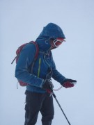
We decided on a long anti-clockwise loop, with a lunch stop at Langden Castle in the heart of the Bowland Forest (it sounds romantic but is actually just an old barn used as a shooting lodge). In the morning we stayed mostly high, in near-constant wind and rain, we were so wet it was actually good fun (apart from one section through continuous peat bogs). We walked most of it but were forced to run down the last valley to avoid being late for our lunch stop, which we made with a couple of minutes to spare.

After lunch, most of the route was unfortunately along roads – the organisers had had to cancel the intended checkpoints on the hills as the grouse were late fledging and the landowner didn't want them disturbed before they're shot next month. But the scenery through the Trough of Bowland was good anyway, and better still it stopped raining, with even some sunshine at times. We failed to find a couple of the checkpoints but rather than waste time looking, we just ploughed on, again walking throughout until forced to run the last half mile to return to the event centre a minute early.

We covered about 32 miles with 1200m ascent, and managed to win again. If only the winners from the first event would show up again, or maybe some proper fell runners, and return us to our rightful place as also-rans!

Great organisation as usual, I'd recommend the event to anyone wanting something a bit different.

Our route here.
More information about The Bowland Challenge.

Pick a grade, any grade…

Wednesday, June 23rd, 2010

As a club we've not had a good success rate in terms of the weather for our recent trips to Northumberland, and perhaps because of this it was a sadly depleted group of 2 who made it to Bellingham last weekend. Either that, or everyone wanted to stay at home and watch the foopball.

For once, the weekend was forecast to be warm and sunny, but form seemed to have reasserted itself when Saturday dawned overcast and windy with occasional drizzle. Not to be deterred by a bit of discomfort, we headed for Selby's Cove, which the guidebook said was sheltered; also it faced west, which we hoped would offer some protection from the cold north wind. Some protection was indeed given, though not quite enough, and we spent most of the day climbing in more clothes than we wore in the depths of winter.

It's not a bad little crag, but judging by the vegetation, not climbed on that much. The main routes were clean enough though. We started with The Corner (Severe ***), Carmen kindly offering me the lead when she saw how steep it was. An excellent route, which would be top end HS anywhere other than Northumberland. Next Carmen led The Arete, a nice Diff (more like boldish VDiff), then it was my turn again with Lichen Wall, allegedly VDiff. This turned out to involve about 5m of unprotected climbing up a slightly overhanging wall on ever-shrinking holds, and by the line described in the book would be at least VS 4b, probably harder. I took a line slightly further left, which was less steep, with bigger holds, and allowed some side runners to be placed, but still felt VS 4b. Finally, I led Holly Tree Wall (Severe *), which would be a good route (with a hard jamming start, maybe S 4c) if it weren't for the fact that the ledge at the top had been recently vacated by nesting ravens, so the rock was mainly white and smelly.

The only remaining routes were a 3 pitch Severe traverse (which we didn't fancy as the 'best' pitch led through the deepest section of guano), or were VS and above, which given the harsh grading we didn't fancy risking. But by now the sun was out, so we stopped off at Simonside North on the walk back. Carmen led Innominate Crack (VDiff **) a nice route and amazingly the grade was right. After I'd spent an age repeatedly failing to work out the crux move of Flake Corner (MVS 4c*) before retreating ignominiously, we finished with a quick ascent of Great Chimney, a brilliant 3-star Diff.

Sunday's weather was much better – bright sun with just enough breeze to keep the midges off, so we headed for Crag Lough, a fine crag on the Whin Sill buttresses immediately below Hadrian's Wall. Despite the weather, the fantastic views, and the large number of multi-starred routes at VS and below, we had the entire crag to ourselves until about 5pm when 2 other pairs arrived. We'd hopped to have a look at the classic HS's of Main Wall and Great Chimney, but a nesting kestrel made it clear that our presence wasn't welcome, so we stayed well clear of that part of the cliff!

Once again the guidebook grades bore little resemblance to the actual difficulty. Routes climbed:
– Spuggie's Gully (VDiff **). A fine lead by Carmen up steeper-than-they-looked cracks, passing nesting jackdaws (sorry) on the way.
– Raven's Tower (MVS 4b ***). My lead, that rarest of beasts an overgraded Northumbrian route. It deserved all of its stars though.
– Tarzan's Mate (VDiff **). Carmen again, and a return to reliable Northumberland sandbaggery. Probably (H)S 4b, but at least the gear was good.
– Hadrian's Buttress (Severe ***). This one took a while! I spent ages working out how to leave the ground, and then higher up I met another impasse that took another aeon to solve. A classic route, but definitely VS 4c!

Finally we wandered along to Peel Crag, a continuation of Crag Lough, where I led Sunset (MS ***). I'd already done this on our previous visit (7 years ago!), and it was just as good as I remembered it – thoroughly recommended to anyone, whatever grade you climb at (unless it's Mild Severe or below, as this one is really a tricky severe, especially the start).

A fantastic weekend – for those who stayed at home, I hope the England match was half as good!

More photos here.