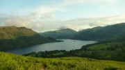
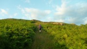
 The Marmot24 is a 24-hour mountain marathon, though with a 12-hour option available. Open to pairs, solo runners, or teams of 4, this year both courses started together at noon on Saturday, with the 12-hour finishing at midnight and the 24-hour at noon Sunday. It's a score course, so you can visit as many controls as we wanted, each one scoring the same, 10 points. Finishing late incurred minor penalties at first, ratcheting up to a loss of all points if half an hour late!
It was possible to return to the event centre for a sleep, food, dry clothes, etc, and the position of the event centre made it quite easy to plan a route to do this. Some people carried tents with a view to camping out on the hill; others bivvied to save weight. There were even tales of people stopping for a pub meal in the evening. But the truly certifiable stayed out and on the move for the whole 24 hours.
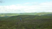 After last year's inaugural event, my blog entry concluded "I'm really glad we did it, but next time I think the 12 hour course may be a better choice, I wouldn't do the 24-hour again." And so, 12 months on, we drove up to Durisdeer in the Southern Uplands to compete in the 24 hour class. Inevitable really. We'd been to the Lowther Hills for the 2007 OMM, but couldn't remember it at all, so it was to all intents a new area for us.
After a leisurely start (we had our big tent, so plenty of room to cook a bacon, egg and bean breakfast) we picked the map up at 9am, giving just under 3 hours to plan.
 The southern half of the map contained what appeared to be relatively gentle hills, though with a lot of the controls looking potentially difficult to find (re-entrants, isolated crags, etc), and a few long gaps between them. The northern half was a lot steeper, with controls closer together and on more obvious features (stream functions and summits). We guessed that this meant that the running was easier in the south, rougher in the north.
Like last year, we decided to go for the harder navigation first, while we were fresh, and so worked out a route looping south to start, with various options for a smaller loop back north at the end. We intended staying out all night (last year's return to the event centre for a rest didn't work out very well).
It was slightly disconcerting at the mass midday start to see the clear majority of people heading off north! But we had a plan we were confident in. Last year we played cat and mouse with another team for the first few hours, but this year we found ourselves on our own after only 5 minutes. Despite occasionally seeing a few people in the distance, and crossing paths a few times with some, we pretty much stayed on our own for the whole event.
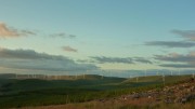 The first half dozen controls went smoothly though mostly without paths, until after a couple of ours the rain started. No problem we thought, the forecast was for dry conditions with occasional scattered showers. It didn't stop raining for about 6 hours! Apparently the northern part of the course stayed dry. So it goes.
What looked like a good track up the valley in the south east corner turned out to be a bog, slower going than it should have been and getting quite chilly in the rain. We stopped briefly at Burleywhag Bothy to escape the rain, dry off a bit, and have some food – if we'd known about the bothy in advance we might have planned a nap!
Last year I felt sick after about 10 hours and had trouble eating for the rest of the event; I put this down to not having eaten or drunk properly earlier on. So this year we'd supplied ourselves with plenty of food, including lots of home-made coconut ice, a packet of jaffa cakes, some bombay mix, 2 pasties, and a pizza! No, really.
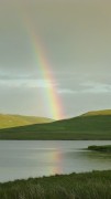 A couple of hours and 3 controls later it finally stopped raining, the sun came out, and gave us a series of rainbows. Missing an outlying control as it looked to be over the other side of a tussocky hill, we found ourselves with a bit of spare time before dark, so added in a spur-of-the-moment dogleg for 20 points. Unfortunately one of these involved a there-and-back knee-deep stream crossing, which didn't start the night off well.
By now dark, we headed for the Southern Upland Way, which we'd planned to follow through the night on the assumption that it would be easy to follow and it took us to some simple-looking controls on obvious features. It quickly became obvious that this was no Pennine Way – a narrow boggy path kept disappearing and reappearing, and gave us some of the hardest going of the event! At least it followed a fence line all the way up making navigation easy.
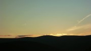 Nearing the top of Lowther Hill, the SUW path took an unexpected detour away from the fence. Not sure exactly where it went (it's not marked on any map) but it seemed to involve rather too much height loss that we then had to regain. Perhaps it actually stuck to the fence, and I was hallucinating.
Unfortunately the cunning food plan had made no difference and my stomach was suffering, but I battled on, groaning bravely throughout.
We eventually reached the summit, with its incongruous golf ball, tarmac road, and street lights, all part of the national air traffic control system. We followed the road to a control on the trig point of Green Lowther, unable to run even the downhills. The last 4km, that looked easy on the map, took us an hour and three quarters, and it was getting cold. I'm sure there was some frost among the dew.
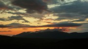
 After a couple more controls, it was at last light, and the head torches went away. It didn't take long until the sun came out, the best weather of the event, though a chilly breeze meant the waterproofs stayed on. At last we could start thinking about the route to take back to the finish.
A brief scare when Carmen thought it was 8.00am was quickly resolved when it turned out to be 6.00 after all – we're not used to being up this early! So we had plenty of time to pick off a group of 5 controls close to the event centre. In fact we had so much time left that we were forced to add in two more as well, adding a steep 200m climb just at the point we didn't want it. All that remained was to sprint quickly/stagger slowly (delete as applicable) back to the finish.
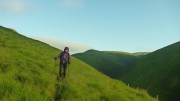 We'd scored 300 points in 23 hours, 36 minutes, and 35 seconds. First mixed team, and 5th overall (on the same score as 4th place, but 10 minutes slower). The winner scored 360 so we were at least in touch.
Yet another really great event, and one that I'd urge anyone else to try (if you like mountain marathons of course!). Don't be put off by the epicness of the 24 hour event, most people take the sensible option of either the 12 hour course, or stopping for a break somewhere on the 24 hour version. They need numbers to increase if it's to remain viable in the future, so don't puit it off too long or you'll miss the chance!
Finally, thanks again to Shane (organiser), Gary (course planner), and everyone else involved.
More photos here
Results here

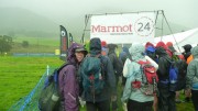
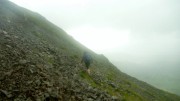 Slightly after midday and in heavy rain, we were off, in a mass start. But it wasn't long at all before we were almost alone, with just one other pair choosing the same first control as us; we had no idea if this was a good sign or a bad one! After 3 controls on Clough Head, we dropped back down to the valley, slightly surprised to find the other pair do the same, as it wasn't an obvious route choice! Four controls on Low and High Rigg proved just as tricky as they looked, but we were pleased to get them all right. A few other teams arrived from various directions, and soon disappeared in some more different directions.
