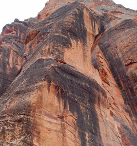
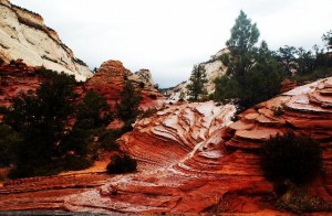
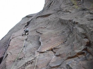
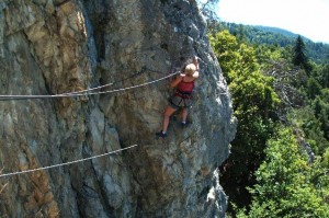
 Yosemite – a mecca for rock climbers, and (in)famous for its gnarly offwidths and runout slabs. A flick through the guidebooks, and there are thousands of routes – but closer inspection reveals they are mainly in the higher grades. And a recent thread on UKClimbing.com asked "is there enough in Yosemite for an E1 climber?". So what hope for a couple of VS bumblies like Carmen and me?
A handful of brief visits over 15 years ago (before my climbing days) reassured me that even if we couldn't climb anything, the walking (sorry, hiking) was magnificent, so off we went. The only direct flights from the UK to San Francisco are from Heathrow, so that's where we flew from – the crux of the route being carrying 6 heavy bags from the train to the Underground, about English 5c at least. 11 long hours later we touched down in San Francisco.
Task 1 – avoid being blown up by terrorists – success.
 A couple of days were spent getting over jet lag by doing tourist stuff. Golden Gate Bridge – tick, cable cars – tick, sea lions – tick. And then it was off to Yosemite…
Task 2 – avoid being buried in a earthquake – success.
The main centres of activity in the Yosemite National Park are Yosemite Valley and Tuolumne Meadows. The Valley is home to the iconic cliff faces of Half Dome and El Capitain, as well as much of the best-known rock climbing. It is also home to a squillion tourists, most of them driving camper-vans (sorry, RVs) as big as National Express coaches. All the campsites (sorry, campgrounds) there were fully booked for the entire duration of our stay, and it tends to be hot – 90 degrees Fahrenheit the day we arrived. So we'd already made the decision to stay at Tuolumne Meadows – about 20 miles away as the bald eagle flies, but 3 times that by road, 5000 feet higher and a 2 hour drive, and more importantly, both quieter and cooler.
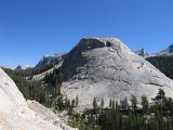 On arrival, we received the first surprise of the trip. The campground has no showers (or indeed hot water) but showers are available at Tuolumne Lodge, a short distance up the road. Or rather, they usually are. There was some sort of problem with the plumbing, and so the nearest showers were now a 40 minute drive away. And cost $4.50 for 5 minutes.
The campsites here are a bit different from the ones we're used to in the UK. They are all hidden in the woods, and you are allocated a specific numbered pitch, each of which has a parking area, a table/benches, a flattish area for pitching your tent(s), and a pit for an open fire. All Americans exhibit an Andrew-Taylor-like fascination for fire, and every morning and evening will light one in the pit provided. Some use this for cooking, some for heat, others just like to watch things burn.
You also get a big metal bear-proof box for storing all your food, toiletries, basically anything that a bear might think is edible. Leave any food in the car or tent, and it's goodbye windscreen (sorry, windshield), goodbye tent, goodbye limbs and/or head. Unfortunately there's no guarantee that the bear-proof boxes are also mouse-proof.
Task 3 – avoid having food eaten by local wildlife – failure.
And so to the climbing…
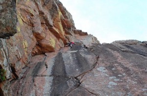
 Day 1. A warm-up day to get used to the rock and style of climbing – five single pitch routes at Bunny Slopes, each between 50 and 60m. We both led a 5.6 (UK HS) and two 5.7s (VS), and top-roped a 5.8 (HVS) and 5.9 (HVS/E1). Warning: top-roping with 2 60m ropes tied together is guaranteed to result in severely kinked ropes! The rock was impeccable granite, studded with 'knobs' (guffaw) – a bit like conglomerate, with pebbles embedded in the rock, but all granite. The routes were apparently all well bolted by Tuolumne standards – about 4 or 5 bolts in 55m! On the two that we top-roped, the crux was before the first bolt (at 5m), and the last 10m of the 5.9 (the 2nd crux) were after the last bolt. Well bolted indeed. The local ethic is that all bolts are originally placed on lead by the first ascensionists using a hand drill – therefore they don't coincide with the hard climbing, but with the places that it is possible to stop to place the bolts, ie usually where the climbing is easiest!
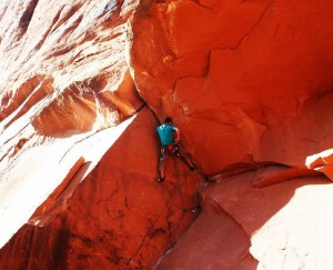
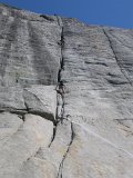 Day 2. Holdless Horror, an ironically named 4-pitch 5.6 crack on Dozier Dome. The threatened hour-long bushwhack approach through the forest turned out to be a pleasant half hour amble, and when we arrived we were pleased to find only one other party there, despite its being a Saturday, and they were on a different route anyway. The route varied from finger crack to leg-sized offwidth, and as well as providing (almost) as many holds as you could possibly want, was well protected throughout by trad gear (bolts are only used on slabs, when trad protection is unavailable) – the only limit being the number of quickdraws we had (12, which makes for some quite big runouts in a 60m pitch!)
Off the hill early for once, so we had time for a drive down to Lee Vining for a sorely needed shower and the best meal you're ever likely to find at a petrol (sorry, gas) station.
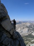 Day 3. Northwest Buttress on Tenaya Peak, a 15 pitch 5.5 (Severe) though mostly much easier (Mod to VDiff). Apparently a long-neglected major classic, we set off early to beat the Sunday queues – there was still frost on the ground as we started the half-hour walk in. On the way we met/passed/were passed by 2 other parties, we all arrived at the foot of the ridge between an hour and 90 minutes later, in different places, none of which bore any resemblance to the guidebook description. We eventually worked out we were at the bottom of pitch 2. One pair had to be back at their car less than 5 hours later, so quickly disappeared up the route, and were on pitch 4 before we set off. We took a much more relaxed pace!
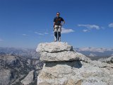 Up to the top of pitch 5, it more-or-less matched the guidebook topo – from then on it was nothing like it, until the last couple of pitches. Reassuringly, we met another 3 or 4 parties during the day, all of them apparently off-route, and none of whom had found the guidebook start – one had arrived at the foot of pitch 6 thinking it was the bottom of the route!
We eventually arrived at the top, after about a dozen pitches, so 3 had gone AWOL. No matter, the views were magnificent, and we had our first sight of the iconic Half Dome, albeit rather obscured by the haze. All that remained was a simple hour-long descent (which took about 3 hours), finishing by the side of the delightful Tenaya Lake – which we decided would make a good swimming spot, so decided to return on a rest day.
A good route, but not really a great one, the line was too vague and the climbing included too many easy slabs between the interesting bits for it to be a true classic.
 Day 4. Southeast Buttress of Cathedral Peak. This route has been on my to-do list ever since I read about it some 15 years ago. Often, a route you've been waiting to do for so long can turn out to be a bit of an anti-climax. But not this one.
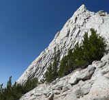 The walk-in took a couple of hours, including a slight detour after we missed the path junction by a mile or so due to not bothering to open the guidebook. There were 2 parties ahead of us when we arrived, one on pitch 2 and the other just starting, but they were both fast so after half an hour spent chatting, we were off. Carmen led the first pitch, which seemed hard for the apparent grade of 5.3, but was spectacularly good up steep exposed knobs (fnarr fnarr) (we later worked out that we'd done an alternative 5.6 start by mistake – oops!).
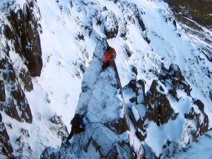
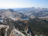 After that, the good climbing just kept coming. A steep 5.6 crack or two, then a 5.6 chimney (would get Diff at Almscliff), the easy 4th class pitch above was steep, exposed, and with jugs all over the place, then some more steep 5.6 cracks, and finally a short 4th class to the top. Stupendous stuff throughout, with a fittingly small summit block perched on the top, steep drops and magnificent views in all directions.
 But it wasn't over yet. A short descent for a couple of hundred metres down 3rd and 4th class slabs brought us to the foot of Eichorn Pinnacle – a slender 30m pinnacle with an improbable looking 5.4 (VDiff) route up it. Just looking at it makes you feel dizzy. But we climbed it anyway (felt more like HS than VD), and it proved a fitting end to the day, superbly exposed but with holds everywhere they were needed, and even a nice (sic) offwidth to finish. A final long walkout, the last hour in the dark (Carmen armed with a rock in case of marauding bears), concluded probably the best climbing day I've ever had.
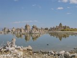 Day 5. About time for a rest day. A walk round the tufas of Mono Lake – rock spires formed by a combination of hot springs and lowering water levels to supply the inhabitants of Los Angeles. Followed by a walk around Panum Crater, formed by volcanic activity only 600 years ago, and still apparently active. A gloss will be drawn over the rest of the day, but it involved a wrong turning, a stuck hire car, a 6 mile walk, and a rescue by some absurdly friendly and helpful locals.
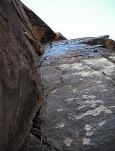
 Day 6. Zee Tree, Piwiack Dome, 5.7. After the least restful rest day ever, we opted for another shortish day to recover, a 5-pitch route opposite Bunny Slopes. We'd eyed this up on the first day, and even considered doing it instead of the single pitch warm-ups, but luckily sense prevailed! I took the first easy (unprotected) 4th class pitch, the crux of which was finding the belay bolts. Carmen then led the crux 5.7 slab, another Tuolumne-well-bolted pitch, with a whole 9 bolts in 50m. I was more than a little terrified and I was only seconding! An easy run-out 5.3 was followed by another easy run-out 5.4. The last pitch was apparently a 5.7 layback (sorry, lieback), and Carmen managed to wangle it so I got the lead, and I approached it with more than a little trepidation (as a rule I try to avoid laybacking!). But it turned out to be much easier than expected, we both reckoned about Severe (5.5). A nice mini-summit, and one for climbers only as we'd done the easiest route to get to the top.
Later had a pleasant walk to the local soda springs, where rangers lurked to advise against drinking the water. We're British though. It tasted a bit like Andrews Liver Salts.
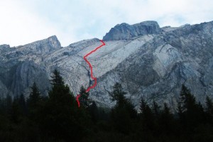
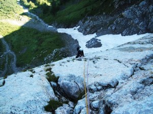
 Day 7. Mount Conness, North Ridge, 5.6. Several people we'd met had recommended Mt Conness to us, either by the West or North ridge. We opted for the latter, as the guidebook reckoned it could take up to 6 hours just to reach the foot of the west ridge, let alone climb it! We rose at dawn, and were on the trail by 7.30. The walk started just outside the national park, and the terrain was quite different from previous days – red coloured rock instead of white granite, more vegetation, and more rubble. As we gained height though, winding our way round idyllic (and very cold) mountain lakes, the granite gradually returned, and the rock became more solid. It wasn't long before we'd reached the Conness Glacier (what remains of it), and clawed our way up a gully by the side of the moraine and onto the ridge. Here we saw the only other 2 people to share our route all day.
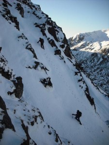
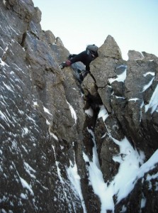
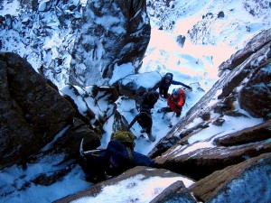
 The ridge itself was a delight, a mixture of moderate scrambling and easy climbing, and we moved together up to the summit of the Second Tower, where we met both the crux of the route, and also a cold wind. Having donned all available clothing, Carmen set off on the first pitch of the downclimbing crux, 5.5. This went smoothly enough, but we opted to ab (sorry, rap) down the next pitch, 5.6. This brought us to the notch below the main summit, and we pitched the rest of the ridge, in about 4 or 5 rope lengths – with a lengthy delay on the last while I struggled to find a route at a reasonable grade, opting eventually for a short ab.
On the summit we met another party, just finishing the West ridge, but that was it for the day. The descent proved rather complex, one section involving a scramble down a narrow rocky gully that was almost hidden from above, good job it was still light – but we maintained tradition by having the last half hour of the walkout in the dark.
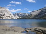 Day 8. Rest Day – a real one this time. Sunny but with a strong cold wind. We arrived at Tenaya Lake to find waves breaking on the shore, but the far end was sheltered by trees, so we got that swim after all. Water temperature was about 4 degrees, so much more pleasant than Scarborough at the height of summer. Had good views of the excellently named Stately Pleasure Dome, with its famous 'easy' route of the Great White Book. Graded 5.6R where R means runout (X would mean death). Pitch 3 is a 55m chimney/offwidth and is totally unprotected unless you have a size 6 Camalot. We looked, and walked on by.
Tried and failed to find a weather forecast for the next day – despite all the guidebook warnings about checking that storms aren't due, the National Park people seem determined not to help. The best we got was a guess that it would be the same as today, ie windy. So decided against a long day tomorrow, rather than the narrow ridge we'd considered…
Woke at 2am. No wind. Change of plan.
 Day 9. Matthes Crest, 5.7. The other suggestion people kept offering for a must-do route. Expecting it to be busy (it was a Saturday), we were up before the crack of dawn (at 5.45), and on the trail at first light. A long approach, largely on sketchy deer trails, led past Budd Lake, round the side of Echo Peaks, and down to the start of the ridge. Three pitches of 5.4/5.5 saw us at the start of the crest, another group of 4 arriving just as we set off. Then we got our first sight of the ridge itself.
 Most so-called knife-edge ridges that I've done tend to be steep on one side, and relatively gentle on the other, often with an easy option or walk- round at the most exposed bits. This one was almost vertical on both sides, and the only option was to stick to the top of the crest – though this mostly provided surprisingly easy (class 3/4) climbing, albeit with huge exposure. Moving together, it didn't take us too long to reach the south summit – though were overtaken first by two very fast climbers who were less moving together than running, and then by 3 young soloists, 2 of them wearing trainers!
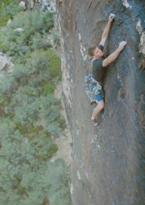
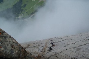
 The descent from the south summit involved retracing our steps slightly, with a 5.4 downclimb, which we pitched. Then it was time for the sting in the tail, a 5.7 rising hand-traverse, steep and strenuous, hard and committing – a proper VS pitch! And suddenly we were at the summit. The fast folk had continued along the rest of the ridge to the north – apparently this goes at about 5.8 and is hard to protect. We went for the usual ab descent. A leisurely 2 hour walk back saw as at the car a little under 12 hours after leaving, and only just after sunset. Which is more than can be said for the pair we briefly watched on Cathedral Peak as we walk by, still 2 pitches from the top with a 2 hour descent to come and only 45 minutes of daylight left…
Against the odds, the route managed to match Cathedral Peak in quality, and gave another perfect day to finish the trip.
And that was it, time to leave Yosemite. A brief stop on the way out to look at some Sequoia trees – they're quite big.
Task 4 – avoid falling off a mountain or being benighted – success.
 We had a day to spare before our flight, so stayed in the youth hostel at Pigeon Point Lighthouse, an hour or so south of San Francisco and adjacent to the local tsunami escape route. The lighthouse itself used to be open to the public, but closed in 2001 after bits started falling off. The next morning we went to Año Nuevo State Natural Reserve, home to sea-lions, elephant seals, harbour seals, pelicans, and thousands of other seabirds. Many photos were taken.
Task 5 – avoid being swept away by a tsunami or crushed beneath a collapsing lighthouse – success.
And then back home.
Task 6 – avoid (again) being blown up by terrorists – success (again).
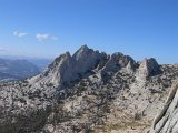 So, does Yosemite have enough to do for bumblies? Absolutely. We ran out of time to do even half of the small number of easy routes in the local selective guide, so Lembert Dome, Hermaphrodite Flake, Pot-Hole Dome, to say nothing of the routes in the more definitive guides, will have to wait. As will the abundance of summits with walking routes to the top. And we didn't even venture near Yosemite Valley itself, deciding reluctantly that adding a 3 hour drive to a 14 hour day to climb Snake Dike (the classic 5.7) on Half Dome would probably be a bit too much! And it's only a relatively short drive to Mammoth or Bishop in the south, Lake Tahoe in the north, where even more climbing and walking can be found.
Will we go back? I wouldn't bet against it…
Some more photos (lots of them!) can be found here
Logistics
We flew from Heathrow to San Francisco with United Airlines. Several others fly this route, and the cheapest will vary from day to day so it pays to look around.
Car hire was arranged via Economy Car Hire, who as well as being cheap, also include full insurance with no excess (except for tyres and windscreen, sorry, tires and windshield), which is quite unusual these days! It is sometimes cheaper to get a Fly Drive deal, ie booking car hire at the same time as flights.
Accommodation in San Francisco is plentiful. We went for a relatively posh option on the first couple of nights, but there are 2 or 3 youth hostels too.
Non-camping accommodation in Yosemite is scarce and expensive. Camping is cheap, currently $20 per pitch per night, so if there are several of you it's an absolute bargain. Half can be booked in advance, and especially in the Valley will be fully booked weeks or months in advance. The rest is first-come first-served, so arrive early and be prepared to queue. We booked a couple of weeks in advance, which was good in that by the time we arrived, the site was fully booked for the first weekend, so we'd have had problems otherwise. On the other hand, it made for less flexibility, and there are limited refunds for unused nights. There are several less busy campsites just outside the national park so even if you just turn up you'll get in somewhere, but may have a long drive each day.
Fuel is dirt cheap (about a quarter of the UK price ), though the locals still think it's expensive. Restaurants are relatively inexpensive. Groceries aren't such a bargain, especially in the national park – expect to pay roughly the same is you would in a small village in the Scottish Highlands.


