Posts Tagged ‘Munros’

YAC go north – Achnasheen February 2017

Tuesday, February 28th, 2017

Long overdue, but I've finally got around to catching up with some blogs, and what better timing to get you in the mood than when we're just getting ready for another round of winter trips!

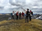
The club Scottish winter trip to Achnasheen headed to the Jacobites MC hut in the Lochcarron valley. This was a 3 night trip so we made the long drive north on the Thursday night, and soon settled in.
The weather for Friday was looking like the best day of the weekend, so we all headed out keen to make the most of the winter conditions, which were threatening to break later in the weekend.
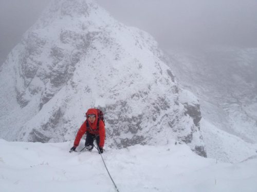
Pete, Dave and Nan headed for Beinn Damh, parking at the Loch Torridon hotel, hiking up through the forest and then following the path up the valley to stay low and out of the winter wind as long as possible. After summiting, they followed the ridge NW and got some great views on the way down when the clouds briefly lifted.
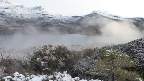
Over on Liatach, Mike, Rob, Karl, Paul, Mark and Russ were having a big day out, which began with some slippery boulder fields as they left the valley and passed the snowline. This soon turned into a powdery covering as they headed up, making progress slow. Never the less, they completed the ridge traverse and made it back after an epic day knackered but with smiles on their faces and ready for the usual food fest! Richard and Phil headed out to do the A'Chioch ridge on Beinn Bhan, Applecross while Simon and Carmen ticked off the snowy Beinn Eighe Corbetts of Meall a'Ghiubhais and Ruadh-stac Beag.

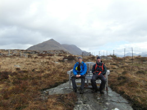
Saturday brought the thaw as forecast, and after the big winter days out on Friday, people were keen to take it easier. Dave, Paul and Rob headed out to tick a munro in the Cuillin forest, Carmen and Simon walked up the corbett An Ruadh-Stac, Mike, Mark and Russ headed low for a walk around Loch Torridon, while Pete and Nan did the same, checking out the coast around picturesque Plockton. Richard and Phil were more adventurous, climbing up the munro of Fionn Bheinn not too far away from the hut.
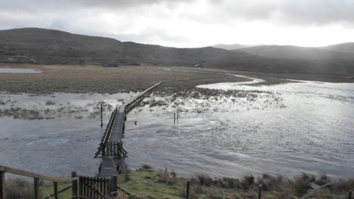
Sunday it definitely didn't feel like winter anymore, with the thaw having flooded a lot of the land around the hut, thankfully the raised walkway took us over most of it, and across the swollen river without getting our feet too wet.
Most of us headed south for the long drive home planning for a food stop on the way, Richard and Phil however got the prize for being the most keen of the weekend, scampering up the Sow of Atholl on their way down the A9. So a good selection of routes, summits and walks done over the weekend, making the most of the changeable weather.

Compleat at last

Saturday, June 18th, 2016

Finished!Just 6 Munros left to do as we headed to Scotland for our annual week's trip. The plan was to finish them over the Bank Holiday the following weekend, when the club was staying at Glen Affric, as 5 of the 6 comprised the Cluanie Horseshoe, which is best done from the north. This needed good luck with the weather though, it would be thoroughly miserably doing a long hill day in the rain.

The 6th was Ben More on Mull, so we spent a few days there. What a great place! We had the benefit of a high pressure system just west of Scotland, so while England and Wales shivered in the rain, we had wall-to-wall sunshine. As well as walking up Ben More and its adjacent Graham Beinn Fhada, we had a trip to Staffa (Fingal's Cave) and the Treshnish Islands (puffins galore!), and also did a spot of cragging. Not world-class climbing, but the wonderful location automatically added a star to everything. And the campsite at Fidden is brilliant.

Mullach Fraoch-choireAfter watching some dolphins swim by in Tobermory harbour we took the ferry back to the mainland for a long drive out through Ardnamurchan (we really need a club trip there!) and Ardgour. We decided to spend the night at Invergarry so we could do a quick ascent of Carn Ghluasaid, the outlying Munro of the Cluanie group. This meant that the 4 remaining summits  formed a more reasonable day's objective without a long there-and-back detour.

So all that remained was to drive to Glen Affric (about 10 miles as the crow flies, but 2 hours by road) to meet up with the club.

Low cloud greeted us on Saturday morning. But we remained optimistic that the weather would improve to give the forecast sunshine.

Charles set off first, intending to add a Corbett to the round. Carmen and I, along with Rob and Annie, followed 90 minutes later to do all 4 Munros. The others (Simon, Debra, Peter and Karl) planned to do the final two, meeting us at the summit of our 3rd.

And things mostly worked.

BubblyThe cloud burnt off to give a sunny day. After a couple of diversions for some Munro Tops we somehow arrived at the top of A' Chraileag within minutes of the others. All that was missing was Charles, whose ambitions were stronger than his legs, and eventually descended after a Corbett, 2 Munros, and a few Tops.

Our final Munro was Mullach Fraoch-choire ("Hill of the heathery corrie"), and what a fine hill it was, shapely and with some fun scrambling up the south ridge. As we arrived at the summit, Simon and Karl produced a couple of bottle of fizz from their rucksacks and we all celebrated in style.

Om nom nomA brilliant end to a long campaign (27 years for me, a rather more sprightly 16 for Carmen), made extra special by the weather, the location, the company, and of course the bubbly!

So what's next? Well I've got 38 Tops left to do. There are lots of Munro-free islands we haven't been to, Rum being top of the list. We've started the Corbetts (probably about 50 or 60 done). And the next day we added another 3 Munros to our 2nd round…

Some more of Simon Fox's photos here

Ours will follow if and when there's time…

Making the most of the sun

Thursday, May 12th, 2016

Ladhar BheinnWith warm summer's weather forecast for the weekend, Carmen and I took the opportunity of a quick trip to Knoydart to finish off one of our last remaining Munros, Ladhar Bheinn (which as you'd expect is pronounced "Lar-venn"). After a short 7.5 hour drive on Friday evening we camped at Kinloch-hourn.

TribblesAn early rise on Saturday morning to beat possible late-afternoon rain saw us walking by 7.30. Cloudy and cool but dry, it took us a little under 3 hours (with a brief pause to photograph some tribbles) to cover the 7 miles or so to the bothy at Barrisdale. We pitched our tent outside the bothy. No time to delay so we set off for Ladhar Bheinn.

Stob a' ChearcaillFar from burning off as expected, the early cloud seemed to be thickening, and it wasn't long before the rain started. The cloud base was high though, well above the summits, so we had good views despite the rain. A short but steep and vegetated scramble up Stob a' Chearcaill was made more exciting by the damp. Then a traverse over a couple of small tops and another steep climb led to the short summit ridge.

Ladhar BheinnThe rain stopped at last, and as we walked out and back to first the high point and then the trig point 300m beyond, the sun even made a weak appearance. The trig point appeared candle-like with the recent addition of a large rock. I expect someone got a large Arts Council grant for it.

Ladhar Bheinn trig pointWe descended over the Top of Stob a' Choire Odhair and into the fine corrie of Coire Dhorrcail before picking up an old stalkers' path back to the bothy. Another 7 hours or so making a 10 hour day, 16 miles and 2200m ascent, rather more than expected from a glance at the map!

The promised rain held off long enough for us to eat in the dry, but it then set in for much of the night, so thoughts of an evening stroll by the sea were quickly abandoned.

Sunday's weather forecast was for a little low cloud first thing, swiftly lifting to give a warm or even hot, sunny day. So we were disappointed (though not surprised) when we emerged from the tent to find the cloud even lower that Saturday, the temperatures the same, but with the addition of a strong wind.

Glen BarrisdaleOur plan had been to walk out up Glen Barrisdale then via a grade 3 scramble up An Caisteal, a traverse of Graham Meall nan Eun and Corbett Sgurr nan Eugallt before descending to the glen just a mile or so from the car. But the wind was strong enough to make walking a fight at times, so with a lot of the rock still damp after the night's rain we quickly abandoned the idea of a scramble, missed out the Graham, and instead slogged up the steep hillside to the low col SW of the Corbett.

Still cloudy and windy with no sign of the sun, we were at least dry, and again the cloud base had lifted high enough to clear the tops – though a thick haze prevented much in the way of views.

Stalkers pathA false summit (Sgurr Sgiath Airigh) with a fine cairn was followed by the real summit with a tiny cairn, and then a few hundred metres away by a 3rd top where the trig point was found (did they always put the trig somewhere other than the high point round here?). Well worth having the Harvey map for this hill, as the OS maps still show the trig point as being the highest. A descent of the NE ridge led to a very old stalkers' path, becoming boggy and hard to follow in places after years of neglect but a delightful route nevertheless. Even better, the sun finally deigned to make an appearance, and by the time we reached the car at about 2pm the temperatures had soared to a massive 15C.

So where was the heatwave we were promised? We met it at Fort William, just 20 miles to the south, where the temperature was 25C!

Despite the disappointing weather we had a great weekend, it's hard to go wrong in Knoydart! Just a shame about the long drive.

6 Munroes to go and still on course for completion later this month…

Some more photos here


Easter 2011

Thursday, May 5th, 2011

After a few weeks of constant sunshine, a rainy blip was forecast to coincide with our Easter trip to Torridon, so a few of us decided to break the long drive up to camp near Glen Lyon on Thursday night and do some Munro bagging the next day. The group of 4 to the north of the glen was chosen, and turned out to be a short easy day, despite adding on all the Tops as well (as I missed them out on my previous visit and am a sad completist – not sure what everyone else's excuse is!). Map here.

Arriving at the Ling Hut later that evening the weather was still kind. But the next morning, it wasn't, with strong winds and persistent light rain. It seemed brighter towards the coast though, so we all headed for Alligin Shuas, near Diabaig. A pleasant walk round the coast included some bouldering from Rob and some rock-pool-gazing from Carmen and Debra, with signs of (probably) an otter's holt by the sea. We'd thought about including a grade 3 scramble at Diabaig, but had left the guidebook in the hut and weren't sure where it went. I had a play on the rocks right of the crag, which weren't the described scramble but quite fun anyway, before catching the others up on the way through the complex landscape of the route back (would make a good location for a mountain marathon!). Map here.

The next day the rain was heavier and more persistent. But by mid afternoon it seemed to be easing off slightly, so Peter, Rob, Carmen and I set off for Ben Alligin, and were rewarded by a lovely dry afternoon/evening. I've done Ben Alligin several times before but it never fails to impress. Map.

Monday was drive-home day, so of course the sun came out. Despite the long drive ahead, most of us opted for a day's climbing. Carmen and I headed for the south face of Sgurr a'Chaorachain, a massive 5 minute walk from the road, where we climbed Bumbly One (HS 4a) – some good climbing in 4 pitches but lots of scrambling too, worthwhile but not a patch on Sword of Gideon on the next buttress (which we climbed last year). We were finished by 2.30 so managed to get home at a reasonable hour.

Which is more than can be said for Peri, Peter and Rob, who went for a look at the Cioch Nose. This classic VDiff (now Severe) was part of Rob's quest to tick the whole of Classic Rock, and after being rained off with Luke last year he was keen for a rematch. After getting slightly lost on the walk in, and taking much longer than expected on the finishing scramble, they eventually got back to York at around 3am!

Even though the weather wasn't the best we've had, it was far from the worst too. The Ling Hut has had a generator installed since our last visit in 2004, so you no longer have to pump water by hand – luxury! There are still no showers (or hot water), but there are public showers available in Torridon village if required (we made do with the cold stream outside the hut!). Hopefully it won't be another 7 years before we go back.

Lots more photos here.
Debra's pictures here.

The Raeburn Hut – New Year Meet 2008/9

Friday, January 16th, 2009

The raeburn HutWe did far too much for a detailed report (cue audible sighs of relief all round) so here's a summary. 

There was not much snow about, but temperatures were around freezing all week (usually well below) so the ground was frozen hard, with quite a bit of water ice, especially on paths and in the glens. A high pressure system was sat over us for the whole trip, giving mostly light winds and sunny skies. The main occasional problem was the low cloud that often came in from the east, except when it came from the west, so predicting the best direction to head in was largely down to luck. So we travelled east, west, north, and south, and occasionally stayed close to the hut. Overview on Google Maps.

Beinn a\' Chlachair from Geal CharnSaturday 27/12. Wall-to-wall sunshine for a round of the three Munros south of Loch Laggan – Creag Pitridh, Geal Charn, and Beinn a' Chlachair – with Rob. Good views of the clouds that obscured all hills east of Ben Alder, so a lucky choice of hills. Descended by the rarely visited SW ridge of Beinn a' Chlachair in order to stay in the sun for as long as possible. Route Map.

Ben AlderSunday 28/12. A big day. Cycled 8 miles from Dalwhinnie to Loch Pattack, then abandoned bikes for a walk up Ben Alder (via a scramble on the Long Leachas) and Beinn Bheoil (where we unexpectedly met 2 other walkers), before a long cycle out in the dark. Rather overcast for most of the day with the summits mainly in cloud, which made navigation across the Ben Alder plateau quite interesting. Route Map.

Beinn UdlamainMonday 29/12. A shorter day round the Munros west of Drumochter Pass. In the clag all day, with a bitterly cold wind.  Carmen only needed the first summit (Sgairneach Mhor), and I'd done them all before, but we made more of a day of it by carrying on to the next two (Beinn Udlamain and A' Mharconaich) before leaving Rob to add the fourth (another Geal Charn). Route Map.

The Lairig GhruTuesday 30/01. The forecast was for sun, and it didn't disappoint. We left the Whitewell carpark (near Aviemore) at 8.25, just before sunrise, and walked down Glen Einich with the intention of climbing just Braeriach. Conditions were so good when we reached the plateau that we added on Cairn Toul and Sgor an Lochain Uaine for good measure (narrowly missing heading south towards Monadh Mor by mistake!), finally reaching the summit of Braeriach at sunset. All that remained was a 7.5 mile walk out via the Lairig Ghru, most of it in the dark, arriving at the car at about 7.10. Total distance 22 miles. Arrived back at the hut to find that the water supply (ie burn) had frozen so there were no showers for the rest of the week. Joined the others in the pub. Route Map.

Brocken SpectreWednesday 31/01. Another forecast of sunshine. A 6.30 alarm call got us to Tulloch Station in time for the first train to Corrour, to do the 2 Munros SE of Loch Ossian (Sgor Gaibhre and Carn Dearg). Disappointingly cloudy for the long walk by the loch, with the hills obscured. But we walked up through the clag for the most magnificient inversion I can recall, peaks in all directions emerging from a sea of cloud. And it got even better on the last summit, with a series of Brocken Spectres added to the mix. It was a shame we had to descend back into the gloom to get the last train back. Route Map.

Crossing Markie BurnThursday 01/01. A late start after a late night, we set off to do Geal Charn (the one in the Monadhliath this time). We left Ben's car at Garva Bridge, and started walking from the Spey Dam. We walked up via Glen Markie (interesting river crossing, luckily the ice held!) and descended via Beinn Sgiath and the SW ridge. More clouds today, and no inversion. But we did find ourselves in a gap between layers, with clouds below us, and above us, and a view of cloud-draped summits in between. Route Map.

A\' ChailleachFriday 02/01. Carmen's final Monadhliath Munro, Sgurr Dearg. A cold mist in the valley, but sadly no inversion. However the clouds did clear gradually, giving superb views of the Cairngorms which were completely clear of cloud, and then the hills to the northwest, similarly bathed in sunshine. Our hills took a little longer to clear, but did so in time to decide to extend the day, following the old fence posts for a few miles to add the two easterly Munros (Carn Sgulain and A' Chailleach). Route Map.

Loch QuoichSaturday 03/01. Decided to head northwest to get some of the sunshine they'd been enjoying for most of the week, so drove for 90 minutes to Loch Quoich, just south of Glen Shiel to climb Gleouraich and Spidean Mialach. Unfortunately this seemed to be just about the only part of Scotland that didn't get sunshine that day. But at least the cloud base was above the summits, so we got good views of the sunny hills elsewhere! The view up Loch Quoich towards Sgurr na Ciste is a contender for the finest in the country. Route Map.

Sunday 04/01. Cloudy with light snow. Drove home.

A tiring week, we kept waiting for the weather to break so we could have a rest day, but it stayed stubbornly fine. A total of 19 Munros in 8 days, and I even managed 6 that were new to me!

Lots more photos can be found here.

Advanced Down Jacket Testing

Monday, December 8th, 2008

After a week of crooning over down jacket specs, the Chosen One arrived in the post just in time for a munro bagging trip. Clearly, no matter what the temperature, some testing was in order, and test conditions seemed excellent, with  roads and car park a skating rink as we arrived in Crianlarich
approaching Stob Coire Odhair
Attempt 1) All attempts at testing the jacket on day one failed due to brilliant sunshine and the exertion of slogging up the Black Mount through knee deep powder snow.   By the time we reached our first summit, Stob a Choire Odhair,  we looked a strange sight – our bottom halves swathed in big boots, gaiters and waterproof trousers, our top halves in sleeveless T shirts. Alastair even had shades and a sunhat on. knee deep in snow
The real air temperature became all too evident once we sat down, we had a hasty lunch then arse-slid down the hill to the bealaich whooping with glee.
We slogged our way up the ridge to Stob Ghabhar and reached the summit cairn just as the sun was setting, then paused to take in 360 degrees of pink tinged snow covered mountains with  bronze glints from the occasional loch. Head torches on hand, but not required – we finished our descent in brilliant moonlight reflecting off the snow.
sunset at the summit of Stob Ghabhar

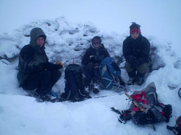
Attempt 2) Fine test conditions. A chilly wind and incoming cloud. We headed for Ben Chonzie. Reputedly the dullest mountain in Scotland, Ben Chonzie is known for  "collecting the snow".   After saturdays 12 mile extravaganza I was knackered before we started and made heavy work of the plod uphill. At the summit near white out conditions  descended and a bitter wind dropped the effective temperature to -12 or less. I was very taken by the grotesque rime formations,  but few photos were taken as removing gloves for even a moment caused stingingly cold fingers (must get some liner gloves). The snow was drifting and at places we broke through the crust into thigh deep holes. A fine chance to test the jacket! Out in came in all its magenta glory, and I am happy to report that combined with a gortex layer it was toastily warm even while sitting on snow eating sandwiches.A nice day for a picnic


http://www.flickr.com/photos/81529845@N00/sets/72157610924975500/