Archive for the ‘Running’ Category

Wolds 20

Sunday, May 15th, 2016

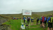
P1010934Early Saturday Morning – Pete Walker, Simon and me set off to Millington to participate in an event being organised by fellow YAC member Warwick.

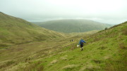
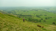
It is a friendly low key event around the Yorkshire Wolds with running or walking options on both the 13 mile or 20 mile courses. Also with 2 refreshment stops – including yummy cakes en route and some tasty hot food at the finish. What more could you ask for? and the weather was spot on too.

Plenty of lambs, 2 hares and a fox spotted whilst running. It is a good route – never too hilly but constantly undulating. I believe the winner finished in 2:47 (beating his 3:01 the previous year). Pete W put us to shame completing in 3:18 (he has been training). Simon & I were running separately, but often together, overtaking each other several times, but ended up finishing together (despite Simon's valiant attempt overtaking me up the final hill) – completing in 3:54. Could have been slightly quicker if we hadn't got lost near the end – but not much.

Thanks to Warwick & family & helpers.

More details here:

http://www.ldwa.org.uk/challenge_events/show_event.php?event_id=14427

From Millington, circular routes around the Yorkshire Wolds taking in Bishop Wilton; the long route then taking in Kirkby Underdale and Thixendale, whilst the short route cuts across before both head near to Huggate before returning to Millington

Another 24 hours

Monday, August 3rd, 2015

Lowther HillsThe Marmot24 is a 24-hour mountain marathon, though with a 12-hour option available. Open to pairs, solo runners, or teams of 4, this year both courses started together at noon on Saturday, with the 12-hour finishing at midnight and the 24-hour at noon Sunday. It's a score course, so you can visit as many controls as we wanted, each one scoring the same, 10 points. Finishing late incurred minor penalties at first, ratcheting up to a loss of all points if half an hour late!

It was possible to return to the event centre for a sleep, food, dry clothes, etc, and the position of the event centre made it quite easy to plan a route to do this. Some people carried tents with a view to camping out on the hill; others bivvied to save weight. There were even tales of people stopping for a pub meal in the evening. But the truly certifiable stayed out and on the move for the whole 24 hours.
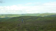
Before the rainAfter last year's inaugural event, my blog entry concluded "I'm really glad we did it, but next time I think the 12 hour course may be a better choice, I wouldn't do the 24-hour again." And so, 12 months on, we drove up to Durisdeer in the Southern Uplands to compete in the 24 hour class. Inevitable really. We'd been to the Lowther Hills for the 2007 OMM, but couldn't remember it at all, so it was to all intents a new area for us.

After a leisurely start (we had our big tent, so plenty of room to cook a bacon, egg and bean breakfast) we picked the map up at 9am, giving just under 3 hours to plan.
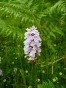
OrchidThe southern half of the map contained what appeared to be relatively gentle hills, though with a lot of the controls looking potentially difficult to find (re-entrants, isolated crags, etc), and a few long gaps between them. The northern half was a lot steeper, with controls closer together and on more obvious features (stream functions and summits). We guessed that this meant that the running was easier in the south, rougher in the north.

Like last year, we decided to go for the harder navigation first, while we were fresh, and so worked out a route looping south to start, with various options for a smaller loop back north at the end. We intended staying out all night (last year's return to the event centre for a rest didn't work out very well).

It was slightly disconcerting at the mass midday start to see the clear majority of people heading off north! But we had a plan we were confident in. Last year we played cat and mouse with another team for the first few hours, but this year we found ourselves on our own after only 5 minutes. Despite occasionally seeing a few people in the distance, and crossing paths a few times with some, we pretty much stayed on our own for the whole event.
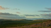
Evening sunThe first half dozen controls went smoothly though mostly without paths, until after a couple of ours the rain started. No problem we thought, the forecast was for dry conditions with occasional scattered showers. It didn't stop raining for about 6 hours! Apparently the northern part of the course stayed dry. So it goes.

What looked like a good track up the valley in the south east corner turned out to be a bog, slower going than it should have been and getting quite chilly in the rain. We stopped briefly at Burleywhag Bothy to escape the rain, dry off a bit, and have some food – if we'd known about the bothy in advance we might have planned a nap!

Last year I felt sick after about 10 hours and had trouble eating for the rest of the event; I put this down to not having eaten or drunk properly earlier on. So this year we'd supplied ourselves with plenty of food, including lots of home-made coconut ice, a packet of jaffa cakes, some bombay mix, 2 pasties, and a pizza! No, really.
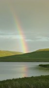
RainbowsA couple of hours and 3 controls later it finally stopped raining, the sun came out, and gave us a series of rainbows. Missing an outlying control as it looked to be over the other side of a tussocky hill, we found ourselves with a bit of spare time before dark, so added in a spur-of-the-moment dogleg for 20 points. Unfortunately one of these involved a there-and-back knee-deep stream crossing, which didn't start the night off well.

By now dark, we headed for the Southern Upland Way, which we'd planned to follow through the night on the assumption that it would be easy to follow and it took us to some simple-looking controls on obvious features. It quickly became obvious that this was no Pennine Way – a narrow boggy path kept disappearing and reappearing, and gave us some of the hardest going of the event! At least it followed a fence line all the way up making navigation easy.
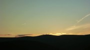
Sunset over Green LowtherNearing the top of Lowther Hill, the SUW path took an unexpected detour away from the fence. Not sure exactly where it went (it's not marked on any map) but it seemed to involve rather too much height loss that we then had to regain. Perhaps it actually stuck to the fence, and I was hallucinating.

Unfortunately the cunning food plan had made no difference and my stomach was suffering, but I battled on, groaning bravely throughout.

We eventually reached the summit, with its incongruous golf ball, tarmac road, and street lights, all part of the national air traffic control system. We followed the road to a control on the trig point of Green Lowther, unable to run even the downhills. The last 4km, that looked easy on the map, took us an hour and three quarters, and it was getting cold. I'm sure there was some frost among the dew.

DawnAfter a couple more controls, it was at last light, and the head torches went away. It didn't take long until the sun came out, the best weather of the event, though a chilly breeze meant the waterproofs stayed on. At last we could start thinking about the route to take back to the finish.

A brief scare when Carmen thought it was 8.00am was quickly resolved when it turned out to be 6.00 after all – we're not used to being up this early! So we had plenty of time to pick off a group of 5 controls close to the event centre. In fact we had so much time left that we were forced to add in two more as well, adding a steep 200m climb just at the point we didn't want it. All that remained was to sprint quickly/stagger slowly (delete as applicable) back to the finish.
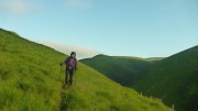
6.20 amWe'd scored 300 points in 23 hours, 36 minutes, and 35 seconds. First mixed team, and 5th overall (on the same score as 4th place, but 10 minutes slower). The winner scored 360 so we were at least in touch.

Yet another really great event, and one that I'd urge anyone else to try (if you like mountain marathons of course!). Don't be put off by the epicness of the 24 hour event, most people take the sensible option of either the 12 hour course, or stopping for a break somewhere on the 24 hour version. They need numbers to increase if it's to remain viable in the future, so don't puit it off too long or you'll miss the chance!

Finally, thanks again to Shane (organiser), Gary (course planner), and everyone else involved.

More photos here

Results here

In the dark

Thursday, January 29th, 2015

We didn't have the best of preparation for this year's Dark Mountains. First Carmen went down with her annual cold/cough, then I duly caught it and turned it into full blown man flu. A week off work was followed by another week wishing I was off work, then the morning of the race I was so tired I thought about pulling out.

But it's become my favourite event of the year (OK, equal favourite with the LAMM), and this year was held in my favourite running area, the Howgills. So I had no choice.

After a brief kip on the drive over I was feeling a lot better, but our aim as we started will still just to get round in one piece, and not to repeat last year's miscalculation which left us in joint last place. Of course this resolution lasted until we were given the maps, at which point I immediately checked where the highest scoring controls were and worked out if it was feasible to get to them! (We were were doing Long Score – 10 hours to get as many points as possible).

We spent a good 10 minutes planning a route, and decided on a vague line to get to the east of the map for a line of high scoring controls. We'd then pick up whatever we had time for before heading for home where there was a concentrated group of controls near the finish.

This plan lasted approximately 2 minutes. There seemed to be more tracks leading away from the start than were marked on the map, and we weren't sure which to take. And we also decided that it would be better to pick up the grouped controls at the beginning, to be sure of getting them all. So that's what we did.

I'd like to say that we found them all first go, but we didn't. However, we found most of the more elusive ones 2nd or 3rd try, without losing more than a few minutes. A couple more changes of mind followed, and we soon found ourselves on the summit of The Calf, with about 4 hours 15 minutes gone.

I was tempted to leg it down the path to pick up a 50-pointer to the south, but Carmen was more cautious (ie sensible). Instead, a 30-pointer loomed in a re-entrant a couple of km away. This looked quite tricky, with no obvious attack point from above so we decided to miss it out – then changed our minds, and were soon counting paces as we traversed the hill before a diagonal descent to the check point. Of course once we reached the re-entrant and got to the right altitude, there was no control. Wrong re-entrant.

A study of the map suggested showed 2 possibilities for where we might be – one slightly too far east, the other slightly too far west. At this point Carmen mentioned some other possibilities, chiefly about what would happen to me if we were late back and lost all our points again. Luckily I made the right choice and we traversed west into the control.

Up and over the hill again, and down to a control inside the Andy Goldsworthy sheepfold above Cautley Spout. We'd been there before on the 2012 OMM, but that didn't stop us running straight past it and having to retrace our footsteps. From here, if we'd been feeling more optimistic then we might have headed north east to pick up a line of good scoring controls. But this would have left us with a long way to the finish over trackless terrain, and I was starting to feel sick, so we decided to play it safe and headed north along the ridge instead.

The downside of this was that we ended up running out of controls to visit, and after a series of climbs and descents to pick up every available checkpoint between us and the end, we finished with some 35 minutes spare. With hindsight we'd probably have had time for that 50-pointer, but better 35 minutes early than 35 minutes late like last year!

Much to our surprise we finished 4th in the long score, and first veterans team (at last, an advantage of middle age!)

Another excellent event, brilliantly organised as usual and with some well designed courses (I might not be feeling the same if we'd done Elite and been faced with a 14km leg to the first control!). Plenty of choices were available on our course – though pretty much everyone did a variation on the same thing. In some ways I wish we'd gone with our initial plan – just to see how it would have compared (almost certainly worse!). The only disappointment was the weather – far too benign! And the lovely snow that had covered the hills a couple of days earlier had pretty much all melted, leaving just a couple of large snow fields and some water ice on the odd occasion that we ended up following footpaths.

Our route here – about 32km and 2000m ascent.

Results here

Happy Helyg

Thursday, December 4th, 2014
10644364_869796693044120_1005588731349764442_o

Annie paying her respects

After the usual musical chairs sorting lifts the first peeps arrived at Helyg just after dark and moved into the hut concocting various suppers as the troops arrived. There were multiple plans, Peri desperate for Tremadog, but many people favouring staying local, what with the weather being undecided. Eventually Pete B arrived and the party could start.

The Climbers Club (CC) is one of the older clubs in the UK, established around 1892 they bought their first hut, Helyg in 1925, in the Ogwen valley, it's the only part of the valley not owned by NT! Helyg is the oldest continually used climbing hut in UK (so i am told) and has been modernised but retains much character, including exhibits from the 1952 Everest Exped as they used Helyg as a training base. Recently it has been opened up for outside club (or individual BMC members) use, so we were pleased to get it. The hut has 13 bunks but we were one over that, but Peri opted for her van, Paul a wee tent, and Annie the floor so all was well.

10474518_869796529710803_454342019900859529_oIn the morning Simon and Carmen had got an early start on their round of the valley, from the hut over the Carnedds and back over the Glyders range, a mere 16 miles an some silly amounts of ascent. Pete E's brother John dragged Pete off for a excellent scramble (Dolmen Ridge – see previous blog) and Peter W and Peg-Leg (Jamie) went on a proper mountain day out, climbing on the Idwal slabs before topping out Cneifion Arete – good effort.

Mark on slate

Mark on slate

A team of 4 went to the slate, or rather the cafe while they waited for it to stop raining then grabbed a few routes in the afternoon. Annie and Donal had a wee stroll around Tryfan, sensibly heading down when the rain came.

IMG_2561

Crib Gogh

Paul and Luke also went for a proper scrambling day out, soloing past some roped climbers on Parsons Nose (2/3) out of Cwm Glas in traditional conditions, before encountering her majesties army coming up Crib Gogh. After a jaunt to the top they backtracked down CG (3 star classic grade 1) and the north ridge (always awkward route finding) but were back in time for tea.

IMAG1426

lunch before Knights Move pitch

Slightly ahead of Annie and Donal Pete B and I made our way upto the east face of Tryfan to tackle Grooved Arete, a 3 star classic rock route on Pete's list, and it was his b'day so his choice of activity. It all went fine but was slimy in places and the rain didn't help much. Never freezing as it's out of the wind, t'was chilly at points. We almost made it back to the car sans head torch.

10406377_10152865488116240_4469882268850460378_n

CAKE

I love meets like this where we all disperse to the four compass points and come back to chat over the adventures with tea and cake in hand. Speaking of cake, it was Pete's B'day and I had made a cake, and enlisted Carmen to stick the decorations on – no candles but – a veritable 'Jelly-Coatta Army' !

For the meal this was preceded by L&P soup with garlic bread, Moroccan Meatballs with cous cous, salads and dips, Peri's excellent lemon Drizzle cake (enormous) and apple crumble. We clearly missing Alan's cheese course 🙂


Sunday most people were a little heavier !

IMAG1442

Rob in Bus Stop Quarry

Team Slate returned to the quarries and had a successful day with Dave W and Peri teaming up to tackle some E1s and Mark and Luke bagging some unknown routes ! Pete, Jamie and I also headed to the slate a little later and messed about in Bus Stop quarry in the sunshine on the excellent easier sports routes there. Simon and Carmen braved the Cromlech in the pass and bagged a brace of CR routes (Spiral Stairs and Flying Buttress),

10551458_869801533043636_4756262770751623690_o

Camen on Flying Buttress

Paul and Pete went for a run on a route that Dave W suggested, along the valley up through Cwm tryfan (a lovely quite spot close to the crowds) and back along the tops to Capel returning up the valley coach road, about 14Km. Great views of Siabod but cold feet says Paul! Donal Annie and Peter went for another walk before heading home.


We all agreed an excellent hut (it's a special place for me as I stayed here for a few weeks when training for my MIA) and one we ought to go back to soon.

RAB Mountain Marathon 2014

Thursday, October 2nd, 2014

The start in CrookdaleThis year's RAB was based just off the A6 a few miles south of Shap. As usual in this event we were doing Short Score – 6 hours on day 1 and 5 on day 2 to score as many points as possible.

Our preparation was sub-optimal, as I went down with a stomach bug a week before, but it would take more than that to prevent me at least starting!

The start was a short walk up the road at the foot of Crookdale. The competition area stretched as far as Kentmere in the west and the southern slopes of High Street in the north. A quick glance at the map showed the greatest concentration of high scoring controls was in the north and west, so that's where we decided to head.

Near Wren GillMost people seemed to be starting up Crookdale to pick up a few controls on the hills to the north, but we went south west to Borrowdale (not the famous one!) and Bannisdale, planning to descend into Long Sleddale before following paths west to Kentmere and the start of the high scorers. It wasn't long before the scale of our over-optimism became apparent! By the time we reached the head of Bannisdale we'd already curtailed our plans drastically, abandoning the trek west in favour of a circuit of Long Sleddale. So we traversed the head of Crookdale to pick up another 15-pointer before the descent into the valley, where we ran past the mid camp before a steep 300m ascent up the side of the valley.

Unfortunately it was now clear that our revised route had been miscalculated as well. We were going to descend almost to Kentmere and back (with some 300m of reascent) for a 25 pointer – but there wasn't going to be time. And having decided to miss this out, there weren't any other controls to add in before we finished. We might have had time to get to Lingmell End and back for another 20, but that would have been touch and go, and with lateness penalties this year becoming draconian after only 5 minutes we decided not to risk it. So we got back with some 40 minutes spare (ie wasted).

At the top of Long Sleddale140 points put us in 53rd place, one behind Alan K who had planned his day much better, finishing just a few seconds late with 144. Peter had been doing well, amassing 125 points, but unfortunately a knee injury slowed him dramatically and he was 45 minutes late back, losing all his points in the process.

The mid camp in Long Sleddale was the same one we'd used for the Saunders in 2010, in a superb location beneath the crags of Buckbarrow. The weather (low cloud and clag with a chilly wind on the summits) wasn't quite as good as the unbroken sunshine of that event, but at least it stayed dry and mild. And on the Saunders, the Sunday's weather was foul, with persistent rain and wind – this year, it was just more of the same, cloudy and dry, though a little too warm with no wind.

Sunday's map gave us two main options – either east to the hills above Borrowdale and Crookdale, or south towards Sleddale Forest. We opted for the latter as there was a group of closely spaced controls, and it also seemed to give more scope for adding/subtracting controls depending on progress.

Ascending Brunt KnottThings went pretty much according to plan at first. A few controls in tricky terrain were followed by a descent to the valley near Hall Beck and a stiff climb back up to the summit of Brunt Knott (despite its trig point and fine views this apparently doesn't feature on any tick lists of summits, Charles please note!), then a there-and-back trip to pick up a 30-pointer, helped by an unmapped track. In order to find a way around the out-of-bounds areas, we now had to descend into Long Sleddale and go a mile in the wrong direction before picking up a lung-bustingly steep track back up onto the fell for 15 more points.

The original idea from here had been to descend to Borrowdale and go up the other side to pick up between 1 and 3 10-pointers. But time was running out, so we had to miss these out and take footpaths round the foot of the fell instead. Carmen led the way and I struggled to follow! Just over 4 minutes late, a total of 135 points – 34th on the day, 42nd overall.

Alan arrived shortly afterwards, having opted for the Borrowdale and Crookdale circuit, picking up all controls bar one to arrive a few seconds early with 130 points – just 1 point behind us (woo hoo!). Peter meanwhile had decided not to drop out, but instead limped over the hills collecting 70 points on the way.

The icing on the cake – at the prize giving we discovered we were 2nd mixed veterans in the short score and won a prize!

This was the first time that Ourea Events had organised the RAB, taking it over after several successful years from Dark & White. They had a hard act to follow, but managed to pull it off. Looking forward to more of the same next year, but first we've got the 2014 Dark Mountains to contend with…

Our routes: Saturday here Sunday here

Results here

More details about the event here

Little Langdale

Tuesday, September 9th, 2014

Langdale PikesIt was looking for a while like there'd be hardly anyone on this meet, perhaps people were put off by the thought of Langdale crowds on an August Bank Holiday weekend. But after a flurry of late sign-ups it was almost a sell-out.

Saturday's forecast was for sunshine, and it didn't disappoint.

For many years I've meant to walk round the Eskdale skyline, but it's somehow never happened. So Carmen and I decided to take advantage of the weather and run an extended version of the route, starting and finishing at the hut. I say "run", but it was actually almost all walking! From part way up Wrynose, we headed up Pike o' Blisco, then across Crinkle Crags (there's definitely an extra crinkle every time I do this!) and Bowfell, over Esk Pike, and on to Scafell Pike.

Scafell PikeDespite being a sunny August BH weekend, there were surprisingly few people around, and we were wondering where they all were. As we approached the summit of Scafell Pike we got the answer, the place was heaving!

From here we descended under Scafell Crag, pausing to admire a hardy team of climbers on a very Upper Eskdalecold-looking Moss Gill Grooves. As we scrambled up Lords Rake and the West Wall Traverse we were on our own again. Then over Scafell summit, down the south ridge over Slight Side, before descending into upper Eskdale, across the Great Moss and over the col into Mosedale. We briefly considered dropping down to Cockley Beck and finishing over Wetherlam, but rejected this as we needed to get back to cook dinner before Annie starved to death! So we traversed to the Three Shires Stone, over Wet Side Edge, and down the valley back to the hut, where we were surprised to be first back!

Our route here for anyone interested.

The Coniston range from Pike o' BliscoMeanwhile, Alan did his own long run, starting up Wethlam, Swirl How and Great Carrs, before a descent to Three Shires Stone. From here, another big ascent over Cold Pike to Crinkle Cragsand a descent of The Band led to a pint or two in the Old Dungeon Ghyll and a return via Blea Tarn.

Steve, Rob, Luke and Mark spent the day climbing on Raven Crag, above the ODG. After a number of excellent severes, Rob and Steve climbed the route Rob had come for, Pluto (HVS ***). 3 Great pitches, a classic crack, an out there traverse and a lovely wall pitch, followed by a pint in the pub while waiting for Luke and Mark to find their way back down after an interesting choice of descent from their last route.

Inverno cruxOn Sunday, we headed for White Ghyll, with Rob, Steve, Mark and Luke. Always keen to try the obscure, I'd been looking for something from the Lake District Revival list. This crag provided the perfect route for me – Inferno (MVS), involving some back-and-footing at the crux. The first pitch looked a bit scrappy but the in situ heather didn't affect the climbing, which was better (and harder) than it looked. The long 2nd pitch provides the meat of the route, with steep parallel cracks leading to a niche in the overhang and the promised chimney practice. Pausing to clean the grass out of the cracks and place loads of gear, everything turned out to be a lot less traumatic than expected, with just a brief moment as the final pull onto the upper wall required unearthing some holds from behind the heather.

The rest of the route was a bit scrappy, but we topped out anyway. For future reference, an enticing diagonal line rightwards from above the crux looked a better option, and I later discovered is recommended in the new guidebook. Despite the vegetation, it's a really good route, full of character, and with a bit more traffic would once again deserve the 2 stars it used to get.

White Ghyll WallHaving humoured me by climbing a route from the choss list, Carmen now got her reward as we did White Ghyll Wall (VS 4c). I led the easy first pitch, Carmen led the crux second, I did the not so hard but quite bold final pitch. We finished the day with a repeat ascent of Slab Route 1 (Severe). A fine route, rather bold in places, Steve and Luke also climbed this earlier in the day.

Rob and Mark started with the excellent Slip Knot (VS 4b) before heading for Haste Knot (VS 4c). A nice first pitch despatched by Mark with ease then the meat of the route, the traverse. Rob's verdict – "Blimey, if you think Pluto is nuts this is bat shit crazy. Well protected with small wires but wild."

Blackpool Tower from WhitbarrowMonday was cold and grey, so we joined Peter, Annie and Steve for a short walk round, round, round, and finally up and over Whitbarrow. Highlight of the day was finding loads of wild damsons! Afterwards we popped into Ambleside to pick up our rewards for doing a route from the choss list – a free T shirt and chalk bag each!

Rob, Mark and Luke manage to fit some more climbing in, doing a couple of good short routes at a different Raven Crag, this one at Walthwaite, before rain stopped play.

More photos here


Sleep is overrated

Sunday, August 10th, 2014

The start
It's a week after the event, and I'm just about rested enough to string a few vaguely intelligible sentences together, so here goes.

Marmot24, the UK's first 24 hour mountain marathon, was launched a few months ago. The principle is simple – you've got 24 hours to score as many points as you can by visiting controls spread out across an alarmingly large area. You can return to the event centre to eat and/or sleep, or you can keep going for the whole time. As well as the 24 hour option, there are 12 and 6 hour classes, each timed to finish at the same time.

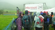
Adopting my usual plan of "try anything once and regret it later" I was keen to give it a go. Carmen didn't take much persuasion, and so last Saturday morning found us in a wet field near Threlkeld with over 80 other like-minded people. Maps were issued at registration, giving us 3 hours or so in which to plan our day. The competition area was huge, about 300 square km, and the route choices limitless. Each control was worth the same, 10 points, but with a few small clusters of relatively close controls.

There were 2 main areas. To the north were Skiddaw, Blencathra, and the hills Back o' Skidda'. To the south were the Dodds and the northern slopes of Helvellyn, with a scattering across St Johns in the Vale, and even some west of Thirlmere; and east to Gowbarrow and Great/Little Mell Fells.

After a lot of staring at the map, we came up with a vague plan. The area to the south had more controls, with a few nice clusters, but many of them looked like they'd involve some tricky technical navigation with lots of knolls, spurs, re-entrants and the like. So we decided to head this way first, while we were still fresh and it was light.

Controls on the two Mell Fell summits were followed by straight paths/roads back to the event centre, and we hoped this would give us an easier night time section. From the  centre, another line of easy-looking options headed back north. By the time we were on to complex terrain again, we hoped we'd be back in daylight. Depending on fitness levels, there were a few options available taking in some or all of the controls at the top of the map.

So much for theory.

Clough Head in the rainSlightly after midday and in heavy rain, we were off, in a mass start. But it wasn't long at all before we were almost alone, with just one other pair choosing the same first control as us; we had no idea if this was a good sign or a bad one! After 3 controls on Clough Head, we dropped back down to the valley, slightly surprised to find the other pair do the same, as it wasn't an obvious route choice! Four controls on Low and High Rigg proved just as tricky as they looked, but we were pleased to get them all right. A few other teams arrived from various directions, and soon disappeared in some more different directions.
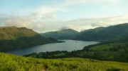
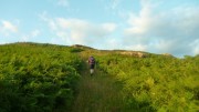
A quick up-and-down through the woods of Great How was followed by a long ascent just west of Castle Rock (nobody was climbing today!) then a rising traverse to the upper slopes of Stybarrow Dodd, by which time the rain had stopped and the sun was out. Here the other team who we'd been leap frogging all afternoon, headed south for a control near Brown Cove and we were alone. We crossed to the east side of the Dodds followed by a not-as-hard-as-it-looked ascent back to the ridge NE of Great Dodd.

Control on Middle TongueHere we decided to miss out one of our planned controls in order to get to easy ground by dark, and so a descent to the east was followed by a short road section through Dockray (the pub was extremely hard to resist). The rain returned briefly, but soon disappeared, and we climbed up Gowbarrow Fell in fantastic evening sunshine – we even had the luxury of a good path through the bracken, at least until we left it and fought through undergrowth, tussocks, and bogs to find a couple more technical controls. The first summit tick of the day was Gowbarrow Fell, with a brilliant sunset over Blencathra, after which we followed some good unmarked tracks to reach the road below Little Mell Fell.

Evening light over UllswaterOur plan had been to get here by about 10 – we arrived at 5 past 🙂 Little Mell Fell went smoothly, but Great Mell Fell was hideous, the path for most of the way up obscured by head-high bracken and the path down the far side seeming vertical to my tired knees. But the road from here back to the event centre was at least easy, with fantastic starry skies to look at, though I didn't have enough strength to run much of it. Passing a few worryingly energetic runners going in the opposite direction – hopefully doing the 12 hour course which had started half an hour before! – we arrived back at the event centre after 13 hours, with 190 points in the bag.

We couldn't keep this up of course.

Excellent track up GowbarrowA cup of tea and a quick chat with Shane (though I doubt he understood most of the gibberish coming out of my mouth) were followed by some food. I was feeling ill and could hardly eat anything, just a couple of mouthfuls of vegetable tikka and a banana. And despite changing into dry clothing (3 layers and a new waterproof), I was cold. But forced myself to get going again, just as the rain returned. Carmen of course was doing much better.

The next control was a sheep fold well away from any paths, and head torches wandering randomly around the hillside confirmed it was going to be tricky. So we stuck to the path until the altimeter showed the right height and traversed to it – I was pleased (and surprised) that we hit it almost spot on! Back down to the valley between Blencathra and Skiddaw, here it should have been runnable but I was having trouble even walking. Another control, then past Skiddaw House to a hideous 2km there-and back tussock-and-heather-bash.

SunsetDawn had by now been and gone, obscured by incessant rain with cloud bases down to 300m at times. Our planned route further north was long abandoned, it was just a question of which route to take us back to base. The cloud base rose for a while, making an potentially difficult re-entrant easy, after which some indecision and a change of tack led to a sheepfold.

Still raining, we traversed Mungrisdale Common to the col below Bannerdale Crags, down the valley and up to a final control just south of Souther Fell. At least it was supposed to be the final control. But we had 2 hours left and the centre was half an hour away, so although neither of us wanted to we headed back up into the clouds and increasing wind on Scale Fell before descending into the corrie east of Doddick Fell. This is somewhere I've wanted to explore for years – I don't know why, and having now been there I still don't!

All that remained now was the final sprint (ha ha) back across the fields to the finish. After 190 points in the first 13 hours, the last 9 or more gave us just 70, for a grand total of 260. Some way short of my hoped-for 300, but pretty good considering how I felt for most of Sunday.  47.5 miles and 14,000 feet ascent. Much to our surprise, we found we'd finished in 6th place (out of 42 starters), and picked up the mixed team prize!

With hindsight, we made the mistake of devising two 1-day routes, but without the benefits of a good night's sleep between them, so the second part was always going to be unrealistic. And it would probably have been better to stay out all night, without the long control-free section to get back to and from the event centre – the first two teams did this and were a long way ahead of everyone else.

Another brilliant event from Shane and team, with another fantastic course from Charlie Sproson.

I'm really glad we did it, but next time I think the 12 hour course may be a better choice, I wouldn't do the 24-hour again. Definitely not. Almost certainly not. Probably not.

When do entries open for 2015?

Results here

Our route here

Even web site here

Dark Mountains 2014

Tuesday, January 28th, 2014

While the rest of the club headed north to battle the elements, we drove south instead. This year's Marmot Dark Mountains (an overnight mountain marathon) was held in the Peak District, on Kinder and Bleaklow – two areas that are notoriously difficult to navigate across in the daylight, let alone in the dark. We did well in last year's inaugural event when in appalling weather we were the first mixed team in the score class. This year score was split into long (10 hours) and short (8 hours), and we went for long (I felt we ought to, as I was one of those who'd suggested the idea!). Could we match last year's rare success?

In a word, no.

In marked contrast to last year's conditions, the weather was fairly benign. Rain earlier in the day had stopped, and apart from a little light drizzle it stayed dry until the next storm arrived shortly after 7am (many of the finishers on the line courses will have been hit by this, but the score courses were over by then). It was actually milder than forecast, no sign of the promised frost, and we ended up over-warm – but better that that too cold.

We began OK, slow and steady, as we made our way south east to the Kinder plateau. The mist came down just as we got to what we'd hoped would be a runnable track along the edge, slowing us to a walk. We opted against a couple of 25-pointers further down the hill, aiming to get a bit further for a group of 40 and 30 point controls instead.

We hit the first 30 OK (difficult to find, I was please we got it relatively easily), then a 40, and were going well enough that we added in another 40. The idea from here was initially an easy descent to the Snake Pass road for three 5-pointers and a steady return to the finish. But we spotted a better option, continuing further round the plateau, picking up another couple of controls totalling 40 points with the possibility of an extra 20 on the way back if we picked the right stream to ascend. More points, shorter, and slightly less ascent. Perfect.

We should have stuck with Plan A. Tiredness led to a loss of concentration, and we started looking for the controls too soon. After wasting half an hour wandering around swearing in entirely the wrong place, we decided to cut our losses and head for home. Unfortunately, being in the wrong place, we headed for home down the wrong valley and didn't notice until the compass started pointing the wrong direction. I worked out the mistake, uttered a few more choice words, and visibly sagged. We were going to be late back, but how late? And how many points would we lose? (the map didn't specify the penalties, and I'd forgotten).

Back in the right valley, we mopped up the 15 points we'd thought about earlier, somehow climbed the steepest hill in the world, and reached the finish a mere 35 minutes late. Not too bad, only 5% error – but enough to lose all our points.

Lessons learned: Expect tiredness and plan accordingly. If you know you're in the right place and the control isn't there, then you're probably not. And remember the downside of score courses – a mistake near the end doesn't leave any margin for error.

Must do better next year…

Once again, a fantastic event, highly recommended to anyone experienced in navigation, whether runner or walker (as we proved, speed matters much less than accuracy!)

Results here

Course details here

Our route here – see if you can spot where we went wrong!

Newlands Valley

Wednesday, November 27th, 2013

It was a cold autumn Friday evening as we headed north from York after work towards the Lake District for our weekend in the Newlands Valley. After a stop off to buy supplies in Penrith, the club met up in the Swinside Inn – closest pub to the hut. Once everyone had arrived, we made the mile long drive south down the rough track to the hut in convoy, blissfully unaware of the drops down to the river on the right hand side through the darkness as headlights picked out the track ahead and the line of red tail lights snaked its way up the valley.

Arriving at the hut it was bitterly cold and already freezing, but the clear autumn night provided a fantastic display of the stars, helped by the lack of artificial lights in the valley. We soon had the pot-bellied stove stoked up and burning away to warm the hut, and the kettle on the hob. Bunks were claimed and sleeping bags lain out before the serious business of planning the following days' adventures over a cup of tea or beer got underway.

Saturday dawned bright and sunny, and once the sun hit the bottom of the valley the hard frost of the previous night was soon burned off, and my choice of the winter boots the forecast had persuaded me to bring seemed a little optimistic! After a good breakfast a group of us headed back along the track before scrambling up onto the ridge towards Maiden Moor. Donal had a scramble in mind from his guidebook, but this didn't look obvious so we took the easier way up through the heather.

Heading along the ridge we walked over High Spy before dropping down for a spot of lunch near Dalehead Tarn. This was a short stop due to the biting wind which was strong for the whole day. We then headed up the steep climb to Dale Head, and a long Hindscrth Edge with great views back down the valley to Bassenthwaite lake. Most of us bared right to Hindscarth, while those who wanted a slightly longer walk continued towards Robinson. Dropping back down the shoulder into the valley we paused above the mineworkings to watch a shoot going on in the valley below, before heading back to the hut in time for tea and flapjacks.

Simon, Carmen and Graeme had been fell running to get in some mountain marathon training, while Alan had also been for a fell run over towards Sail, managing to finish in the pub!

Once all were back we set to work cooking the now legendary YAC Saturday night meal, which seems to grow in size on every meet. This time we enjoyed an excellent pea soup made by Simon and Debra, followed by Chilli con carne from David, Peter and Louise and then Mike's fruit pies for dessert. Alan's home made cheese and biscuits followed, all washed down with wine or beer. The fire was again roaring and the down jackets of the previous night were instead replaced by t-shirts and a reluctance to sit in the seat closest to the stove unless you fancied an impromptu sauna!

P1020272Sunday was again cold and windy but dry. The group dispersed with some heading back early to York, or choosing to browse the outdoor shops of Keswick. After a good fry up, packing up and cleaning the hut, we left Simon, Debra and Jamie to go for a walk from the hut, while the rest of us headed to Braithwaite village to park the cars and head up Grisedale Pike, Alan and Carmen setting an early pace the likes of us non fell-runners couldn't keep up with. The views on the top were excellent, looking north across the Solway Firth to the Galloway hills. We found a sheltered spot out of the wind for another quick lunch, which is unfortunately when David realised he'd left his sandwiches on the side in the kitchen! We dropped down to the saddle then climbed back up to Eel Crag, which was feeling very wintery, coated in a thick white frost and just above the cloudbase. We headed over Sail, then dropped left to descend towards Braithwaite, following the grassy, rolling descent from the top of Barrow back to the village.

A hot chocolate with the 'full works' of cream and marshmallows in the Royal Oak provided a great end to the weekend before hitting the road back to York. It dawned on me on the way home how much I'd enjoyed getting away from all. The hut has gas lighting and cookers, with the coke stove for heating and no electricity. There was no phone signal in the valley and we hadn't touched a tarmac road or been past a settlement at all on Saturday, giving the weekend a real rustic, wilderness feel despite being only 4 miles as the crow flies from Keswick. Just what was needed before beginning December and the busy run up to Christmas!

The Great Storm of 2013?

Thursday, November 7th, 2013

"Britain is braced for a repeat of the devastating Great Storm of 1987" screamed the newspapers. It could only mean one thing – it was time for the OMM. Could we be in for a repeat of the ill-fated 2008 event? There was only one way to find out.

This year was a return to the Brecon Beacons, where it was last held in 2004, not an area I was familiar with. I'd heard horror stories of bogs and tussocks, surely they couldn't be as bad as the Elan Valley?

The weekend's weather started relatively benignly, there was even some sunshine, but the clouds had already gathered, occasionally lowering over the hills.

As usual we'd opted for the long score class, where we had 7 hours on day 1, and 6 on day 2, to collect as many points as possible. A 40 minute walk and 30 minute bus ride eventually took us to the start, and half an hour later we were off.

There were 2 obvious starting points – a loop to the south, or a loop to the north. Since the southern option seemed to have a break midway without any controls, we headed off north. We began cautiously, to allow for being slowed by the promised tussocks and bogs, but the terrain turned out to be mostly friendly. So making faster progress than expected, we changed plan completely a couple of times and ended up looping back to the south of the map. Here we met Alan and partner, also doing long score. They were running up hill so we didn't chat for long!

Undecided how many controls we had time for near the finish, we opted for a zig-zag that allowed us to visit as many or few as we could. In the event, a long there-and-back detour allowed us to mop up the whole area, finishing with a final sprint and just under 3 minutes to spare, for a score of 290 and 31st place out of 141 starters.

With impeccable timing, the heavy rain had arrived about 20 minutes before us, but we just about managed to keep the inside of the tent dry while putting it up. We'd invested in a new one for this year, a Nordisk Telemark 2. Only 880g, but a genuine 2-person tent (unlike the standard Laser series, which weigh a little less but are only really big enough for 1). Three hours later, the rain stopped and we briefly emerged from the tent to find that we'd somehow made the chasing start (the top 5 mixed teams are included) and our start time the next day brought forward by over an hour.

This was just as well, as a problem with the pegging of the tent meant that one of the pegs came out, and we woke up at 5am with wet feet. Moral – try a tent out at home before taking it on a mountain marathon!

The forecasts had apparently changed slightly, and the Great Storm was now due to arrive on Sunday afternoon, rather earlier than initially predicted. The organisers had therefore wisely opted for the bad weather courses; for us, this meant a time limit of 5 hours instead of 6. This meant that some controls were now too far away to justify.

Again, we adapted our plan as we went. The streams were swollen after the overnight rain, so we decided against a loop to the west for some high scores as this would have mean crossing a stream that was marked on the map as difficult when in spate. Also, there was a strong westerly wind with some occasionally heavy rain, and we didn't relish the thought of battling face-first into it. So instead we headed up to the top of the map, heading up and over the impressive summits of Mynydd Du on the way.

A final sprint back through the forest, already churned up into a mud bath, brought us to the finish over 20 minutes early (there were no more controls close enough to get to in that time). We were slightly disappointed by this, but turned out to have done better than the day before, finishing 26th on the day with 190 points, and also 26th over all. Alan also did well, finishing 61st overall and 7th veterans team.

All that remained was to get the car out of the camping field, a task that for most of us was only achieved with the help of the farmer and his tractor!

And what of the Great Storm? It never turned up. The storm's path stayed further south and in any case it didn't arrive until much later. The headline writers didn't seem to want to mention this though!

Some links:
photos
results
maps
a superb tent