Posts Tagged ‘clag’

Dark Mountains 2014

Tuesday, January 28th, 2014

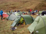
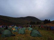
While the rest of the club headed north to battle the elements, we drove south instead. This year's Marmot Dark Mountains (an overnight mountain marathon) was held in the Peak District, on Kinder and Bleaklow – two areas that are notoriously difficult to navigate across in the daylight, let alone in the dark. We did well in last year's inaugural event when in appalling weather we were the first mixed team in the score class. This year score was split into long (10 hours) and short (8 hours), and we went for long (I felt we ought to, as I was one of those who'd suggested the idea!). Could we match last year's rare success?

In a word, no.

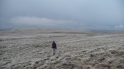
In marked contrast to last year's conditions, the weather was fairly benign. Rain earlier in the day had stopped, and apart from a little light drizzle it stayed dry until the next storm arrived shortly after 7am (many of the finishers on the line courses will have been hit by this, but the score courses were over by then). It was actually milder than forecast, no sign of the promised frost, and we ended up over-warm – but better that that too cold.

We began OK, slow and steady, as we made our way south east to the Kinder plateau. The mist came down just as we got to what we'd hoped would be a runnable track along the edge, slowing us to a walk. We opted against a couple of 25-pointers further down the hill, aiming to get a bit further for a group of 40 and 30 point controls instead.

We hit the first 30 OK (difficult to find, I was please we got it relatively easily), then a 40, and were going well enough that we added in another 40. The idea from here was initially an easy descent to the Snake Pass road for three 5-pointers and a steady return to the finish. But we spotted a better option, continuing further round the plateau, picking up another couple of controls totalling 40 points with the possibility of an extra 20 on the way back if we picked the right stream to ascend. More points, shorter, and slightly less ascent. Perfect.

We should have stuck with Plan A. Tiredness led to a loss of concentration, and we started looking for the controls too soon. After wasting half an hour wandering around swearing in entirely the wrong place, we decided to cut our losses and head for home. Unfortunately, being in the wrong place, we headed for home down the wrong valley and didn't notice until the compass started pointing the wrong direction. I worked out the mistake, uttered a few more choice words, and visibly sagged. We were going to be late back, but how late? And how many points would we lose? (the map didn't specify the penalties, and I'd forgotten).

Back in the right valley, we mopped up the 15 points we'd thought about earlier, somehow climbed the steepest hill in the world, and reached the finish a mere 35 minutes late. Not too bad, only 5% error – but enough to lose all our points.

Lessons learned: Expect tiredness and plan accordingly. If you know you're in the right place and the control isn't there, then you're probably not. And remember the downside of score courses – a mistake near the end doesn't leave any margin for error.

Must do better next year…

Once again, a fantastic event, highly recommended to anyone experienced in navigation, whether runner or walker (as we proved, speed matters much less than accuracy!)

Results here

Course details here

Our route here – see if you can spot where we went wrong!

Littondale Skyline

Tuesday, January 15th, 2013

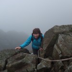
On Sugar LoafWhile the others were climbing in the sun at Scugdale, we decided to take advantage of the good weather and do a long walk in the Dales.

Unfortunately, the weather had other ideas, and after a sunny drive across, the clouds gradually lowered, and we ended up  doing some navigation practice in the clag.

Despite this, it's a fine route and recommended. Starting in Litton, you head north up the side of the valley, then follow the watershed west before cutting back south over Plover Hill and Pen y Ghent. Although quite long (18 miles with around 5000 feet ascent), the going is mostly easy (especially if like today the bogs are frozen!) and it takes around 7-9 hours. The super-fit could start from Arncliffe and include Fountains Fell at the end of the day – maybe one for the summer!

A map of the route is here

and some more photos here

The best OMM for years

Saturday, November 12th, 2011

This year's OMM was held in the Breadalbane area of Perthshire – little visited by walkers other than those slogging up Ben Chonzie, one of the contenders for the most boring Munro. The area had never before used for mountain marathons – too often there is a very good reason for this! But it turned out to be one of the best events for a while.

As the weekend approached the forecast was for persistent heavy rain, gale force winds, and low cloud all weekend. In other words, perfect conditions for those of us who can navigate reasonably well but aren't fit enough to do much running. The event centre was at Cultybraggan Camp, an old WW2 POW camp – very different from the traditional marquee-in-a-field! We didn't get to see much of it though, as we arrived well after dark on Friday evening, and had an alarmingly early start the next morning, catching a bus at 7.15.

The first surprise as we crossed the start line and collected our map is that other than a final compulsory 10-pointer, all controls on the long score course were worth the same, 20 points, so there was no obvious incentive to go for the outlying checkpoints. This had the effect of spreading teams out rather more than usual, there is often an obvious line of high scoring controls to take, but this time there were several equally likely-looking options.

We set off with a rough route in mind, but were going well after a couple of ours, well ahead of schedule, so added on an extra loop. This almost worked well, but after wasting 15 minutes looking for a control in the clag we were forced to miss out our final intended control. Still running short of time we made a very long sprint for the finish, covering the final 5 miles in just under an hour to finish with 30 seconds to spare out of our allotted 7 hours!

It had rained pretty much all day, but just after we'd got the tent up it got much heavier, and we ended up staying put for most of the night, glad that we'd opted for our slightly heavier but much more comfortable tent. All our clothes were either wet or damp, as was my sleeping bag (the waterproof bag wasn't). We were 45th out of 144 starters and 137 finishers (24 other teams entered but for some reason never turned up), and were one of 12 teams all on 210 points. The first 5 mixed teams were all taking part in the chasing start, luckily we were 6th so escaped the added pressure (and super-early start).

Sunday's weather was better than Saturday – still low cloud and windy, but only occasional showers and even some sunshine. The controls reverted to tradition with different scores for each, and we chose to start by a long climb up a hill behind the camp for a 30-pointer followed by a descent back almost to where we'd started. After this, all went more-or-less according to plan, until we were ambushed by a camera crew filming for a forthcoming documentary of some sort. Despite my streaming nose they decided to point the camera at me, so after muttering a few inane sentences I duly led us off in the wrong direction, and we ended up at the wrong control, a mile or so from where we'd been meaning to go. At least they didn't capture that bit on camera!

This detour meant that we didn't have time to get tempted by a final extra 10-pointer (well I was tempted anyway but luckily Carmen's caution won out). We eventually finished with 13 minutes to spare and a score of 180 – 41st on the day, and 40th over all.

We really enjoyed this event, the terrain was interesting with some difficult navigation, and the route choice extensive. Although we never got to the top on our course (some courses had a control on the summit), Ben Chonzie failed to live down to its reputation – most of those who call it 'boring' probably choose the normal ascent via a long landrover track that goes almost to the summit, missing out entirely on its cliffs and corries.

Full results here.
No more photos – although I carried a camera round all weekend, other than a handful of shots on Sunday morning I never turned it on!

Wet Widdop Weservoir and a Froggie day

Sunday, October 30th, 2011

widdop in the autumn sun

Here is the short version of our Sunday bouldering:
Me, Graham and Angela went to Widdop, it were gopping wet, we stayed a while then went home.

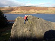
The longer version – well, it was gopping wet. We stayed till 3.30, but in the end only found a few problems dry enough to get up, everything was horribly slithery. But its a lovely place, overlooking the reservoir with the colours all gold tinted in the low autumn sun, and frustratingly we could see there would be lots of really good stuff with good landings (just as well coz theres a few you have to jump down from) that will be well worth returning for on a crisp dry day.


On Saturday me and Rachel went to Froggatt. Once again everything was on the soggy side and we suspected nothing much would be climbable, but in the end we did four very enjoyable routes before the weather clagged in again. I did Diamond Crack, a lovely little HS that I am amazed I have always walked past before, and Sickle Buttress Direct, slightly thin pro at the top but lovely moves. Rachel did Green Gut and Tody's Wall, which she managed very slickly.  So a nice day against the odds, but very chilly – it had the feel of one of the last trad days of the year. We were saved the decision between shivering up another route or heading for tea and cakes by the approach of a wall of grey wetness and gratefully abandoned crag for the Outside Cafe in Culver with honour intact – I recommend the St Clements cake.

Sod It!

Wednesday, January 27th, 2010

A week after the thaw and all the low level ice has gone. But it's been mainly cold up high, and there have been some reports of good conditions in the usual places (Great End, Helvellyn, etc), so we thought we'd go for a look. We didn't fancy the stupidly early start that would be needed for a day trip to those crags (which we'd guessed, perhaps wrongly, would be heaving anyway), so decided to try Foule Crag on Blencathra – less than 2 hours' drive from York, and only an hour's walk in.

The knee deep powder of my previous visit last month was gone, which made for a quick walk. Unfortunately, the blue skies of the earlier trip were also missing, and when we reached the crag the whole thing was hidden. Fortunately I could remember enough to know roughly where to go, or we'd probably have failed to find anything!

Our intended route was Traverse of the Sods (II/III), because
(a) it was the longest there (180m);
(b) it follows a natural line; and
(c) a route with a name like that just has to be climbed!

As the name sort-of implies, it relies on frozen turf rather than snow or ice – just as well, as the snow we had to cross to get there was all soft and deep.

The first pitch, to reach the traverse line, was steep, rocky, vegetated, and throughly horrible. There may have been turf, but the shrubbery was so thick that the axes failed to reach it. 50m with no protection didn't do my nerves a lot of good either! If there'd been an easy walk-off from the top then we'd probably have taken it.

Luckily there wasn't, as the remaining 3 pitches were all good fun, following a narrow grassy ledge in a rising traverse up the face. Quite easy climbing (no more than II) but hardly any protection other than our single warthog, and belays were on axes with the picks buried optimistically in the frozen turf, plus a sling wrapped even more optimistically round a 2 inch thick icicle. The whole thing was nicely exposed, with continuing clag throughout adding to the atmosphere (and also occasionally to the confusion – on one pitch, a steep snow-covered overhanging corner loomed out of the mist, it was only as I got closer looking for a way round that it revealed itself to be a nice 30 degree neve slope).

A short icefall near the end took a screw, though the ice turned out to be only a couple of inches thick with air behind so no more than psychological value! But a second icefall at the final belay was several inches thick so provided the first (and last) reassuring belay of the day 🙂

We topped out at the summit of the crag. The way off was obvious, down a corniced ridge, so we didn't waste time getting the compass out. Luckily, a few minutes later we stopped to take crampons off and took the opportunity to check our bearings; a 90 degree turn to the right took us back to the right valley 😉

A good day out, and not too long (about 12.5 hours house-to-house). Not a classic route by any means, but worth doing, and certainly better than sitting at home watching TV!

More photos here.

Best laid plans

Saturday, December 13th, 2008

After our last efforts at finding climbs resulted in wandering around looking for ice, this time I persuaded Will to head for Hellvelyn a place he knows well. Given we had to wait till Friday due to work commitments (how inconvenient!) we hoped being high it would be a good bet. A relaxed start and some roadworks and diversions in Thirlmere got us to the Greenside car park before 10 and on the track with a few others with similar ambitions and a pair of skiers!

It's quite a easy walk up (about an hour on good track) but it was pretty cold and the wind was much stronger than anticipated. Arriving at Red Tarn (partially frozen) the mist was down, visibility about 10..15m and no shelter from the wind.

Plan A: Confident that Will could find V-Corner we set, leaving a couple of soloists poking around looking for one of the easier gullies. We wandered back and forth across the face, up and down a bit and traversed he whole hill side until we hit Striding Edge! On top we met one of the soloists and a team emerging from the Gully.

Plan B: descend the grade I gully to get us to where we wanted to be. This plan lasted about 2 mins, until the high winds, spindrift, very poor vis and poor snow (some powder, some windslab and some neve') meant a retreat to the summit shelter.

Plan C: We descended Swirral Edge, intent on another foray onto the face

Plan D:Worsening vis meant we legged it down and around Catstyescam to do the gully (grade I/II) in its north flank. We traversed for a while found a gully like line which petered out into snow plod/slopes but got us back to the ridge (and the wind). Probably nothing, but good exercise.

Plan E: The path down was easy and it started to rain – don't think its stopped yet

Narrowly avoiding a deer which jumped into the path of the car was the most exciting thing to happen all day!

Wonder if I'll find any routes this season ?

Pix to follow from Will.

Pillaried

Monday, August 4th, 2008

Pillar from Robinson\'s CairnGood job it is light till about 10pm at the moment. Setting off at the crack of 2pm from Gatesgarth (Buttermere / Honister) Jules and I headed of for Slab and Notch a Grade 3S(***) scramble on Pillar Rock – and I can tell you that's a bloody long way away (5 miles ish). Over Scarth Gap, you get a great view of the distance to go, down to the Youth Hostel without much Scarth Gap - Buttermere in view incident before the reasonable climb to Black Sail Pass and a fair bit of wind. The high Level traverse is easy to find, but splits into a higher and lower, doesn't matter which you take as they both end at the Robinson Cairn with a grandstand view of our objective in the swirling mist. All that moisture added to the unnerving feel of the place, making some of the rocks on the Shamrock Traverse greasy.

The SlabThe route is quite straightforward and marked by worn holds, but is serious, in the sense of slipping off would be terminal! scary ....We justified breaking out the rope by 'ML training' and a healthy dose of concern. Most for the route was dry and straightforward and passed without incident using spikes to set up quick direct belays. The top presents wonderful panoramas of Ennerdale – but in cloud it aint so impressive. Now comes the the fun part; you have to reverse the whole route to get off! Again we made use of the rope – it's surprising how much it boosts your confidence in poor conditions but also slows you down.

Pulling onto the summit plateau of Pillar (having ticked Pisgah – grade 1 easy v. short jaunt) in thick cloud, the next trick was to find the trig point. 'Hmm wish I'd brought the 1:25,000' , the BMC 1:40,000 lacks the detail to locate us accurately by the features only (orientation of the edge of cliff and the spur we had come up). Jules used the tried and trusted method of randomly wandering of into the mist until she could see it 25m away during a break in the cloud. 7:10 pm – hmm back at the car for 10 maybe? We made good time (not stopping at the YHA despite or maybe because Didgerdoo man had arrived) and briefly chatting to two lost souls at Scarth Gap) and arrived back at 9:15 , drove to the pub just in time to miss the last of the food!

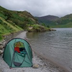
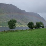
campsite - bit tight!Camping beside Crummock Water rainbow over Crummock Water(sounded like in the water) gave us great views with a car park just across the road. After breakfast the heavens open and the car park turned into a convention for rubber and gas fetishist. Rain dominated the rest of the day and we had a mooch about the shops and pootled back.


Great walk and great scramble, maybe set off a tad early next time !