Archive for the ‘Running’ Category

Clapham

Friday, October 25th, 2013

The YMC hut in Clapham is always popular when we stay there, and this year was no exception, with another sell-out meet.

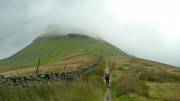
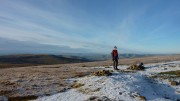
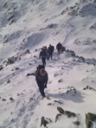
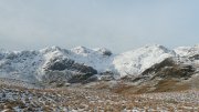
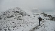
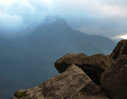
It rained heavily on Friday night, but nevertheless a group of optimistic climbers spent most of the morning hoping the showers would stop and give the chance for a crag to dry out. Carmen and I eventually gave up waiting, and went on a run instead, taking a valley route from the hut to near Horton, and then doing 2 of the Three Peaks (Pen-y-Ghent and Ingleborough) before descending back to the Clapham. It stayed dry all day, until about a mile from the hut, when the heavens opened and we ran through a thunderstorm, soaked to the skin.

Leni and Alan meanwhile had driven to Horton to run the full Three Peaks. We met them on top of Ingleborough, and they managed to get back to their car in Horton just before the rain started. Leni said the route was easy, but was knackered by the end.

The rest of the climbers had more patience than us, and were rewarded by a good afternoon's climbing at Twistleton. The first routes were a grade or 3 harder than normal due to slippery rock, but it dried out quickly, and climbing was only stopped by the return of the rain at the end of the afternoon.

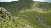
On Sunday, most of us drove to Malham, where we did the walk to Gordale Scar and Malham Cove – one that most of us have done many times before, but it's always worth doing again!

A weekend of two halves

Sunday, September 15th, 2013

This weekend saw the traditional opener to the orienteering season – the Aire weekend in the Dales.

Saturday's weather could hardly have been better, with blue skies, sunshine, and a pleasant breeze. Having done no running for weeks due to various injuries, I decided to ease myself in gently by doing the longest hardest course available, Black. Expecting to come last, I surprised myself to finish 16th out of 18.

Today was not a good day to be out on the hills, so I decided in advance to go for the Blue course, at 5.7km. Of course when I arrived I found myself entering Short Brown instead, 7.1km. Oops. Most of the next 2 hours was spent wandering round in circles in zero visibility trying to work out which knoll in the sea of knolls was the right one. The answer was, none of them, I was 200m too far west. If this had been a mountain marathon I'd have liked the conditions, as it would have given me the chance of gaining a few places on the fell runners who can't navigate. However, being an orienteering event, there are shit-hot navigators all over the place, so in the end I finished a very wet 19th out of 20. But still did better than the 12 who dropped out without finishing!

Next it's the RAB mountain marathon, in 2 weeks time. Hope the weather's more like yesterday than today!

Hadrian's Wall

Tuesday, July 2nd, 2013

Hadrian's ButtressThis summer's (sic) first camping meet was to Once Brewed, by Hadrian's Wall. Despite the lack of anything particularly summery, a great time was had by all.

On Saturday, Peter, Mike, Alan and Donal went off to Kielder for some mountain biking, where Peter was eaten by midges. Carmen and I met up with Jamie at Crag Lough, under the Wall, to take advantage of the dry conditions for some climbing. Any midge that had shown its head would have been immediately blown into the North Sea, so we stayed uneaten.

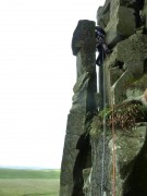
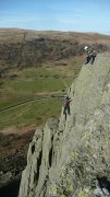
The roc's nest on Grad's GrooveWe managed half a dozen routes, from VDiff to MVS, though as is often the case here, the guidebook grades bore only a passing resemblance to their actual difficulty. Jamie led the classic hard severes of Main Wall and Hadrian's Buttress. I led Dexterity (S) and Hadrian's East (VD). And Carmen led Ash Tree Wall (S) and the main sandbag of the day, Grad's Groove. Graded MVS 4b, but with 5a moves to leave the ground, the crux for Carmen was climbing into and then out of the massive nest that blocks the upper chimney.

Sunday brought more of the same weather. Mike headed off for some more biking. Alan did a long run along and around Hadrian's Wall. Donal and Peter finally managed to climb at Crag Lough, after many years of rainy visits, but called it a day after being sandbagged on two "VDiff"s Bracket, and Tarzan's Mate – climbing at this crag takes some getting used to!

TrapeziumCarmen and I started out at Peel Crag, where I led Tiger's Chimney (VD) prior to Carmen's attempt on Tiger's Overhang (VS 4c, with the crux involving getting over a large horizontal roof). Discretion won the day and she retreated into the chimney, to return sometime in the future, packing extra bottle. We then returned to Crag Lough, where I led Face Route (S, but easier than most of the VDiffs) and Carmen did Sinister Groove (S, but would be VS anywhere else). Some light rain put an end to anything hard, so we finished with Trapezium (Diff), Back Alley (Diff), and Route Two (VDiff).

A few more photos here.

It was a dark and stormy night…

Monday, February 11th, 2013

"A new mountain marathon", announced my Inbox.
Excellent, tell me more.
"It's in January".
No problem, keep going.
"At night".

A completely bonkers idea, so of course I was immediately hooked. Carmen didn't take much persuasion, and ignoring the warnings of others ("it's far too dangerous, you'll all die in a freezing bog") we signed up.

There were 4 linear courses – Elite, A, B, C – but we opted for Score (8 hours to visit as many controls as possible). Mostly because that's what we usually do, but also because it gave the option of cutting it short if things got too grim.

As the time got closer, things changed from mild and rainy, to cold and icy, and then a couple of weeks before the event it started snowing. We managed one night time training session, in deep powder snow across unseen (but very much felt) bogs, when we averaged a feeble 1.8 mph. Things can only get better, we thought. Ha.

A couple of days before the start, the clear blue skies disappeared and it snowed. A lot. The organisers announced bad weather courses would be used, and shortened ours to 7 hours. It duly snowed some more, and the last controls were put out on skis. If it had stayed that way, however, it would have been too easy. So they arranged for the temperatures to climb, the wind to pick up, and the rain to fall.

The event centre was at Muncaster Castle, near Ravenglass in the south west Lake District, so we stopped off at Eskdale Green on the way over for a last supper. The drive from there to the Castle took us along a road that we'd briefly follow during the event. It was under 2 inches of water.

A brief word about kit.

Obviously the normal MM kit of "as little as possible" was out of the question, so after much indecision we ended up going for the "far too much" option instead. I had 2 pairs of trousers + over-trousers, thick base layer plus fleece plus waterproof, 3 different hats and enough pairs of gloves for a Himalayan expedition. Plus 2 spare tops and even a spare waterproof (I'd just reproofed my thick one and wasn't sure how waterproof it would be). Carmen had similar (top tip – Paramo trousers are ideal).

Now for the race.

At the start we were given an extra bit of safety kit – the maps were so big they could easily serve as an emergency blanket. Luckily the scale was 1:25K, but even so it was clear that we could ignore most of it as we'd never get to the edge of the map and back in the time allowed.

My first big problem was seeing anything. Glasses were out, contacts meant I could see distance but not the map, so I took the risk and removed one lens – one eye for close up and one for route finding. It sort of worked, though next time I'll go for the naked eye option – not much distance vision needed when it's dark.

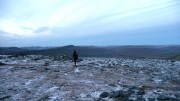
We started, along with everyone else, with a selection of controls on Muncaster Fell. Intermittent patches of ice made running too risky – first bruise to Carmen – so we walked most of it from here on. Brief loss of concentration lost us a few minutes ("it's only worth 10 points, how hard can it be"), lesson learned, nothing's easy at night.

A brief study of the map gave us a vague game plan. Almost all the closer controls were worth just 5 or 10 points, but there was a small cluster of 30-pointers that looked like it might just be achievable. So we decided to take as direct a line as we could for those, ignoring anything that involved much of a detour.

After a brief stop to change into some dry clothes (my "waterproof" jacket wasn't) we battled our way into the wind to reach the control on the summit of the aptly named Water Crag. A descent to Devoke Water was followed by a rising traverse towards the next control, interrupted briefly by a short patch of ice that left me 20 feet further down the hill with a bruised arse.

By now the snow was deep and wet. We both had waterproof socks, but even my thick merino ones had no effect on the cold – being permanently encased in slush puppies is probably a challenge too far for any sock.

The distant head torches that had kept us company up to now gradually disappeared, as their owners saw sense and headed for home. No quitting for us though – this was serious fun!

At the next control, on White Pike, the wind was so ferocious we were on our hands and knees to reach the top, even though it was just 442m above sea level (and still only worth 10 points!). The planned continuation along the watershed was obviously not going to happen, so we dropped down instead and contoured below the ridge line.

By now it was clear that we'd not be able to reach the group of 30-pointers, but we wanted to at least manage one that scored over 10, so headed south towards the 20-pointer at Holehouse Tarn. A handy fence gave us something to haul ourselves up the steep hill through knee-deep snow; we found the control but not the tarn, presumably it was buried. At last we could turn back north and have the wind behind us!

A short delay failing to find an "easy" 5-pointer at a stream junction (not so easy when the whole hillside is one big snowy stream) was followed immediately afterwards by finding the missing control a few metres further down the hill – the stream junction had become the middle of a small river. Then up into the lowering clag for a final 10-pointer, down the other side to hoover up a final clutch of 5-pointers, and all that remained was a marked route across boggy tussocks (or was it tussocky bogs) to finish with 20 minutes to spare.

We'd averaged just 1.7 mph, but despite the usual collection of "what-ifs" that could have gained a few extra points, we were happy with our meagre haul of 105 points. Even more so when we found that we were the first mixed team, and 4th overall! Over 100 points behind 3rd place, but if we'd had the fitness for an extra couple of miles then we'd have had access to another 150 points, so not as big a gap as it seemed.

But winning and losing were largely irrelevant, just finishing (or even starting!) in those conditions took some effort. As a measure of how tough things were, only half a dozen teams on the linear courses completed (none at all on B or C), everyone else missing controls and heading for home.

My toes were slightly numb for a couple of days (frost nip?). Chilblains lasted a week. Three weeks on, the bruise on my hip is finally fading. But the memories will last a life time.

Would I do it again? Just try and stop me!


Some photos here

Results here

Event website here
 

Three Peaks

Monday, December 3rd, 2012

A weekend of clear sunny weather was too good an opportunity to miss, and when Carmen suggested going for the often-planned but never-realised run round the Yorkshire Three Peaks I didn't need much convincing.

A rather more leisurely start than was wise saw us at Horton in Ribblesdale for a 10.15 start. Pen-y-Ghent first, a stiff pull got us to the summit by 11. The descent was slower than expected due to extensive sheet ice, and walking poles came in handy crossing a not-quite frozen river. But the next long boggy section was frozen solid, making it easy if sometimes slippery going. One fall each on the ice.

After Ribblehead Viaduct we opted to stick to the path rather than take the direct route up Whernside, possibly a mistake in hindsight as the path was mostly covered ion sheet ice so we spent as much time off it as on. We reached the summit a little after 2pm.

The descent to the Hill In took only half an hour, and it was tempting to call in for a pint or three, but Ingleborough (and the approach of sunset) beckoned. We reached the top shortly before 4pm. Sadly the hoped-for sunset wasn't visible due to a bank of cloud over the Lake District to the west, but at least that meant we didn't stop for an extended photo session.

The long descent to Horton was again quite slow due to ice, and slower still once night fell and the head torches came out, but we eventually reached the car just before 5.30, a hardly impressive 7 hours 9 minutes after setting off (the record is a few seconds shy of 2 1/2 hours!).

A magnificent day to be out, cold, clear, sunny, and hardly a breath of wind. Perfect conditions for my first ever time round the 3 Peaks.

Vital statistics: 24 miles, 1500m ascent.
More photos here
Route map here

Midgetastic LAMM

Friday, June 15th, 2012

It was that time of the year again – time to kick start the mountain marathon season with the LAMM (Lowe Alpine Mountain Marathon) which is always held in Scotland. Last year was a Northern year – so this year we knew it wouldn't be quite so far. Simon & I were already holidaying in Scotland – so even less of a drive for us. Fortunately there was a mobile signal in the camp site at Morvich so we were able to find out the location of the event centre (always only released on the Thursday before the event) nr Ben Cruachan.

It was lovely and breezy when we arrived at the camp site in the afternoon. Unfortunately this did not last long and by evening it was getting rather midgy. The midges were even more irritating in the morning. I gave up trying to scoop the midges out of my tea – it only seemed to make more space for others to land! I ate my malties walking up and down frantically and having the occasional respite with the midge net lowered.

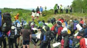
We had an 07:30 assembly time – so left the camp site at 07:20. At 07:45 we were on the coach and driven off to the mystery location of the start. This turned into a much longer trip than ever intended – the coach driver took a few wrong turns and took us to Victoria Bridge via Glen Coe. Hence we arrived at the start at 09:10 with at least one later bus arriving before us.

We were on the score course – planning our own route and had a number of alterations throughout the day. We didn't feel that we were choosing the best line and doubted anyone else would have chosen the same order of controls. As we headed back towards the finish time was running out fast – we were forced to run all the way from the last control to the finish, passing Rob and Pete B along the track to the finish. They thought we must be hours late given our earlier start time (unaware of our mystery coach tour) – however we made it back with 24 seconds to spare (out of 7 hours). The weather was excellent all day, with just a couple of passing showers, in stark contrast to the forecast rain and low cloud!

Rob & Pete had their own agenda for the weekend. Both had injury problems and decided to take it easy. Rob was in Munro-bagging mode and used the opportunity to visit summits which had no controls on them! They scored other points along the route and didn't do at all badly given they were not really trying.

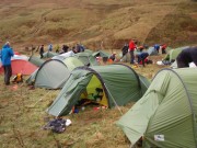
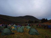
The overnight camp site was in a lovely spot but was midge hell once the wind dropped. Most people were driven inside tents rather early due to the swarm of midges. Annie you would have loved to have been there! Things were not any better in the morning – I didn't remove my windproof and midge net until we had finished marking up the maps and were off on the move.

The cloud was rather lower today and so we decided to stick to controls that should be easier to find. Fortunately we did not get too wet until the last hour or so when the rain started and soon became rather heavy. We managed to finish with a whole 2 and a bit minutes to spare this time. Meanwhile Rob and Pete had been off bagging a couple more unnecessary Munros and sauntered in with 22 mins to spare.

Overall we finished 14/81. We were rather amazed as we felt we had chosen poor controls and I was unable to run much given the ever lasting cough and lack of training. Rob & Pete finished 47/81 without even trying and having bagged four new Munros not on the scoring route!

More photos here
Our routes Day 1 and Day 2
Results and reports here

Patterdale

Saturday, March 17th, 2012

There was another good turnout for the March trip to Patterdale, staying at the Cleveland MC's Agnes Spence Memorial Hut for the first time in over 10 years.

On Saturday, an unusually large mountain biking contingent went off pushing their bikes round a series of cake shops. Rob and Nigel did a fine little scramble up the outlet gill from Angle Tarn, followed by some navigation practice and a few more Wainwrights for Rob's tick list. While I went for a long run/walk, Carmen decided on something easier due to a nasty cough, but still ended up doing a 15 mile round of the Helvellyn Range from Raise to Fairfield and St Sunday Crag – unfortunately mostly in the rain, which the rest of us managed to avoid.

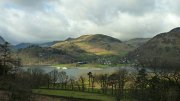
My run took me on an extended circuit of Ullswater. Fast going along good paths took me quickly to Pooley Bridge. A short diversion to the (rather disappointing) earthworks of Maiden Castle, was followed by another diversion up Little Mell Fell and back. From here I crossed Great Melldrum and Gowbarrow, before a long slog up to Stybarrow Dodd, and then back over Sheffield Pike. Route map here.

Sunday was bright and sunny, and most people went for a walk (or run in Alan's case) up Helvellyn via Striding and Swirral edges. Carmen, Rob and I headed for Gouther Crag for some climbing, but spent more time sitting in the sun listening to the birdsong and Carmen's coughing. We did manage to fit in ascents of Kennel Wall (S) and The Fang (MVS).

Photos:
Nigel
Fliss
Simon & Carmen

Coniston Snow

Thursday, February 2nd, 2012

After a largely snow-free start to the year, a couple of days before the January meet we were treated to some heavy snow for the Lake District. It hadn't been cold for long enough to give decent climbing conditions, but walking conditions were superb.

Saturday was cold, bright and sunny. The mountain bikers chose to take advantage of this with a long cycle through the valleys. Rob and Carmen did a snowy scramble on Coniston Old Man, finishing at the summit, where they met up with Mike, Antony, and Dave for a walk over the rest of the Coniston range to Wetherlam, returning via valley paths to Walna Scar.

I opted for a long run, the plan being to start up Coniston Old Man, cross the range before descending to Wrynose Pass, then up to Crinkle Crags and seeing how far I got before time ran out. Fantastic running conditions on the Coniston hills were replaced by deep powder snow for the ascent of Cold Pike and the continuation to Crinkle Crags, slowing me to snail's pace. A brief attempt on the Bad Step was abandoned due to chest-deep drifts, a steep slightly worrying scramble to the left reached the crest again. My original idea of continuing as far as Scafell Pike was by now abandoned due to the snow conditions, so I carried on over Bowfell before descending from Ore Gap into Eskdale and back down Moasdale to Cockley Beck.

There was still plenty of time, and the weather was still good, so rather than heading down the Duddon Valley to pick up the Walna Scar road, I decided to head back for the tops. A long slog up Grey Friar led to a second traverse of the range, this time finishing at the col above Goat's Water. Thoughts of finishing over Dow Crag were abandoned as the light began to fail so I returned from here direct to the hut. A great day, even though the running element had finished at the Three Shires Stone!

Route here

Sunday was much cloudier, but still dry. Carmen and I headed for Grasmere, where we did the Fairfield Horseshoe – unfortunately mostly in the clag. Most of the others were temporarily blocked in by Andrew's flat tyre and then Annie's car parked in the gateway, but Rob and Dave managed an afternoon ascent of Blencathra and the hills behind. Not sure what everyone else did, sorry!

More photos here
Rob's photos here

Late Autumn Sunshine

Wednesday, November 30th, 2011

Tryfan from Careg Mianog

The warm autumn weather this year encouraged people out and the November meet at Capel Curig was almost full – in fact we had trouble fitting people round the table in the evenings.  Rob had also brought his Movember  'tash.   A full pack of mountain bikers was there, with the obligatory start – an On The Spot repair of Annies bike by Pete the Pie. The weather on saturday was beautiful, so while the bikers biked, the climbers headed for the rocks- except for Simon and Carmen who fancied an 8 hour run round the Carneddau.

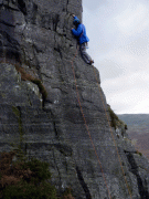
Rob, PeteB, Angela and me headed for Tremadog to bask on the sunny rocks like lizards. After a lengthy gossip in Eric's Cafe, me and Angela headed for One Step in the Clouds, a 3 star VS which I have wanted to do for ages. It was as good as I had hoped, an easyish start then a delicate and exposed traverse followed by an airy hand traverse along a flake which finishes at the prettiest belay ever, a mossy rock ledge surrounded by holly bushes and rowan.

We arrived at this point late in the day as we had to divert part way up the route to help a team on Hail Bebe who had a dramatic fall after going off route. Neither was badly hurt, but the belayer was pulled from the stance and was unable to get back up by himself due to rope burns. So I was very glad Debra and me had been on a self rescue course the year before which helped deal with the situation – thanks, Paul! There was a slightly surreal moment when another member of their club arrived by abseil announcing "Hello, I'm a doctor". For one moment I expected him to whip out a sonic screwdriver and take on the Cybermen.

Next day was still dry but a lot chillier, so while Angela and a friend headed for Holyhead Mountain, where she did her first ever trad lead – well done! – and Simon & Carmen headed for Tryfan,  I teamed up with Rob and Pete who were heading for Careg Mianog, an obscurish but accessible crag with a reputation for catching the sun. Which I'm sure it would have, had there been any sun to catch…

Biceps Wall, allegedly Vs 4c

The walk in was flat but marshy so probably took us about 40 minutes. We found the crag wet in places, and all the grades seemed on the stiff side, the phrase "[insert grade here] my arse!" was used a few times. However we had the place to ourselves and it felt wild and woolly, with spectacular views of Tryfan.  In particular we thought Biceps Wall a complete sandbag at VS 4c – tough moves and not very reassuring protection at the start. We ran out of daylight and bailed from the second pitch, managing to get across the marshy section just in time to avoid complete darkness.

The best OMM for years

Saturday, November 12th, 2011

This year's OMM was held in the Breadalbane area of Perthshire – little visited by walkers other than those slogging up Ben Chonzie, one of the contenders for the most boring Munro. The area had never before used for mountain marathons – too often there is a very good reason for this! But it turned out to be one of the best events for a while.

As the weekend approached the forecast was for persistent heavy rain, gale force winds, and low cloud all weekend. In other words, perfect conditions for those of us who can navigate reasonably well but aren't fit enough to do much running. The event centre was at Cultybraggan Camp, an old WW2 POW camp – very different from the traditional marquee-in-a-field! We didn't get to see much of it though, as we arrived well after dark on Friday evening, and had an alarmingly early start the next morning, catching a bus at 7.15.

The first surprise as we crossed the start line and collected our map is that other than a final compulsory 10-pointer, all controls on the long score course were worth the same, 20 points, so there was no obvious incentive to go for the outlying checkpoints. This had the effect of spreading teams out rather more than usual, there is often an obvious line of high scoring controls to take, but this time there were several equally likely-looking options.

We set off with a rough route in mind, but were going well after a couple of ours, well ahead of schedule, so added on an extra loop. This almost worked well, but after wasting 15 minutes looking for a control in the clag we were forced to miss out our final intended control. Still running short of time we made a very long sprint for the finish, covering the final 5 miles in just under an hour to finish with 30 seconds to spare out of our allotted 7 hours!

It had rained pretty much all day, but just after we'd got the tent up it got much heavier, and we ended up staying put for most of the night, glad that we'd opted for our slightly heavier but much more comfortable tent. All our clothes were either wet or damp, as was my sleeping bag (the waterproof bag wasn't). We were 45th out of 144 starters and 137 finishers (24 other teams entered but for some reason never turned up), and were one of 12 teams all on 210 points. The first 5 mixed teams were all taking part in the chasing start, luckily we were 6th so escaped the added pressure (and super-early start).

Sunday's weather was better than Saturday – still low cloud and windy, but only occasional showers and even some sunshine. The controls reverted to tradition with different scores for each, and we chose to start by a long climb up a hill behind the camp for a 30-pointer followed by a descent back almost to where we'd started. After this, all went more-or-less according to plan, until we were ambushed by a camera crew filming for a forthcoming documentary of some sort. Despite my streaming nose they decided to point the camera at me, so after muttering a few inane sentences I duly led us off in the wrong direction, and we ended up at the wrong control, a mile or so from where we'd been meaning to go. At least they didn't capture that bit on camera!

This detour meant that we didn't have time to get tempted by a final extra 10-pointer (well I was tempted anyway but luckily Carmen's caution won out). We eventually finished with 13 minutes to spare and a score of 180 – 41st on the day, and 40th over all.

We really enjoyed this event, the terrain was interesting with some difficult navigation, and the route choice extensive. Although we never got to the top on our course (some courses had a control on the summit), Ben Chonzie failed to live down to its reputation – most of those who call it 'boring' probably choose the normal ascent via a long landrover track that goes almost to the summit, missing out entirely on its cliffs and corries.

Full results here.
No more photos – although I carried a camera round all weekend, other than a handful of shots on Sunday morning I never turned it on!