Archive for the ‘Running’ Category

Bang goes the neighbourhood

Tuesday, October 18th, 2011

Last weekend, two dozen members and ex members met up at Coniston Copper mines to celebrate the 30th Anniversary of York Alpine Club.

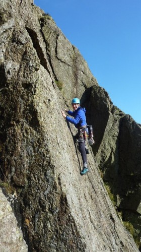
The unexpectedly blue sky on Saturday tempted most of us to get out (fairly) early. Margaret headed off to meet Jonathan Moffett for a walk to the west of Coniston. Simon, Carmen, Rob and Pete B opted for the short walk to the esoteric Little How Crag. This gave them plenty of time for climbing and they notched up ten routes between them, including the atmospherically named Thunderclap, Thunder Slab, Greased Lightning and Sunshine Arete.


Peri, Dave, Jamie and Paul all headed up to Dow. Peri and Dave got a Classic Rock tick with C Ordinary Route, whilst Jamie and Paul did the equally good Giant’s Crawl.

Donal, Simeon, Silvia, Alan, Peter, Simon F, Debra and Annie chose a lovely but short lived scramble as a means of approach to Wetherlam. We then continued on to take in Swirl How, Coniston Old Man and Dow before the long plod down Walna Scar road back to the hut.


Andrew and Karen made a later start up the Coniston fells, but Andrew put his foot down a rabbit hole and twisted his ankle. Back at the hut, he swapped his boot for a mop bucket of cold water, which provided lots of entertainment for everyone else.


In the evening, Phil, Tom and Fliss joined us for the party. The weather gods defied Simon’s doom-laden prediction for the planned fireworks and instead provided a mainly clear moon-lit evening.

Thanks to Andrew’s bargain hunting, we managed to acquire a rather large quantity of munitions fireworks, hand assemble by children in Far Eastern sweat factories. Despite fears of a pyrotechnic disaster, these provided an excellent display, with only one of the rockets suddenly changing direction mid-flight!

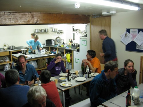
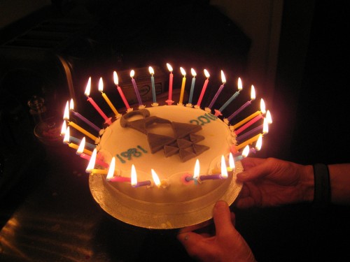
Celebrations continued indoors with large quantities of food and alcohol (including fizzy stuff) whilst we all watched the increasingly blurry slide show. We mainly managed to identify lots of different YAC members in unusual situations (both physical and geographical). If in doubt, we guessed Simon in Scotland and were usually right! Like all the best parties, we were too stuffed to eat the birthday cake and rolled off to bed vowing never to eat or drink again.


The next day, the weather was not so good, but most people made half hearted attempts at outdoor activities and those that did, at least had the birthday cake to sustain them!


RAB Mountain Marathon 2011

Thursday, September 29th, 2011

It's unusual to find a mountain marathon in North Wales, as apparently it can be hard to gain the necessary permissions. So we were rather looking forward to this year's RAB, starting and finishing in Bethesda and heading into the heart of the Carneddau. Even the ominous weather forecast didn't put us off too much.

The format of the event is time limited, with 6 hours on Saturday, 5 on Sunday (an extra hour per day for the Elite class), to pick up as many points as possible. Controls scored anything between 5 and 50 points, with most of the big ones being a long way away; points are deducted for being late. The master maps displayed in the event centre contained rather too many out-of-bounds areas for my liking, too often this leads to limited route choice.

The strong Friday night winds in the campsite (school football pitch) didn't bode well, and the next morning it was raining for good measure and views of the hills were non-existent. We were raring to go!

A quick glance at the map as we crossed the start line and marked up the control list gave a number of options, but the one that stood out headed up onto the high tops for some high scoring controls, with various options available near the mid camp depending on how well we were going.
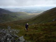
Heading south east towards the lower slopes of Carnedd Llywelyn we were soon faced with our first big decision, whether or not to take on a 350m climb to the north ridge of Carnedd Dafydd for an extra 40 points before losing all that height again, or just to contour up the valley to the next control. What the hell, might as well go for it. It turned out less hideous than it looked, and only added around 50 minutes, so probably a good move. From here we lost all the height we had worked so hard for, with the next control down in the valley bottom. A group of people were looking too hight and by the wrong stream, but we went straight there by following the right stream throughout. As we left, one of them spotted us and made for the checkpoint – one person then stood by it and whistled loudly and waved to her partner on the other side of the valley, so giving the location away to everyone within a mile or two!

We now followed the main ridge northwards, with detours off each side to collect controls, and as we had plenty of time spare managed to add in an extra dog-leg for 20 more points near the end. Finished in 5 hours 50 minutes, timing it well (despite both forgetting to note exactly what time we started!) with 10 minutes to spare, not enough to have added any extra controls, so we were pleased. 255 points, 39th out of 300 overnight, though that fell to 44th after they'd adjusted other teams' points due to two missing controls.
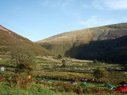
The weather had gradually improved all day, with rain turning to showers before stopping, and cloud gradually lifting to give a fine sunny evening. The overnight camp was excellent, in fields at the edge of the open fells above Abergwyngregyn – lots of space, so easy to find a pitch, and plenty of soft vegetation to make for a relatively comfortable sleep.

The next day we were greeted by continuing sun, and were soon off. Again, one route suggested itself immediately – unfortunately this was pretty similar to Saturday's route, visiting many of the same controls and following the same ridge. As it turned out, probably due to the improved weather, it all seemed very different.

A steep slog up the hill at least had the benefit of getting us onto the tops as soon as possible. After revisiting two of the last controls from the day before, we dropped over a col to another of Saturday's sites, but from here we contoured round the side of the ridge rather than going over the top. This leg was potentially confusing in mist, luckily it was clear, and as we approached we saw the usual group of people clustered round the control, showing everyone else where it was (for once I was pleased!). Another short climb back to the ridge was followed by some more contouring for a 40-pointer. We were wondering whether to go straight on or right after this, but everyone else headed left, so I checked the map and found an extra easy control hidden over the fold – so we duly followed them leftwards.

We were now thinking of options for the finish. An extra 15-pointer involved 150m ascent so we ruled that out, but there were 3 5-point controls near the end, I reckoned we'd probably get them all with 10 minutes to spare. Carmen didn't believe me, and was right, we got one of them and sprinted in with just 7 minutes left.

210 points, 42nd on the day, so pretty consistent, and pulling us up to 41st overall out of 300. Very pleasing, given that we've done very little preparation this year and I had a knee op in January.

Alan K was the other club representative, running solo. After a disappointing Saturday he pulled the stops out on Sunday (scoring the same points as the day before) to finish 134th.

An excellent weekend, in an interesting and unusual area. Next, an appointment with the OMM…


Results

Photos

Route Day 1

Route Day 2

I suppose this is what they call 'training'

Monday, September 26th, 2011

This month's hut meet in Little Langdale unfortunately coincided with a rainy weekend, so the planned climbing went out the window and floated off down the road.
So I checked the internet and found that there was a fell race on Saturday that started almost on our doorstep. We've got a mountain marathon coming up next weekend and haven't done any running or even hill walking since the Bowland in July, so it seemed too good an opportunity to miss.

An impressive 297 runners started in heavy rain, but the cloud was above the tops and the wind non-existent so it wasn't as bad as it could have been. Most people started quickly, across the river near the Fylde hut and along farm tracks to the intake wall, so we were soon both overtaken by most of the field before the first killer climb, 550m straight up up the side of Wetherlam. In an ideal world, I'd have overtaken them back again when they got tired, but unfortunately when they got tired I got even tireder. The section from Wetherlam to the Three Shires stone was actually good fun at the time – the rest had to wait for a good dose of hindsight. On the final ascent of Lingmoor Fell both legs cramped badly, so just getting to the finish was an achievement.

The winning time was a few seconds over 2 hours. Out of 288 finishers, I was 257th in a time of 3.52.12, Carmen 279th in 3.44.12.

After this, the sensible course of action was a rest day on the Sunday.

So we were up at 7 and off to Cartmel for the Cartmel Three Peaks Outing (C3PO, geddit?). There are 3 routes – a 4/5 mile family walk, a 13 mile walk/run, and a 22 mile walk/run. So naturally we went for the 22 mile option. This took in all three of the 'peaks' – How Barrow (170m), Hampsfell (222m) and Humphrey Head (53m – sic!). There was the option this year of omitting Humphrey Head as the routes both there and back were flooded, but we did it anyway, 2 feet deep on the outward leg, just a foot deep on the road on the way back.

We finished in 7 hours dead, with the emphasis being on 'dead' (though it would have been slightly quicker without a short stop to pick some rose hips).

A good little event, hopefully it'll be more popular in future years, it deserves it. The 13 mile route is possibly the best choice (it's the same as the 22 miler for the first 11 miles), as there's too much road running/walking on the longer route. On the other hand, the long route includes the fine peninsula of Humphrey Head, and also a stroll along the prom prom prom of Grange-over-Sands.

Not sure exactly what everyone else did during the weekend. On Saturday, Alan had a fine run along Crinkle Crags and Bowfell to Scafell Pike, then back via Eskdale and Mosedale. Andrew went biking, Gordon went drinking, most of the others walked over the hills to the pub in Elterwater and back. Sunday, some more walking was done, and Peter and Annie badly miscalculated their biking route and didn't have time for a cafe stop.

Three Shires:
Route
Photos
Results

C3PO
Route
Photos
Website

Bowland Challenge 2011

Tuesday, July 19th, 2011

We were due to join the club in Blaenau Ffestiniog, but the forecast was awful and we couldn't face yet another weekend of walking up wet Welsh hills, so decided instead to walk up some wet Lancastrian hills.

The Bowland Challenge has been running for about 5 years now, and YAC have entered one or two teams every year (except last year when it was cancelled due to access problems). Rather embarrassingly, after finishing 2nd in the first event, we have won it every year since.

It's a sort of cross between a score orienteering event and a treasure hunt. There are somewhere between 70 and 100 controls worth between 2 and 20 points each, and you have 10 hours to score as many points as possible. With this number of checkpoints it's not possible to put control markers out, so instead there are grid references with associated "clues" with multiple choice answers, things like "during whose reign was the post box built?" or "what is the number of the trig point?". And to add a bit of complication, there is a designated "lunch" spot part way round which you have to visit, and you also have to say what time you'll get there. Too late and you lose points, too early and you can't set off again until the appointed time.

We decided on a long anti-clockwise loop, with a lunch stop at Langden Castle in the heart of the Bowland Forest (it sounds romantic but is actually just an old barn used as a shooting lodge). In the morning we stayed mostly high, in near-constant wind and rain, we were so wet it was actually good fun (apart from one section through continuous peat bogs). We walked most of it but were forced to run down the last valley to avoid being late for our lunch stop, which we made with a couple of minutes to spare.

After lunch, most of the route was unfortunately along roads – the organisers had had to cancel the intended checkpoints on the hills as the grouse were late fledging and the landowner didn't want them disturbed before they're shot next month. But the scenery through the Trough of Bowland was good anyway, and better still it stopped raining, with even some sunshine at times. We failed to find a couple of the checkpoints but rather than waste time looking, we just ploughed on, again walking throughout until forced to run the last half mile to return to the event centre a minute early.

We covered about 32 miles with 1200m ascent, and managed to win again. If only the winners from the first event would show up again, or maybe some proper fell runners, and return us to our rightful place as also-rans!

Great organisation as usual, I'd recommend the event to anyone wanting something a bit different.

Our route here.
More information about The Bowland Challenge.

Phew What a Scorcher!

Wednesday, July 6th, 2011

At last, a weekend of warm dry weather, perfect for climbing or a nice walk in the hills. So of course we were doing the Saunders Lakeland Mountain Marathon, 2 days of running up and down hills carrying camping gear. This year we started at Chapel Stile in Langdale, and headed for an overnight camp at Steel End Farm near Thirlmere. YAC was represented by Carmen and me doing the Bowfell (all the courses are named after hills); Alan and Peter doing Carrock Fell; and Graeme and non-YAC Will on Kirkfell.

This year's courses were tougher than usual, so everyone suffered. Ours went northwards over the hill and into Easedale, before heading north west into Langstrath. Here we had the first major route choice of the weekend – contour round Langstrath or go down to the valley bottom and up the other side. We opted for the latter, with hindsight (and a view of the planner's recommend routed) we should have gone for the former, but I don't think we lost more than about 10 minutes on a 2-hour leg. A traverse of the Glaramara ridge was followed by the usual Saunders sadistic descent to the valley floor and straight up the other side, then finally a circuit of Ullscarf before a tricky steep and rocky descent to the last control and the finish – 7 hours and 44 seconds. We felt we'd done just about as well as we could given our fitness levels, and were pleased to be lying 14th out of 58. Alan and Peter arrived an hour or so later, 41st out of 104. Unfortunately Will had sprained an ankle so he and Graeme hobbled slowly home and couldn't continue on Sunday, but still managing to finish a creditable 39th on day 1 – without the injury they'd have been looking at a possible podium finish.

The next day we were expecting things to be a bit easier, Sunday usually being an hour or more shorter than Saturday. More fool us.

The route started up Dunmail Raise before heading back west via Easedale to Langstrath again, via an endless switchback of descents and reascents. A misjudged traverse (too high) round Bowfell slowed us as we picked a way through broken crags, after that exhaustion set in. A steep grassy scramble up the NW ridge of Kettle Crag (no, I hadn't heard of it either) led to another climb onto Lingmoor Fell for the sting in the tail, some orienteering-style micro-navigation to find a re-entrant in a bank of re-entrants, and a knoll in a field of knolls. We finally crawled across the finish line some 7 hours 48 minutes after starting. 22nd on the day, and 19th overall, but the most telling statistic is that there were only 29 finishers out of 58 starters! Peter and Alan appeared an hour or so later, with a final position of 48th out of 106 (61 finishers).

Another great weekend, though the hardest event I've done for a long time.

A few photos here – not many as I was too hot and bothered to take my camera out!

Our routes:
Day 1, 17 miles and 1900m ascent
Day 2, 16 miles and 2000m ascent

Full results here and more details of the SLMM here.

Stoney Middleton

Sunday, September 26th, 2010

Just a brief report, as the trip was 3 months ago so my memory is hazy!

This was a new hut for the club, in the village of Stoney Middleton, just up the road from the famous limestone crag.

On Saturday, Carmen and I decided to make the most of the location, and walked to the local crag. For some strange reason we decided to warm up on Froth, a fine 2-pitch VS. Carmen led the first (4b), which the guidebook led us to believe was a polished horror. It actually turned out to have some fine climbing, with some nice bridging, laybacking, jamming and thrutching, well worth a star or two in its own right. I did the second pitch, a long 4c traverse, which I decided to make harder by faffing as much as possible, and going backward and forward enough time to ensure I was completely pumped before I eventually committed to the crux.

After this, Carmen led Asparagus (VS 4b) – again not as polished as expected, we might have gone off route near the top when we traversed right to avoid an unprotected vegetated crack. And we finished up with Glory Road, another VS 4b. I led the first pitch, a Diff-ish chimney, then Carmen led the steep and slightly shiny second pitch, luckily steep enough that it didn't get too wet when it started to rain.

Meanwhile, the others headed for Froggatt where all sorts of things were climbed, including Sunset Slab, Sunset Crack, Turret Crack, Trapeze, and Allen's Slab.

The next day, it rained.

Carmen and I went for some orienteering near Harborough Rocks, after which we went to explore Rainster Rocks (Brassington). Given the weather we left the climbing kit in the car, though in the event it was dry enough for some easy soloing and we could have done some harder things if we'd brought rock shoes!

The others went for a very wet walk in the Hope Valley, while Debra sensibly went home!

Carmen's and my photos here
Debra's photos here.

May Day Meet

Thursday, May 20th, 2010

This year's May Day weekend was a return to the George Starkey hut in Patterdale, and we had a good turnout.

Saturday's forecast was for early sun with rain later. Carmen and I opted for some obscure climbing near the hut. We started with Coffee Slab (details on frcc.co.uk), which turned out to be a large boulder with half a dozen piss-poor 'routes' – despite being only 5 minutes from the path it's not worth the trouble. We then moved up the hill to Dubhow Crag, another new addition with details on the FRCC site. This one was a bit better, though over-starred. We started in the wrong place and ended up doing a new route by mistake (Caterpillar Ridge S 4b) – nothing great, but no worse than the rest of the routes we did when we found the right buttress! Rain was by now threatening so we wandered back to the hut but managed to stay dry – whcih is more than can be said for anyone else!

Peter and John had set off at first light for Eagle Crag in Grisedale. They climbed the fine Kestrel Wall (S **) and were half way up Doctor's Grooves (HS *) when the heavens opened, so they abbed off and swam back to the hut.

Peri led another group of climbers to Castle Rock of Triermain, where they had time for Via Media (S **) before the rain arrived.

There were also various walking/scrambling parties, but I'm afraid I've forgotten what they did (I'm writing this 6 months after the trip) – I do know that it involved getting very wet though!

The next day was much better, dry with some sunshine. Carmen and I set out early for a long run, training for the Fellsman. Round the east side of Ullswater to Martindale, then up the curiously-named Pikeawassa and along the ridge to Wether Hill. Then south over Rampsgill Head, High Street, Thornthwaite Beacon, Stony Cove Pike, and down to the Kirkstone Inn. Slog up Red Screes, then round the ridge to Fairfield, back over St Sunday Crag to Patterdale and the hut. Phew!

Peri's group of climbers went to Shepherds Crag, and various walks were done, perhaps someone will remind me of the details!

Finally, on the Monday, John, Peter, Carmen and I all headed for Longsleddale, where the Buckbarrow bird ban had been lifted early. The Evanses climbed the crag classic Sadgill Wall (S **). We'd done the route before, so went for Dandle Chimney (VDiff *) – some good climbing, but extremely vegetated. This was followed by Slab and Rib – allegedly VDiff but due to guidebook confusion I think we finished up a VS instead! Bright and sunny with a bitterly cold north wind. Peri and co chose Corvus on Raven Crag, and claim to have enjoyed themselves despite the wind!

More photos here.

The Fellsman

Wednesday, May 12th, 2010

Well here we were. 9am in Ingleton, at the start of the Fellsman. Time to see if all the intense training (ahem!) paid off. Fortunately the rain that had been forecast earlier in the week has stayed where it belonged, in the south of England, and we had dry mostly sunny weather, though with a strong cold wind.

The first steep climb up Ingleborough was a shock to the system, but we had to force ourselves not to try to keep up with everyone else – it's not the first hill that matters, but the last! This was followed by Whernside, then a descent into Kingsdale (with a slight diversion caused by a temporary stile having been placed across the wrong wall!), a painful slog up Gregareth, and a long stony descent into Dent. We'd done the first 20 miles, in almost exactly 5 hours, and I was shattered.

We allowed ourselves a few minutes at the Dent checkpoint, savouring the free oranges and sausage rolls, before forcing ourselves to leave. A long gradual ascent up Blea Moor followed, not as bad as expected, followed by a long gradual descent to Stone House, then a slightly shorter, much less gradual reascent up Great Knoutberry Hill, and finally a long relatively flat run in via Dodd Fell to the Fleet Moss checkpoint at the 38 mile mark. Our aim had been to get here before 7.30pm, the cutoff point for grouping where everyone is forced to join together in groups of at least 4 for the overnight section. Fleet Moss is a notorious bog and we didn't want to get into any heated debates about the best way across! Much to our surprise, we made the deadline with 10 minutes to spare, and were soon off again.

The next section was the one that we'd recce'd a few weeks ago, so we allowed ourselves to relax a little – bad mistake! It went well up to Middle Tongue, managing to avoid the bogs entirely (it helped that it had been fairly dry for the last few weeks) – but after that it went rather less well!

I was using the Harveys map, which showed the wall/fence we needed to follow; I knew to stick to this until a tarn, then head off in the same direction and we'd hit the Hell Gap checkpoint. Unfortunately, there was a second fence, not marked on that map (though marked on the OS 1;25K map in my rucksack!). I didn't notice the junction and we followed the wrong fence, and only realised the mistake when I saw Wharfedale spread out in front of us, rather than out of sight over the hill to our right! It cost us about an hour by the time we traversed back round (too low) and climbed back up the path to the checkpoint, where we confused the marshals by not having been grouped yet!

We got grouped at Cray, with some folk who we'd been leap-frogging all day, so our paces were roughly matched. Buckden Pike went smoothly, and even Great Whernside wasn't too bad, though between us we failed to find the optimum route. The descent from there was by what in retrospect was probable a poor route choice, heading down a path marked on the map but not on the ground, looking for a vague traversing path which led to the next checkpoint. We got there, but it was slow. We'd probably have been better off sticking to the top of the ridge and following a fence/wall line down directly above the control – slightly longer but with little room for error.

All that remained was the very long descent back to the Yarnbury checkpoint we were were ungrouped as dawn had now broken. We should really have stayed grouped for a little longer, as one of the group had fallen behind due to a painful knee so we should have stuck together – but Carmen and I did the decide thing and waited for him, as by now we weren't racing against anyone else, just determined to finish in more-or-less one piece. We partly ran, partly walked, partly stumbled down the tarmac for the last few miles, back into Threshfield.

63 miles (including the unplanned diversion near Middle Tongue!), 11000 feet of ascent, in a shade over 19 and a half hours – plenty of room for improvement next year 🙂

Links:
More photos
A map of the route
Results
Fellsman website

Silly things to do

Thursday, May 6th, 2010

Well the Fellsman is almost upon us! I wish I could say we'd done plenty of training and were feeling quietly confident, but we haven't and we're not. It's the Met Office's fault – they predicted a mild winter, and the resulting snow-fest meant that we were out winter climbing at every opportunity between December and mid-April. Which is good for overall fitness I suppose. But a short walk carrying a few tons of pointy bits of metal doesn't really prepare you for 61 miles with a tiny rucksack and a couple of cereal bars.

Last month we almost ran the 3 Peaks, but decided against it when we found out that the official 3 Peaks race was on that day. So we contented ourselves with some half-hearted climbing-masquerading-as-running instead. Up Simon's Seat, climbed a few routes. Down the other side to North Nab (which I'm writing up for the next Yorkshire Gritstone guide) for a bit more climbing. Then back up the hill to Lord's Seat for a final route. Great fun, but less than 12 miles and only a few hundred rather than the required several thousand feet of ascent.

Then last weekend we finally did a long run/walk. Staying in Patterdale for the Bank Holiday meet (of which more later no doubt), we started by running round Ullswater to Howtown. Then up Steel Knotts onto Wether Hill, and south over High Raise, Rampsgill Head and High Street to Thornthwaite Beacon. Turn right over Stony Cove Pike and down to the Kirkstone Pass for a soul-destroying slog up Red Screes. Northwest to High Bakestones, then over Dove Crag and Hart Crag to Fairfield, before a final leg over Cofa Pike and St Sunday Crag back to Patterdale. 25 miles and 7500 feet ascent, and great fun. Could we run past the hut and done the whole route again? I don't think so! But that's a measure of what we'll have to do on Saturday…

Clearing the cobwebs

Tuesday, March 9th, 2010

xOff to the Macclesfield Forest for the last in the series of three 3-hour score events that make up the RAB Mini Mountain Marathon league. It was supposed to be in January, and then it was supposed to be in February, but each time it was cancelled at the last minute due to snow blocking the approach roads. And it very nearly didn't happen for us again, as Carmen is in the middle of a stinky cold and was up half the night coughing. But she somehow hauled herself out of bed at stupid o'clock, and a few hours later we were off.

The weather was glorious – cold (ice on the reservoirs) but sunny, without a cloud in the sky and not a breath of wind. We were a bit more conservative in our route choice than usual as we weren't sure how much energy Carmen would have, but we needn't have worried, she was as fast as ever. We eventually finished with 15 minutes to spare – could have gone for those extra controls after all! 240 points was good enough for 2nd on the day in the mixed vets class (out of only 7 starters). Whether this is good enough to win the league remains to be seen (we were leading after the first 2 events, but were pipped at the post last year and finished 2nd).