 Historians of YAC will know of our excellent pedigree in this event, culminating in the glorious victory of last year, so the pressure was on to live up to the high standards set by our forebears. Unfortunately training for this, my first such event, had not gone well (I hadn’t done any) and my Challenge partner Chris (who I had never done any walking with before) was recovering from two broken wrists so was in no better shape. In short, we were not well prepared and I knew I would need to draw on every ounce of my experience, fitness and supply of Breakaway biscuits if we were to even threaten the leaderboard.
Having pitched our tent on the Friday evening we decided to lay down our first psychological marker at the route planning stage. This was a tortuous process with each team given a list of around 80 grid references that had to be plotted onto a map before an appropriate route could be designed and submitted to Challenge Control that night. It was during this exercise that I made a valuable discovery: consumption of real ale allows you to plot grid references much more quickly, confidently and accurately than would normally be possible. I made a careful note of my findings and felt sure my hypothesis would be proved correct the following day.
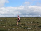
Awaking to blue skies on Saturday morning we left the start line at 7.30 am, just a few minutes after Team YAC (Simon, Carmen and Alan). The first few hours went beautifully as, fuelled by bacon butties, Fig Rolls and Breakaway bars, we romped among the peaceful grassy valleys, farms and low hills that surround the campsite. For the uninitiated the concept of the Challenge is straightforward: teams have 10 hours to walk a route that takes in as many grid references as possible and each location yields the answer to a clue. Some references are worth more points than others depending on location and remoteness. Good ground, easy navigation and fairly straightforward clues meant we were well on schedule when we finally broke out onto the open fells at around 10.30.
From here things got a little harder as we cut across empty swathes of bog to the summit of Wolfhole Crag, the remotest (and one of the smallest) gritstone crags in the country. As a devotee of esoterica I half expected to see Simon here, thrutching up some VDiff chimney in his trainers but bar two spindly fellrunners it was deserted. Moving on from the summit, where we picked up a massive 20 points, we made our way along the broad ridgeline, where several members of Bowland MRT were keeping an eye on competitors from a tent, as well as salivating over a copy of ‘Nuts’ magazine.
By now it was around noon; teams had to nominate a time by which they would arrive for lunch at one of two points and a late arrival meant losing points. We had a big decision to make: we could play it safe or bomb down into the valley to pick up some additional clues before tearing back up a steep hillside to the lunch huts. We opted for the latter.  After an ankle-shredding descent to the valley (meeting Simon et al who were coming from the other direction) it was here that my hypothesis of the previous night went badly wrong. We couldn’t seem to locate the information board in the village that we were looking for. Short of time I re-checked the grid reference from the original sheet. I had mis-plotted the reference by a whole kilometre. We were in the wrong place. Already short of time we set off up the hillside, me swearing and apologising in the knowledge we had lost a good 30 minutes and were up against it to get to lunch on time. Chris took this all pretty well and after setting a fierce pace we arrived with a few minutes to spare, sweating freely, legs feeling like they were encased in concrete.
After a weary start to the afternoon’s efforts, morale picked up on the summit of Ward Stone thanks to a useful combination of cheese, more Breakaway bars and some easy points. From here we headed off to Clougha Pike, grateful for the combination of boggy footpath and landrover track. A quick visit to a beautiful Andy Goldsworthy sculpture  on the summit slopes saw us gain more valuable points and we began to think about the homeward stretch. Coming off Clougha we opted to try and hoover up several references in the last 90 minutes. Unfortunately this was also the toughest terrain of the day: tall reeds and marsh on the flat with tussock and hidden rocks on steep ground meant slow going. Somehow, Chris had maintained dry feet until this point but it was not long before he sunk into a knee-high bog which evened things up a bit. It was here that the fatigue really set in and I was grateful for Chris’ excellent navigation in a tricky area that saw us pick up all the points we were looking for. By 5 we had hit the road which gave us a full 30 minutes to cover the last kilometre to the campsite. With no time to pick up clues away from the road we ambled gently back to the start.
After some excellent buns and hot chocolate provided by our support team (my girlfriend Jill) it was time for the highlight of the day: dinner. It was here that the YAC members were in their element and we laid waste to the enormous spread put on by the Bowland MRT. I decided to forgive the real ale for the manner in which it had led me astray the night before and had a few beers whilst waiting for the results. It looked as if Team YAC were set for another victory as their impossibly long route had taken in most of the county and, unlike us, they had probably not made any hideous navigational cock-ups. Chris and I would have been happy to finish mid-table so were delighted when we learnt we were third, only 10 points off second with Team YAC a long way ahead in 1st. Simon collected the trophy and posed for a few snaps from likes of ‘Hello!’ and ‘OK’. Not content with this he also managed to win the Cotswold Outdoor prize draw too: snaffling up a snazzy dry bag whilst I picked up an oversized fleece from the raffle.
Once the euphoria of the results had ebbed away it was time to take to the tents and give our aching muscles a chance to contract and seize-up completely overnight. Morning came with the recollection that I had promised to do the event next year as well as a mountain marathon in 2009 too and, to tell you the truth, I can’t wait.
A big thanks to the Bowland MRT for making it happen and to Chris for putting up with me for the weekend. Alas, I didn’t take any pictures but Simon grabbed a few which you can see here: http://climbing.me.uk/Bowland2008/index.html
More information about the event can be found at http://www.bowlandchallenge.co.uk/


