Archive for the ‘Fell running’ Category

Clapham

Friday, October 2nd, 2009

After a series of poorly attended camping trips over the summer, we were back to full strength with the return of the hut meets, a sell-out at the YMC hut at Clapham in the Yorkshire Dales.

Saturday was grey and cloudy, with occasional drizzle, but everyone got out anyway. Carmen, Debra and I made for Ash Tree Crag, a nice little unpolished outcrop about 45 minute walk from the hut. Debra managed a few VDiffs before heading for the pub to meet Simon, who'd just run the 3 Peaks (time to beat = 6.5 hours), Carmen and I stayed until just before nightfall and managed to complete all 9 starred routes at VS and below. Pick of the crop for me was Christmas Cracker (VS 5a **).

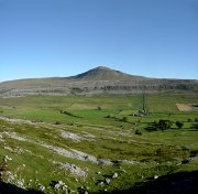
Meanwhile Donal and Annie went mountain biking, and everyone else went for a walk around, over, and/or up Ingleborough.

That even Donal pulled out all the stops and served up a gourmet meal that made the whole weekend worthwhile by itself. Chicken, roasted vegetables, and cous-cous was followed by peaches/mincemeat courtesy of Annie, and cheese & biscuits provided by Paula and Steve.

Sunday in pleasant contrast to the day before was clear and very sunny. Donal, Peter, and Dave headed for Penygent where they climbed Red Pencil and Damocles Groove ('much more solid than expected'). Simon & Debra went to Chapel-le-Dale, a recently developed outcrop near Twistleton which promised oodles of starred low grade routes. In the event, most of them proved disappointing and/or hard-to-find.

Carmen and I went to Twistleton where we climbed 10 starred routes, all completely unpolished. It seems that everyone heads for the Main Wall area to add to its deep gloss, we saw no-one all day until we neared that area, where a dozen people or more were lined up queueing.
Best routes:

High Noon (VS 4c **), a tricky wall, delicate traverse, and strenuous chimney
Mozambique (VS 4c **), a steep crack topped by an overhang, looks unlikely for the grade but is actually quite easy
Juggernaut (S 4b **), steep and, er, juggy.

I think most of the others went for a walk up Penygent.

A few more photos here.

Challenging Bowland

Thursday, July 23rd, 2009

Bowland ChallengeOff to the Forest of Bowland last weekend to defend our title in the Bowland Challenge. The inspirationally named "Team YAC" (Alan K, Carmen, and me) spent 10 hours on Saturday running/walking/crawling round the hills north west of the Dales, covering about 31 miles/4600 feet ascent in the process. Amazingly it stayed dry all day, and even more amazingly, despite our best efforts in failing to find several of the controls, we managed to win.

Highlight of the day – rescuing a particularly stupid sheep who had managed to end up on its back and was waving its legs feebly in the air, unable to right itself, like a big woolly beetle.

A good fun event, open to both runners and walkers, next year I'll try to remember to circulate details in advance. Their website is here.

The view towards the lake District from Hutton RoofsThe next day Alan stuck with his plan to drive home and sit on a lounger watching golf. Meanwhile, Carmen and I abandoned our plan of climbing steep limestone at Trowbarrow, as I'd managed to strain a leg muscle. So instead we contented ourself with a bimble in the sun around Hutton Roofs – a 6/7m high limestone edge with about 80 routes, mainly below VS, we managed 15 of them. Not a crag to drive a long way for, but worthwhile if you're in the area (eg retreating from lake District rain) and fancy an easy day. UKC crag details here.

GL3D Lakeland Challenge

Thursday, May 7th, 2009

The Great Lakeland 3 Day is a three-day run in the hills, covering a total of about 80 miles and a squillion feet of ascent. After 2 previous attempts (one successful, the other less so), we were back for our third go.

This year we started in Braithwaite near Keswick. After an excellent Last Meal in the Middle Ruddings Inn on Friday evening, we were up bright and early the next morning, raring to go. Ahem.
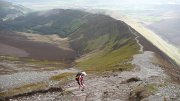
After a gentle start along a pleasant footpath, it was uphill all the way via Grisedale Pike to the first control on Hopegill Head. We rejected the undulating ridge of Whiteside due to its extra ascent and instead headed steeply downhill into the valley – possibly a mistake as we ended up wading through thick heather, but with a bit more luck/judgement we'd have found a grassy way down. This took us eventually to the second control, north of Crummock Water.

Next up the rarely visited valley of Mosedale to what looked from a quick glance at the map like a small hill, Hen Comb. Appearances can be deceptive, despite its modest 509m height, it was a long way up!

From here, a long rising traverse took us to the High Stile ridge, and a control on High Crag from where we had good views of climbers on Grey Crag – in the sun and out of the cold wind it looked like an excellent crag choice. A nice scree run into Ennerdale (not yet run out as hardly anyone goes this way) led us towards the next control on Steeple on the other side. Most people apparently followed a forestry track to pick up a footpath at the foot of the north ridge. But the map we were using didn't have the footpath marked, so we attempted to traverse up by the edge of the forestry plantation to climb onto the ridge from near Mirk Cove on its eastern flank. I say 'attempted', as we managed to miss the edge of the forest and ended up fighting through dense conifers for a couple of hundred interminable metres. Despite this, I think it was a good route choice – but could have been a lot better with more care! The corrie itself was an impressive place, and would repay a longer visit, there looked to be some good scrambling possibilities.
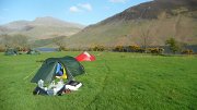
The rest of the day was relatively uneventful, with a final slog up Seatallan before a descent down the beautiful valley by Nether Beck to an idyllic camping spot in a field on the shores of Wastwater. A splendid sunny day, despite the cold wind at times, and with beer available courtesy of Joe, plus the luxury of a few spare hours before sunset, a perfect end to the day.

A rainy night followed, and so we were expecting a damp day to follow, but the next morning the rain stopped, the clouds thinned, and the sun appeared.
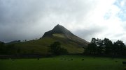
No gentle start today, with the first control on the summit of Yewbarrow, 550m above us. From here, we followed the ridge up and along to Pillar for control number 2, accompanied by patchy sunshine, a bitterly cold wind, and occasional hail showers.

The next control was a loooong way away, on the summit of Great End. But at least we had the luxury of a relatively flat few miles as we traversed round the side of Kirk Fell, followed by the climbers' traverse past Napes Needle on Great Gable – a few hardy climbers were out despite the cold wind. The flat section ended abruptly at Esk Hause, with a steep 450m ascent up The Band ridge on Great End. For some reason hardly anyone ever goes up this way, and there was not much path to speak of, but in different circumstances it would make a fine way to the top.

From the summit we had a good view of some heavy hail falling over Glaramara, where we were headed next – for once it paid to be fairly slow, the hail had disappeared by the time we arrived. As indeed had the control marker – we spent a good 20 minutes looking for it until 2 others arrived and confirmed that it wasn't there. Oh well, at least it gave us the chance to stop for a while 🙂
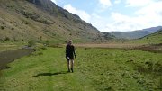
A descent across complex terrain (luckily with good visibility) into Langstrath, was followed by the day's sting in the tail, an unrelenting 550m slog up Ullscarth. We couldn't face losing too much height again after this, so rather than take the direct down-then-up route to the final control on Steel Fell, we went for a longer-but-gentler line, traversing the head of the valley around the aptly named "The Bog". All that remained was a pleasant (though knee-wrackingly steep) descent down the ridge to the campsite at Steel End.

Another fine site with the chance to chill out with some beers. But the forecast for the next day was poor, and the day expected to be long, so we were in our sleeping bags before dark.

Having been kept awake for half the night by the strengthening wind and rain, I managed of course to fall into a deep sleep moments before being woken by the alarm at 4.45am. One of the hardest parts of the day followed, namely getting out of a warm dry tent into a cold wet and windy outdoors. After a bit of packing and faffing we finally set off at 6.25.
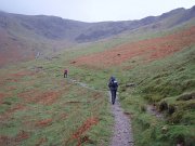
The first control was a pig – the summit of Helvellyn – made worse by the fact that the second control was by the side of Thirlmere, just a couple of miles along the shore from our start point! The ascent was warm and muggy (or as warm and muggy as it gets at 7am) but the summit was very, very cold, so we ran down as fast as we could. 1 hour 35 minutes up, 35 minutes down again, and we were back where we started.

The next path was visible directly across the lake, but to get there we had to walk all way round the shore. At least it was flat! Which is more than can be said for the ensuing 300m ascent up increasingly boggy ground to High Tove and across the watershed to Watendlath. There followed another of those bits that look simple on the map, but turn out not to be. Mainly in this case due to loss of concentration, I thought that every minor knoll and bump on Brund Fell was the summit, but as ever it turned out to be the steep craggy bit in the distance after all.

All the while the rain continued – it hardly stopped all day – while the wind gradually grew stronger.

Next down to Rosthwaite by a good direct line; feeling pleased with myself for finding it, I then let the side down with one of those brain waves that might work well, but rarely do.
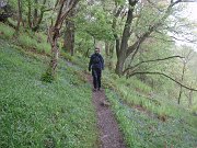
The next control was on Robinson, on the other side of Dale Head. Instead of taking the obvious steep path straight up to Dale Head, we decided instead to head for Honister Pass, and then contour up the apparently grassy hillside to the col just before Robinson. The reasoning being that the weather was pretty foul so staying as low as possible for as long as possible could only be a good thing, even though the route was quite a mile or two longer.

The first part of the plan went well, though Honister Pass looked like it had the potential to become a morgue (OMM joke). However, the hillside that the map showed as grassy turned out to be an unbroken slate slag heap, and it quickly became obvious that it would be slow or impossible to find a way across. So we headed up Dale Head anyway, and then compounded my mistake as I attempted to traverse round the top of the hill instead of going to the summit; unfortunately I'd mis-set my altimeter and we ended up trying to traverse some 50 metres too low. At least we weren't competing against anyone else, just against ourselves – if our aim was to beat other people then we'd have given in before we started!
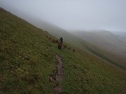
As expected, the weather on the ridge was 'exciting', and we had to fight to make any progress at all. So as soon as we reached the summit we fled as fast as possible down to the next control being at Newlands Hause. The end now started to feel close (even though it was still 6 miles away), as the last major ascent was out the way. A long traverse on sheep tracks above Sail Beck, up-and-over Sail Pass, then a final quick pull to the summit of Outerside was followed by a gentle descent back to Braithwaite and the finish.

All in all a truly excellent weekend (though it didn't always feel that way at the time!). Thanks as ever to Joe Faulkner and everyone else involved. As we battled through the rain on Monday morning I promised myself this would be the last time. But maybe I'll keep the May Day weekend free next year, just in case…

My photos are here.
Maps of our routes:
Day 1
Day 2
Day 3

Results and GL3D details

Vital Statistics. Distances were probably slightly longer than shown, and ascent figures slightly less:
Day 1. 24 miles, 8500 feet ascent, 8 hours 40 mins
Day 2. 21 miles, 8850 feet ascent, 9 hours 57 mins
Day 3. 27 miles, 9000 feet ascent, 9 hours 50 mins

High Peak Marathon – Triumph and Disaster

Saturday, March 7th, 2009

Actually there wasn't any of either but it makes quite a good title.

Pre-dawn blurWe started at 11.01 (pm of course), one of the first teams to go. By the time we got to Moscar (11.5 miles), all other teams had overtaken us except for one. And they passed us at Cut Gate.

Overnight the weather was a mixture of persistent drizzle and hill fog. After dawn the skies cleared to give some hazy sunshine but with a cold wind.

The bog monster was on holiday, it was all much drier than on our recce, and much to our surprise there were only two immersions – me up to my knees, and Carmen up to her thighs (serves her right for taking my advice on a good crossing point).

It was all very, very tiring.

Carmen grabbing some sleep on the wayA little over 2000m ascent and 43 miles. 49 teams started. 43 finished. We were 42nd, in something like 15 hours 50 minutes (a mere 7 hours behind the winners).

Early afternoon sunshine on KinderBut that wasn't the point. We finished, which was our only aim. Despite no training, and a little half hearted reconnaissance, we got to the end. A sterling effort by all. Will, who had never done anything remotely like this before (nor will again if he's got any sense), and did half the course with blisters on 2 toes which were as big as the toes themselves. Alan, who has done stuff like this before, but still wanted to take part – more fool he. And Carmen, who faced with yet another silly idea, just couldn't say no.

And a special mention to Will's parents for kindly chauffeuring us home afterwards.

Roll on next year!

…when we can stay at home and eat pizza instead.

Some more photos here.

Route map here.

Results.

HPM Recce 3 – The Dark Side

Saturday, February 28th, 2009

Alan had a cunning plan. Take 2 cars, drop one off at Cut Throat Bridge, drive to Edale, and then do the first 12 miles of the HPM. An excellent idea, we all agreed.

One other minor detail – this was to happen after work on a Friday, so it wouldn't affect any other weekend plans. A good theory.

Will was one step ahead of us and arranged a prior engagement. So it was just Alan, Carmen and I who set off from Edale in the dark at 5 to 7 last night.

It was actually quite fun, though the fun abated slightly as we waded through the oozing "mud" thoughtfully provided by a field of cows on the approach to the first hill. The skies were clear though, and it was lighter than I'd expected, courtesy mainly of the City of Sheffield.

Hollins Cross and Lose Hill were fun (though a few tumbles left Alan reconsidering his decision to wear walking boots), and the going easy enough to allow some half-hearted running. It was made a bit trickier by the portable hill fog, as every breath was illuminated by our head torches. The ascent of Win Hill was brutally steep but fairly short, the descent from there to Yorkshire Bridge was steep, muddy, and unending.

Avoiding the temptation of a pint or 3 in the pub, it was up the road to Stanage. The path to High Neb is easier to follow in the daylight, and the climbs easier to identify! We missed High Neb slightly, but consulting the climbing guide later I'm fairly confident we'll find it on the night (I'll probably live to regret that statement). All that remained was a boggy yomp along the edge to Moscar, and back down the road to Cut Throat Bridge.

Last year's race times for this section were between 2 hours 10 minutes, and 4 hours 15. We had hoped to take about 3 hours, but took 4 hours 13 minutes. Oops. We consoled ourselves with the knowledge that we could have been faster if we'd run more, but on the event we'll need to conserve as much energy as possible for later on.

Got back home about 1.30am. So much for not affecting weekend plans, it's 6pm and I'm off for a snooze.

Less than a week to go…

Vital statistics: 11.5 miles, 980m ascent, 4 hours 13 minutes

Trial by name…

Monday, February 2nd, 2009

Yesterday at some stupid early hour, Carmen and I set off to Hayfield for the Kinder Trial, a fell runner's version of orienteering – lots of running with a bit of navigation.

We had to visit 10 controls in any order, though in practice the main choice was just whether to do the circuit clockwise or anti-clockwise. I went for the anti-clockwise option, as it would hopefully leave a long downhill run from the last control to the finish. Coincidentally, Carmen made the same choice, but I soon managed to shake her off so she had to make her own mistakes for most of the race rather than copying mine!

The weather stayed cold and cloudy, with regular snow flurries, but the clouds were well clear of the tops all day. Which was a shame, as it gave less advantage to those of us who can navigate OK but can't run for toffee (it's a well known fact that 98% of fell runners don't know what a map is). At least most of the boggy bits were well frozen.

It was mostly great fun (in an exhausting sort of way), and visited some parts of the Kinder area that people wouldn't normally see. The main exception to the 'great fun' rule being the planned easy run down from the last control, which by the route I choose mainly consisted for the first mile or so of deep exhausting heather. I'm told that there was a runnable route available if you looked in the run place. Arse.

There's a map of the route here.

And some photos here and here

Vital statistics:
about 11 miles/2600 feet ascent.
153 started, 136 finished.
The winning time was an amazing 1:49:28, the final finisher took 4:55:59. I was 67th in 2:46:17 and Carmen was 108th (20th female) in 3:34:12

HPM Episode 2 – Attack of the Bog Monster

Thursday, January 22nd, 2009

Another Saturday, another HPM recce. This time Alan couldn't come because his house had blown down (or something like that), but Will wasn't quick enough with the excuses. We dropped Will's car off at Snake Pass and drove back to Cut Throat Bridge to do the 17 mile section in between. We were having second thoughts as we drove up towards the pass in driving rain and hail, but somehow by the time we left the car, the clouds had gone and the sun was shining.

Conditions were very different from the week before, with the ice replaced by mud, but the sunshine made it feel like Spring, and we made good progress as far as Cut Gate. I even worked out where we'd gone wrong the previous week.

After that though it all went horribly wrong. We'd been up here before, in the Grin 'n' Bear It 2007, and I had memories of bogs. But it was all so much worse than I'd remembered, and any attempt to wade led to retreat through knee-deep quagmire, followed by lengthy detours to get round the boggy bits. And it didn't relent. Every time we began to think we might be past the worst, one of us inevitably started sinking. To make matters worse, the sun had gone behind threatening clouds and a cold winds had picked up. It took us about 3 hours to do the next 5 or 6 miles, but felt like eternity, as we collectively lost the will to live. Navigation up here is going to be a nightmare in the dark.

So bad were the bogs that the 2 miles of peat hags we encountered when we finally reached Bleaklow Stones came as a blessed relief. We even managed to find a path through this area (or at least, an almost continuous channel with a few cairns, footprints, and bleached bones of previous visitors). An hour later we reached the Pennine Way, just below the Wain Stones. A unanimous decision that we couldn't be bothered to go up the hill to find the location of the checkpoint, and we all ran down the PW flagstones towards Snake Pass.

17 miles, 6 hours 10 minutes. If we get through this bit in one piece on the night then we'll almost certainly get to the end! At least the rain held off until 10 minutes after we finally started the drive home.

High Peak Recce

Sunday, January 11th, 2009

Derwent EdgeLast November, a few of us (Alan, Will, Carmen and I) put a team together and applied for this year's High Peak Marathon, on the mistaken belief that we stood no chance of getting a place (it is always oversubscribed by at least 300%). Sadly our hopes were cruelly dashed last December when we were told that we were in. 40 miles of the finest peat hags our country can offer, starting at 11.30pm on a Friday night in March – should be a doddle.

This weekend, we'd hoped to head for the Lakes for some winter fun before the ice melted, but having established that we were a day too late, we switched at the last minute and decided to investigate part of the HPM route. Will and Alan were both busy due to the complete lack of notice, so it was just the two of us. After a lazy start, we parked at Cut Throat Bridge at about 12.30.

We took a cross-country route to get onto the Edge, to check whether it would be feasible in the dark (it should be). Progress was then rapid for a few miles, courtesy of a paved path for most of the way. After Lost Lad the route leads down to a checkpoint by Abbey Brook (not sure why the route doesn't follow the watershed here, possibly conservation problems, or a vastly increased chance of getting totally lost!)

The next section heads back uphill and regains the watershed. We managed to lose the path at this point, which doesn't bode well for doing it in the dark! A short flat and featureless section follows before we picked up a good path again towards Margery Hill and then Cut Gate, and since it was by now almost 3pm we decided to call it a day and descend to the valley, where we followed a forestry/water board track back. This was rather further than it looks, and hard on the joints as it's effectively road running for most of its length, luckily we won't have to do this on the day.

Got back to Cut Throat Bridge just before 5.30. About 17 miles round trip, and quite fun (except for the valley bit) despite the bitterly cold wind.

Here's the route we took.

The Langdale Horseshoe

Monday, November 24th, 2008

Ascending Lingmoor FellThe forecast was for clear blue skies with excellent visiblility, so Carmen and I decided to make the most of it with a 'run' (of the 95% walking variety) round the Langdale Horseshoe. The classic fell race covers 14 miles with about 5000 feet of ascent, with the record standing at a few minutes short of 2 hours. We wanted a longer day than that though, so added in a couple of extra summits to give a round of 19 miles/7300 feet ascent (I didn't measure this until afterwards or it's likely we'd have thought better of it!).

Pike o\' Blisco and Crinkle Crags from Silver HoweSo, we were up at the crack of dawn (7.05), and a mere hour and 20 minutes of faffing later, we set off. The promised clear blue skies were hidden behind high cloud, which lowered occasionally over the highest tops to leave a light covering of snow. The ascent started over the road from the hut, and 1000 feet of steep climbing later we reached the summit of Lingmoor Fell. From here, an easy path down into Elterwater was duly missed, and instead we opted for a slow steep route down scree and short vegetated crags to the valley.

Jack\'s RakeOver the road and time for another steep climb up to Silver Howe. From here the route undulated a lot, with much descent and reascent, but spread out over a few miles so it never felt too hard. An hour later we reached the foot of Pavey Ark, and the first people of the day, a nose-to-tail line of red and blue jackets leading off up Jack's Rake. After a short food stop (very short due to frozen toes), we followed up the rake, pausing for a few words with Peri and David who had taken the direct route from the hut.

Langdale Pikes and Bowfell from the ascent of Esk PikeOnwards over all the Langdale Pikes, then a long marshy descent to Stake Pass – the constant sub-zero temperatures had not been enough to solidify the bogs – and on to Angle Tarn in an increasingly bitter northerly wind (temperatures falling below -5). This section was one of the few that we actually ran rather than walked, icy water is slightly less unpleasant if negotiated quickly.

From here it was a choice between Plan A – Esk Hause and back over Esk Pike to Ore Gap – or Plan B – a shorter but steeper route straight up to Ore Gap. "Plan A" said Carmen, who was using a different naming convention and thought she was voting for the shorter route, but by the time she realised it was too late.

Descent from Crinkle CragsAs we crossed Bowfell the crowds reappeared, but they were mostly headed down to the valley again as we started the ascent of Crinkle Crags. Just before the Bad Step we met Rob, Cef, Simon & Debra, who had been doing various scrambly walky things on Bowfell. Another short run down to Red Tarn was followed by a long crawl up Pike o' Blisco, from where we again avoided the obvious track and followed instead the pathless ridge down to the north, emerging near Blea Tarn before a final short section of road back to the hut. Where we found ourselves in the unusually situation of being first back. Note to self: in future, find out where the key is going to be left before setting off…

Sunday morning view from the hutSunday dawned snowy and blowy, and after the standard dithering, we opted for a short walk from the top of Wrynose Pass up Great Carrs, Swirl How, and Wetherlam.  About 4 miles, and 3000 feet of ascent, but Saturday had taken its toll and we limped round in 4 1/4 hours.

Lots more photos here

Bowland Challenge

Thursday, July 17th, 2008

Carmen near Ward's Stone summitHistorians of YAC will know of our excellent pedigree in this event, culminating in the glorious victory of last year, so the pressure was on to live up to the high standards set by our forebears. Unfortunately training for this, my first such event, had not gone well (I hadn’t done any) and my Challenge partner Chris (who I had never done any walking with before) was recovering from two broken wrists so was in no better shape. In short, we were not well prepared and I knew I would need to draw on every ounce of my experience, fitness and supply of Breakaway biscuits if we were to even threaten the leaderboard.

 Having pitched our tent on the Friday evening we decided to lay down our first psychological marker at the route planning stage. This was a tortuous process with each team given a list of around 80 grid references that had to be plotted onto a map before an appropriate route could be designed and submitted to Challenge Control that night. It was during this exercise that I made a valuable discovery: consumption of real ale allows you to plot grid references much more quickly, confidently and accurately than would normally be possible.  I made a careful note of my findings and felt sure my hypothesis would be proved correct the following day.

 Awaking to blue skies on Saturday morning we left the start line at 7.30 am, just a few minutes after Team YAC (Simon, Carmen and Alan). The first few hours went beautifully as, fuelled by bacon butties, Fig Rolls and Breakaway bars, we romped among the peaceful grassy valleys, farms and low hills that surround the campsite. For the uninitiated the concept of the Challenge is straightforward: teams have 10 hours to walk a route that takes in as many grid references as possible and each location yields the answer to a clue. Some references are worth more points than others depending on location and remoteness. Good ground, easy navigation and fairly straightforward clues meant we were well on schedule when we finally broke out onto the open fells at around 10.30.

 From here things got a little harder as we cut across empty swathes of bog to the summit of Wolfhole Crag, the remotest (and one of the smallest) gritstone crags in the country. As a devotee of esoterica I half expected to see Simon here, thrutching up some VDiff chimney in his trainers but bar two spindly fellrunners it was deserted. Moving on from the summit, where we picked up a massive 20 points, we made our way along the broad ridgeline, where several members of Bowland MRT were keeping an eye on competitors from a tent, as well as salivating over a copy of ‘Nuts’ magazine.

 By now it was around noon; teams had to nominate a time by which they would arrive for lunch at one of two points and a late arrival meant losing points. We had a big decision to make: we could play it safe or bomb down into the valley to pick up some additional clues before tearing back up a steep hillside to the lunch huts. We opted for the latter. Alan on the last ascent, Ingleborough in the backgroundAfter an ankle-shredding descent to the valley (meeting Simon et al who were coming from the other direction) it was here that my hypothesis of the previous night went badly wrong. We couldn’t seem to locate the information board in the village that we were looking for. Short of time I re-checked the grid reference from the original sheet. I had mis-plotted the reference by a whole kilometre. We were in the wrong place. Already short of time we set off up the hillside, me swearing and apologising in the knowledge we had lost a good 30 minutes and were up against it to get to lunch on time. Chris took this all pretty well and after setting a fierce pace we arrived with a few minutes to spare, sweating freely, legs feeling like they were encased in concrete.

 After a weary start to the afternoon’s efforts, morale picked up on the summit of Ward Stone thanks to a useful combination of cheese, more Breakaway bars and some easy points. From here we headed off to Clougha Pike, grateful for the combination of boggy footpath and landrover track. A quick visit to a beautiful Andy Goldsworthy sculpture Andy Goldsworthy sculpture on Clougha Pikeon the summit slopes saw us gain more valuable points and we began to think about the homeward stretch. Coming off Clougha we opted to try and hoover up several references in the last 90 minutes. Unfortunately this was also the toughest terrain of the day: tall reeds and marsh on the flat with tussock and hidden rocks on steep ground meant slow going. Somehow, Chris had maintained dry feet until this point but it was not long before he sunk into a knee-high bog which evened things up a bit.  It was here that the fatigue really set in and I was grateful for Chris’ excellent navigation in a tricky area that saw us pick up all the points we were looking for. By 5 we had hit the road which gave us a full 30 minutes to cover the last kilometre to the campsite. With no time to pick up clues away from the road we ambled gently back to the start.

 After some excellent buns and hot chocolate provided by our support team (my girlfriend Jill) it was time for the highlight of the day: dinner. It was here that the YAC members were in their element and we laid waste to the enormous spread put on by the Bowland MRT.  I decided to forgive the real ale for the manner in which it had led me astray the night before and had a few beers whilst waiting for the results. It looked as if Team YAC were set for another victory as their impossibly long route had taken in most of the county and, unlike us, they had probably not made any hideous navigational cock-ups. Chris and I would have been happy to finish mid-table so were delighted when we learnt we were third, only 10 points off second with Team YAC a long way ahead in 1st. Simon collected the trophy and posed for a few snaps from likes of ‘Hello!’ and ‘OK’. Not content with this he also managed to win the Cotswold Outdoor prize draw too: snaffling up a snazzy dry bag whilst I picked up an oversized fleece from the raffle.

 Once the euphoria of the results had ebbed away it was time to take to the tents and give our aching muscles a chance to contract and seize-up completely overnight. Morning came with the recollection that I had promised to do the event next year as well as a mountain marathon in 2009 too and, to tell you the truth, I can’t wait.

 A big thanks to the Bowland MRT for making it happen and to Chris for putting up with me for the weekend. Alas, I didn’t take any pictures but Simon grabbed a few which you can see here: http://climbing.me.uk/Bowland2008/index.html

More information about the event can be found at http://www.bowlandchallenge.co.uk/