Posts Tagged ‘snow’

New Year Meet 2009

Tuesday, January 12th, 2010

This year's new year trip was to the Alex Macintyre Hut, near Glencoe. A dozen of us made the journey north, and for once the snow didn't all melt the day before we arrived. Carmen and I drove up on Boxing Day, everyone else turned up a day or two later.

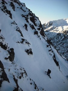
December 27. Sron na Lairig, grade II. Supposed to be an easy warm up day, but the deep snow put paid to that! The 4km walk in took a couple of hours, under grey skies with occasional snow flurries. The climb itself was trickier than expected, with no ice but loads of powder over rock with a little mostly frozen turf. A great mountaineering route, with some mildly terrifying pinnacles and an a cheval snow arete near the top, for which we roped up. The continuation to the summit took an age, as it was knee-deep snow all the way with little sign of any recent visitors, but also because the skies had cleared so we had to keep stopping to take photos. The summit too was deserted, nobody else had been that way all day despite its being a Munro. The descent was down the NE ridge, with its notorious bad step. Again, harder than expected – all possibilities looked too scary so in the end we abbed down the last section just as the last of the daylight disappeared. Luckily the full moon was bright enough to throw shadows as we continued along the ridge. We opted for an early descent into the valley, at a point where we could see there were no major crags to find a way round. It still took a good hour to cover the 1/2km to the bottom!

December 28. Definitely a short day this time, a walk up the twin Munros of Buachaille Etive Beag. We'd both done them before but not on as glorious day as this. Plenty of other people about (though most only did the main summit) so the paths were well trodden. Spectacular views in all directions, but especially of Bidean nam Bian and our previous day's route. Meanwhile, Alan and Nigel went for a long walk up Gulvain (near Glenfinnan), finishing long after dark.

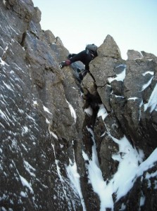
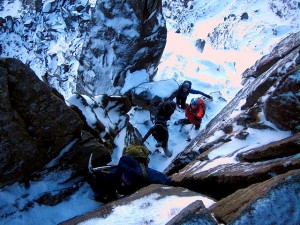
December 29. Aonach Eagach (grade II/III). A winter traverse has been on my "to do" list for years, but every previous winter trip to Glencoe has been preceded by a massive thaw. Not so this year! Strong winds were forecast so it was without much optimism that Alan, Rich, Jenny, Carmen and I slogged up the hill. But somehow we managed to be sheltered along the whole ridge – Peter and Annie were on the other side of the valley and had trouble walking due to the wind (or was it the pies?), and Simon, Debra and Ben had a similar experience on Beinn an Dothaidh. It was worth the long wait for winter conditions, we had a magnificent day in clear cold conditions (between -6 and -8 along the ridge). Quick progress at first gradually slowed as we all started to tire, and the ropes came out to safe guard the pinnacled section. But we had passed the tricky bits before the sun set, all that remained was the ascent of the final Munro and the long descent in the dark back to the car we'd left at the Youth Hostel. 12 hours car-to-car, a great day.

December 30. Wild weather was forecast, and duly arrived. Ben and Nigel joined us for a short walk up Sgurr na' h-Eanchainne, a Corbett on the other side of the Corran Ferry. At least I thought it was a Corbett, but realised half way up it was actually a few metres short, so no ticks today, much to Nigel's disgust A nice little hill, with superb views across to the Glencoe hills and further north to Ben Nevis. Peter and Annie pushed their bikes round some snowy woods, I'm not sure about the others!

December 31. Expecting a sunny day, we plumped for the Ballachulish Horseshoe (Beinn a' Bheithir). The ascent up the NE ridge of Sgorr Bhan proved trickier than expected, and soon Carmen and I were on our own. Ben took a long detour round the awkward bit, hoping to meet us later, while Simon and Debra retreated to the nice warm hut. Sadly the forecast sun never arrived and we spent most of the day in the clag. We briefly considered heading back from the col between the Munros, but Ben had left his car at the far end so we pressed on. There was no sign of Ben, but not much sign of anything else either, so we decided not to wait. Navigation on the last section proved tricky, with undulating terrain and loads of identical small lochans, many not marked on the map. But eventually we emerged from the cloud, in roughly the right place. The final descent was a little more entertaining than hoped for, as we had to find a way in the dark round countless small outcrops and a couple of large cliffs, but we made it to the road and soon met Ben, who in best Annie style had bumped into an old friend on the hill and taken the descent from the col. I'm not sure what everyone else did – I think Annie and Peter went up Gulvain, but cheated by taking mountain bikes for the long approach.

New Years Eve. Preparation of the haggis supper was well under way, when suddenly we were plunged into darkness. The main fuse had blown! So we adjourned to a quiet and atmosphere-free Kings House for dinner before returning to the hut – where Nigel had nobly remained to organise an emergency electrician, so we had light in time for the customary new year falling asleep.

January 1. A return to the Beinn a' Bheithir for Carmen and me, this time for some ice climbing. Very slow going through deep powder with a hard crust which sometimes supported, and sometimes gave way. When we reached the north ridge of Sgorr Bhan we saw a small icefall and took the opportunity to stop for a rest and climb it. Nice easy climbing on fantastic ice, Carmen led straight up the middle for a good little 30m grade II. After this, some more crusty powder led to the main route of the day, Russian Roulette II/III. I say 'main' but it's only 50m high! Loads of ice, though more brittle than our first route, with lots of dinner-plating. Back to the sacks just as the last of the light disappeared, and the standard walk-out in the dark.

January 2. We decided on an easy day with a short walk in so went for a look at the Aonach Dubh cliffs on Bidean nam Bian. We didn't bother with a guidebook as we were just looking for some short easy angled ice to play on. Firstly we tried the Allt Coire nam Beithach but there was too much flowing water and not enough ice. Higher up though, there was loads of ice. A steep icy gully looked tempting but probably too hard, and there was a group of 3 just starting (we later found that this was Number 6 Gully, grade IV ***). So we went for an easy looking line of ice further right, which looked about grade II and one or two pitches. One minor epic and 3 pitches later, we reached the top – much steeper than it looked, the last pitch was vertical for a few metres! Harder than anything else we'd done, I reckoned about III/IV. Consulting the book later it turned out to be Squaddies Climb, grade II/III, only mildly humiliating – fun though.

A great week, in great weather – and it was just the beginning of a great winter!

Loads of photos here.
Peter's bike-pushing pictures here.
Debra's photos here.

Blencathra in the snow

Thursday, December 24th, 2009

After much dithering, Will and I decided to head for the Lakes yesterday. In typical British style we chose to ignore the "A66 closed" signs on the A1, as the roads were clear and there was no sign of falling snow. They must have been left on after earlier problems, mustn't they. Er, no actually. The snow gates were closed at Bowes.

We decided it would be quicker to wait for the road to re-open than to try to find an alternative route. 90 minutes later we were off, and arrived at the layby near Blencathra some 4 hours after leaving York. So much for the early start, by the time we were walking it was almost midday!

At least the late start meant that a trench of sorts had been worn through the deep powder (up to a foot deep even in the valley, knee-deep higher up). A series of mini-avalanches could be seen below the path, triggered by passing walkers. As we slogged up, we passed 2 guys descending on skis and one on a snowboard, who had skied all the way from the summit to the road. In the Lake District, in December!

Without much hope of finding anything climbable due to the powder, we nevertheless traversed under Sharp Edge through thigh-deep powder to the foot of Foule Crag. It was clear that most of the normal lines were going to be difficult, unpleasant, and possibly dangerous due to the snow. But at the left end of the crag we saw an obvious turfy buttress, immediately to the left of Blunt Gully. It's not in the guide but it looked a reasonable option so we decided to give it a go, we didn't fancy yet another day carrying climbing kit for a walk!

Up close, it looked a lot steeper, and appearances weren't deceptive. Will took the first pitch, with excellent turf to start. An overhanging wall could probably be taken direct by someone competent, so we went round it. There seemed to be an easy option on the left, so Will went right, swimming up the totally unconsolidated start of Blunt Gully, before moving back onto the ridge. I took the next pitch, much more pleasant up well frozen turf with a few rocky steps. Total gear for the 80m route consisted of a very dodgy nut backed up by an even dodgier bulldog. Blunt Gully Buttress, grade II/III.

We topped out at the start of Sharp Edge, so finished up this (grade I/II) – easy enough as it was all snow rather than ice, with a well trodden path – just a couple of short but awkward and exposed descents, involving strategic use of buttocks.

We arrived at the summit shortly after sunset, and had the place to ourselves (apart from a cold looking mouse). Glorious views in all directions, with the whole of the Lake District visible, and everything covered by snow. A quick descent down the Scales Fell ridge returned us to the car at 5pm.

Lots more photos here.

First Hot Aches of the season

Sunday, November 29th, 2009

on the snowy ridgeA cold wet weekend forecast. What to do? Obviously perfect conditions for a walk and scramble, so Simon, Carmen, Rob and me headed for Winnats Pass in the Peak, for a scramble followed by a walk up Mam Tor and back via Cavedale and Peveril Castle.


Heading off at a civilised 8.30 in pouring rain, our doubts about our sanity eased as we got closer to the Peak and the downpour stopped, to be replaced by the sight of snow on the ground. Parked up above Winnats, walked back down and eyed up Elbow Ridge, which was disconcertingy wet and snowy. Eventually Rob decided to take the lead and started up, so one up all up it was. Elbow Ridge is an exposed limestone fin, it's an exhilarating but easy diff in good conditions, however when the holds are wet and slippery, your hands are numb from wet snow and you look down at the road way below it feels altogether more exciting. Once we topped out hot aches set in, there was a vicious cold wind and the mist was blowing sideways in sheets as we were now inside the cloud.


Arriving at a unanimous decision that none of us fancied the scramble up Matterhorn Ridge in these conditions we moved hastily on to the walking part of the day. As we headed up Mam Tor the wet white stuff turned to proper creaky snow. Me and Carmen cunningly got to the top first and ambushed Rob and Simon with snowballs, but were beaten off by Rob's cheating tactics of catching all our snowballs and throwing them back at us. Most of the day the visibility was pretty poor but it stayed dry and every so often we got clear views and pretty golden light filtering through the mist.


Heading back through Cavedale and past Peveril Castle we found a heated and barred off cave containing machinery. Rob Simon and Carmen agreed this must have been something to do with the nearby show caves, however I prefer to believe it was Dr No's secret underground headquarters. We completed the walk just as the light began to fade, and felt that all things considered we had made good use of the day.

Advanced Down Jacket Testing

Monday, December 8th, 2008

After a week of crooning over down jacket specs, the Chosen One arrived in the post just in time for a munro bagging trip. Clearly, no matter what the temperature, some testing was in order, and test conditions seemed excellent, with  roads and car park a skating rink as we arrived in Crianlarich
approaching Stob Coire Odhair
Attempt 1) All attempts at testing the jacket on day one failed due to brilliant sunshine and the exertion of slogging up the Black Mount through knee deep powder snow.   By the time we reached our first summit, Stob a Choire Odhair,  we looked a strange sight – our bottom halves swathed in big boots, gaiters and waterproof trousers, our top halves in sleeveless T shirts. Alastair even had shades and a sunhat on. knee deep in snow
The real air temperature became all too evident once we sat down, we had a hasty lunch then arse-slid down the hill to the bealaich whooping with glee.
We slogged our way up the ridge to Stob Ghabhar and reached the summit cairn just as the sun was setting, then paused to take in 360 degrees of pink tinged snow covered mountains with  bronze glints from the occasional loch. Head torches on hand, but not required – we finished our descent in brilliant moonlight reflecting off the snow.
sunset at the summit of Stob Ghabhar

Attempt 2) Fine test conditions. A chilly wind and incoming cloud. We headed for Ben Chonzie. Reputedly the dullest mountain in Scotland, Ben Chonzie is known for  "collecting the snow".   After saturdays 12 mile extravaganza I was knackered before we started and made heavy work of the plod uphill. At the summit near white out conditions  descended and a bitter wind dropped the effective temperature to -12 or less. I was very taken by the grotesque rime formations,  but few photos were taken as removing gloves for even a moment caused stingingly cold fingers (must get some liner gloves). The snow was drifting and at places we broke through the crust into thigh deep holes. A fine chance to test the jacket! Out in came in all its magenta glory, and I am happy to report that combined with a gortex layer it was toastily warm even while sitting on snow eating sandwiches.A nice day for a picnic


http://www.flickr.com/photos/81529845@N00/sets/72157610924975500/

Howgill stroll

Sunday, December 7th, 2008

great veiw to end the daySat was due to be a fine day with clear skies and reasonable temps, but Friday night was set for mucho wine so no hope of getting an alpine start for the Lakes. Much to our surprise Simon C suggested a civilised 9am start, and picking up Jules and I we headed into the snowy Dales. The drive to Cautley Spout is spectacular when the hills, though small, are snow capped.

Setting off on an icy path we sprinted across the bridge to beat the farmer driving his sheep in our direction. sheep  misbehaving

We needn't have hurried as the sheep were going through the river not over it! Well eventually they would, not before some serious water avoidance and many harsh words from the farmer and a few nips from the dogs.

A long pull up right eventually brings us (stripped down a bit) to the summit of Yarlside, and some indecision as to where to head. We choose to drop down into the valley then slog up towards Hazel Gill Knot.
The descent proves a tad faster for Jules as she slips then slides about 60m or so down the icy slope. Quite some feat as I couldn't slide more than a foot. Spreadeagled and head first seems to be the most effective for those interested in repeating the feat! down we go

Once on top we scoffed cake in the windless sunshine with great views to the Lakes (picking out all the fells from Sharp Edge, Blea Water and High St, the Langdales, Bowfell, Scafell and Coniston hills).

A long slow trudge through the snow, thin crust and 6 inches of powder made it harder than it should have been, but the hordes had dissipated by the time we summited the Calf. The way down was to follow a fell runner's tracks in quite a level traverse across Bram Rigg Top and Calders and Great Drummocks before running down the snow fields and back to the car with a warm pink glow and great sunset.

What use is a temperance pub, especially when it's closed and it wasn't yet dark!

MAP:

View Larger Map

Streetmap / OS

Simon's Pictures

Rob's Pictures

A Winter Round of Helvellyn.

Saturday, December 6th, 2008

With snow on the ground in York and Rowntree Park pond frozen over, various folk were talking of winter conditions near and far.

The following party on the classic pinnacle shot

Peri was off to Scotland for some Munro bagging and down jacket testing, we thought we would risk our luck closer to home and try the Lake District. We all know how hit and miss it can be there, so decided to go equipped for all events. Kirk even packed his rockshoes! That way we could either walk or try to climb something.
Seven o'clock and Pete McDonald picked up Kirk and I, then Guido on route. Over the A66 and down to the ever popular Glenridding. Guido with his wealth of experience had predicted that Pinnacle Ridge on St Sunday Crag would be doable in any condition.

Grabbing a handy parking spot at the bottom of the walk in valley, we donned our boots and hats and skidded on up the valley.

Steep snow on the approach plod

The MWIS had predicted cold conditions and had proved to be spot on, the day had dawned clear and bright. The farm track was riddled with frozen puddles and would catch you out the moment you dropped your guard.
Eventually you leave the track at a small plantation and zig zag up the side of the hill to where you contour around to the bottom of Pinnacle Ridge. It can be hard to pick out, but we eventually located it and started kicking steps up some steep snow.

The snow was quite deep covered with a frozen crust. After the steep snow through some broken rocks we eventually found ourselves at the bottom of the ridge proper. I think this is regarded as the crux when done as a summer scramble and has a wall with a crack in and a corner on the right. As we were soloing at this point, I chose to bridge my way up the right-hand corner, which felt nice and secure. The next section was quite steep and offered 3 choices,

I tried left and got a bit stuck and had to reverse back. Pete tried the centre and got up, I resorted to the right-hand variant, which I think Guido and Kirk did too.

First man up-Jim on the crux

The next obstacle was the Pinnacle, I presume this gives the route its name and where all the photos get taken. No bother to climb, but looking down from the top is a different story. All I could see was a steep snow covered slab. However Pete Mac soon managed to descend it by hanging off his axe which he had hooked over the top edge. Pete located a few buried footholds and I managed to downclimb it without having to use the sling I had taken out of my pack.
We were then treated to watching Guido and Kirk and a following party of two navigate on and off it, while getting lots of good photos.
All that remained was an easier bit of scrambling and step kicking till we gained the final summit slope of St Sunday Crag.


We paused on top for a bite to eat and a drink and headed off in glorious sunshine and clear blue skies over Cofa Pike and up onto Fairfield.

Looking down the crux at the crowds behind us

Lots of people out on the ridges and the snow was deep and secure enough to not have to wear crampons. From Fairfield we descended to Grisedale Tarn, enjoying three sections of sliding down on our bums and using our axes as a brake.
From here we were faced with a long slog up Dollywagon Pike and then Helvellyn. It was here I found it really hard going, I had been suffering a cold all week and my lungs were starting to feel it.

I also developed a cramp in my upper right leg, so I downed a Power Gel.

The superb ridge to Cofa Pike & Fairfield

Vile is the only word I can describe, the taste was awful and the consistancy was something similar to what arrives in nappies.
I plodded on after the others and found the cramp wearing off as I crested Helvellyn. Thanks for waiting 10 minutes Guido, Pete and Kirk.
It was thought a better idea to descend Swirral Edge as it is shorter and a bit easier than Striding Edge and the sun was just touching the horizon treating us to a splendid sunset.  We made good time and were walking out of the corrie with good light. However this soon faded and we spent a good part of the next hour slipping and sliding down the path.

Some spots were soft, other bits were hard water ice. We even saw one guy fall over wearing crampons!

A lone Skier descends into a Helvellyn sunset

The conditions were so bad we had to slip into the 'Traveller's Rest' pub where a few pints were downed and we recovered enough to walk back to the car.
All in all one of the best days out in a while, Thanks to Pete for driving, thanks to Guido for the route choice and I can't wait till we can get out again.

The Langdale Horseshoe

Monday, November 24th, 2008

Ascending Lingmoor FellThe forecast was for clear blue skies with excellent visiblility, so Carmen and I decided to make the most of it with a 'run' (of the 95% walking variety) round the Langdale Horseshoe. The classic fell race covers 14 miles with about 5000 feet of ascent, with the record standing at a few minutes short of 2 hours. We wanted a longer day than that though, so added in a couple of extra summits to give a round of 19 miles/7300 feet ascent (I didn't measure this until afterwards or it's likely we'd have thought better of it!).

Pike o\' Blisco and Crinkle Crags from Silver HoweSo, we were up at the crack of dawn (7.05), and a mere hour and 20 minutes of faffing later, we set off. The promised clear blue skies were hidden behind high cloud, which lowered occasionally over the highest tops to leave a light covering of snow. The ascent started over the road from the hut, and 1000 feet of steep climbing later we reached the summit of Lingmoor Fell. From here, an easy path down into Elterwater was duly missed, and instead we opted for a slow steep route down scree and short vegetated crags to the valley.

Jack\'s RakeOver the road and time for another steep climb up to Silver Howe. From here the route undulated a lot, with much descent and reascent, but spread out over a few miles so it never felt too hard. An hour later we reached the foot of Pavey Ark, and the first people of the day, a nose-to-tail line of red and blue jackets leading off up Jack's Rake. After a short food stop (very short due to frozen toes), we followed up the rake, pausing for a few words with Peri and David who had taken the direct route from the hut.

Langdale Pikes and Bowfell from the ascent of Esk PikeOnwards over all the Langdale Pikes, then a long marshy descent to Stake Pass – the constant sub-zero temperatures had not been enough to solidify the bogs – and on to Angle Tarn in an increasingly bitter northerly wind (temperatures falling below -5). This section was one of the few that we actually ran rather than walked, icy water is slightly less unpleasant if negotiated quickly.

From here it was a choice between Plan A – Esk Hause and back over Esk Pike to Ore Gap – or Plan B – a shorter but steeper route straight up to Ore Gap. "Plan A" said Carmen, who was using a different naming convention and thought she was voting for the shorter route, but by the time she realised it was too late.

Descent from Crinkle CragsAs we crossed Bowfell the crowds reappeared, but they were mostly headed down to the valley again as we started the ascent of Crinkle Crags. Just before the Bad Step we met Rob, Cef, Simon & Debra, who had been doing various scrambly walky things on Bowfell. Another short run down to Red Tarn was followed by a long crawl up Pike o' Blisco, from where we again avoided the obvious track and followed instead the pathless ridge down to the north, emerging near Blea Tarn before a final short section of road back to the hut. Where we found ourselves in the unusually situation of being first back. Note to self: in future, find out where the key is going to be left before setting off…

Sunday morning view from the hutSunday dawned snowy and blowy, and after the standard dithering, we opted for a short walk from the top of Wrynose Pass up Great Carrs, Swirl How, and Wetherlam.  About 4 miles, and 3000 feet of ascent, but Saturday had taken its toll and we limped round in 4 1/4 hours.

Lots more photos here