Posts Tagged ‘wind’

Wales November 2009

Monday, November 23rd, 2009

Cefn Garw Hut The club trip to Wales was warm and sunny as usual…
Finding the hut was quite interesting as it was up a steep, rocky, muddy, unmarked and flooded track. Simon and Carmen arrived first shortly followed my me. The hut had plenty of room even if it was a bit dirty. On arrival Andrew did his usual trick of putting the fire out and Simon Fox had an early night.


On Saturday Andrew, Donal and I set off to bike on Dinorwig, near Llanberis. We decided to drive to the highest possible point on the road to avoid a long boring road climb in the poor weather. Once parked up we sat for some time whilst we watched the rain and the car was rocked by the wind. After a while we drove down to Petes Eats and visited Joe Brown Mountaineering. From then on it was a tour of the cafes and gear shops of Chapel Curig and Bets y Coed. Donal took us for lunch at a cafe with most expensive coffee in the world and Andrew found new topics of conversation and areas of life to over-complicate.

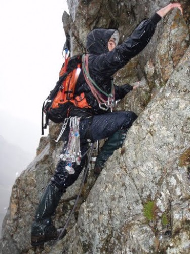
The climbers – Rob, Simon C, Carmen and Pete – climbed the Cneifion Arete after having waited to do a route on the Idwal slabs.

Simon

We're queuing in the rain, just queuing in the rain…

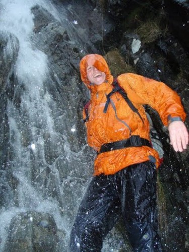
Wet Rob

Simon F and Debra went for a walk up Moel Siabod. Initially they had to go to a gear shop to buy the things they had left at the hut. After abandoning their scramble Debra had a slip and small fall near the summit which resulted in a bruised knee. Fortunately, they were carrying all of the emergency equipment needed, a head torch each, first aid kit, etc and were able to evacuate the hill under their own steam.

Saturday night the group enjoyed a fantastic vegetarian feast, sprouts being a particular highlight. The planned bake had to be replaced by a stew owing to the hut having no oven. Andrew was banned from meddling with the fire.

On Sunday the bikers headed to do a ride from a guide book that had been written by Donal's brother/sister/inlaw??? The high winds and heavy rain made getting lost on an unrideable track even more entertaining, but at least the company was good.

On Sunday the climbers did a little wet cold windy walk near Conway. Simon F and Debra headed home to tend to Debra's injury.

Present: Donal, Carmen, Simon Caldwell, Simon Fox, Debra, Andrew, Rob, Gordon Pacey, Margert, Pete Bradshaw and me.

Mike

Kinder Lingers

Thursday, June 4th, 2009

A belay with a viewI've been meaning to climb at the Kinder Downfall area ever since I saw the photo of Zig Zag in On Peak Rock some 15 years ago. other than a quick scramble up the downfall itself, circumstances (normally in the form of rain) have always conspired to thwart my plans, until last weekend when we finally made the 90 minute walk from Snake Pass.

It was hot and sunny with a gentle breeze gale to keep the midges away as we eventually reached the crag. Zig Zag (VDiff ***) was out of the sun and in the wind, so extra layers were donned and Carmen quickly reached the top – the route has more jugs per metre than any other route I've done! Somehow it was both shorter and less exposed than it appears in the photos, but the climbing is all superb.

The Mermaid's Ridge pitch 2As we descended we noticed we were no longer alone – some-one was abbing down near our intended next route, Great Chimney (HS 4b ***). Bloody top-roping punters, they get everywhere, trust our luck to have to queue at a crag nobody ever goes to. It soon became clear that this particular top-roping punter was Sam Whittaker cleaning a death-on-a-stick Last Great Problem, so we had our route to ourselves. A tricky route (ie I made a fist of it) but got to the top successfully in the end, muttering about sandbags. Briefly watched the LGP (quick progress was being made, I half expected to read the UKC headlines that evening reporting a successful lead, but nothing yet) before wandering off to the next buttress.

Here we did The Mermaid's Ridge, a 2-pitch HS (or VS in Rockfax) 4b, 4c *** – I led both pitches, and each was worth 3 stars in its own right. Worth the long walk just for this one route.

Final destination in our brief tour was Kinder Upper Western Buttress. Carmen led South Wall (VDiff **), likened in the guidebook to Heaven Crack at Stanage – a very pleasant route but a bit short. It was getting late by now so I abandoned thoughts of Extinguisher Chimney (VS 4c ***) and decided to have a quick look at Spike Chimney (Diff **). But as we approached, a peregrine appeared noisily from the adjacent chimney and flew round screeching wildly.

Sensing that perhaps we weren't welcome, we packed up and after a quick solo of another Diff out of harm's way, went home.

A great place to go, I'll try to arrange a club trip over the summer.

More photos here

Ambassador, with this crag you are really spoiling us…

Sunday, May 10th, 2009

Still suffering after last weekend's run, we couldn't face the early start needed to join the others in Grindleford for 9am. So a very lazy start saw us arrive at Agden Rocher at about 12.30.

Agden where? No it's not the best known crag in the Peak District. But unusually for me, it's not some scrappy little choss-pile either. In fact, it's probably the most under-rated crag in the Peak. This is largely due to the 1983 guidebook, which gave it a worse write-up than the (genuinely bad) Stannington Ruffs. 'Rockfall is probable', 'climbs rely on suspect rock', 'changes in grade will occur with time', 'the top is rubble merging to grass', and so on.

The reality is rather different. Although there is some loose rock, there's far less than at many popular limestone crags, and the chossy topouts on parts of the crag are no worse than those at Millstone. To its credit the 2005 guidebook goes some way to putting the record straight. 'Plenty of sunshine', 'position and outlook unrivalled in the Peak'. Sadly, it gives a very abbreviated coverage of much of the crag and many worthwhile routes are described as 'poor'; but it's a start!

The New Foggy Dew - the suspect block in the bottom leftWe'd been many times before and already done most of the 'classics', so we started with the first decent-looking route we came to, "The New Foggy Dew" (Severe). This replaced "The Foggy Dew", an old Diff that was lost in a rockfall sometime in the late 70s, and starts below an alarming-look semi-detached block before moving right beneath it as quickly as possible. The block is mentioned in the 1983 guide as 'about to disappear' but it's still there 26 years later, so is presumably more solidly attached than it looks! From here the route steps back left in a fine exposed position before continuing direct to the top of the crag, with a though-provoking 'sting in the tail' to finish.

By now it was clear that the forecast sunshine had been and gone while we were still asleep, and the wind was more than a little bracing. But despite this, I headed for Double De-Clutch (VS 4c *), a fine looking arete. 20 minutes later and only 3m from the ground, I finally admitted defeat, as I couldn't do what was presumably the crux, so I finished up the adjacent corner of Disappointment (VDiff) instead. A suitably named route in the circumstances, though with some surprisingly good climbing. Carmen seconded up the arete I'd backed off, and made me feel better by finding it tough.

By now it was getting cold, so I stepped down a gear with Agden Arete (HS 4a), described as 'poor' in the new guide, but I've learned to ignore such things. And it turned out to be a very nice route – too disjointed to be worth a star, but with some interesting climbing. After a hard start, it was a pleasant VDiff – maybe HVD 4b overall.

Finally, in attempt to get out of the wind, I led Square Chimney (VDiff), the original route of the crag first climbed in 1914. It turned out to be no more than Diff, which was just as well, as the long-threatening clouds arrived in force and we were duly rained off the crag.

We'll be back for more before too long, and I'd recommend the crag to anyone interested in some quality climbing off the beaten track. We've done loads of good routes at VS and below, and for the non-punters among us there are many more starred routes from HVS up to E4.

GL3D Lakeland Challenge

Thursday, May 7th, 2009

The Great Lakeland 3 Day is a three-day run in the hills, covering a total of about 80 miles and a squillion feet of ascent. After 2 previous attempts (one successful, the other less so), we were back for our third go.

This year we started in Braithwaite near Keswick. After an excellent Last Meal in the Middle Ruddings Inn on Friday evening, we were up bright and early the next morning, raring to go. Ahem.
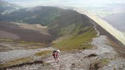
After a gentle start along a pleasant footpath, it was uphill all the way via Grisedale Pike to the first control on Hopegill Head. We rejected the undulating ridge of Whiteside due to its extra ascent and instead headed steeply downhill into the valley – possibly a mistake as we ended up wading through thick heather, but with a bit more luck/judgement we'd have found a grassy way down. This took us eventually to the second control, north of Crummock Water.

Next up the rarely visited valley of Mosedale to what looked from a quick glance at the map like a small hill, Hen Comb. Appearances can be deceptive, despite its modest 509m height, it was a long way up!

From here, a long rising traverse took us to the High Stile ridge, and a control on High Crag from where we had good views of climbers on Grey Crag – in the sun and out of the cold wind it looked like an excellent crag choice. A nice scree run into Ennerdale (not yet run out as hardly anyone goes this way) led us towards the next control on Steeple on the other side. Most people apparently followed a forestry track to pick up a footpath at the foot of the north ridge. But the map we were using didn't have the footpath marked, so we attempted to traverse up by the edge of the forestry plantation to climb onto the ridge from near Mirk Cove on its eastern flank. I say 'attempted', as we managed to miss the edge of the forest and ended up fighting through dense conifers for a couple of hundred interminable metres. Despite this, I think it was a good route choice – but could have been a lot better with more care! The corrie itself was an impressive place, and would repay a longer visit, there looked to be some good scrambling possibilities.
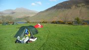
The rest of the day was relatively uneventful, with a final slog up Seatallan before a descent down the beautiful valley by Nether Beck to an idyllic camping spot in a field on the shores of Wastwater. A splendid sunny day, despite the cold wind at times, and with beer available courtesy of Joe, plus the luxury of a few spare hours before sunset, a perfect end to the day.

A rainy night followed, and so we were expecting a damp day to follow, but the next morning the rain stopped, the clouds thinned, and the sun appeared.
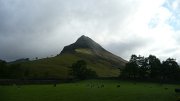
No gentle start today, with the first control on the summit of Yewbarrow, 550m above us. From here, we followed the ridge up and along to Pillar for control number 2, accompanied by patchy sunshine, a bitterly cold wind, and occasional hail showers.

The next control was a loooong way away, on the summit of Great End. But at least we had the luxury of a relatively flat few miles as we traversed round the side of Kirk Fell, followed by the climbers' traverse past Napes Needle on Great Gable – a few hardy climbers were out despite the cold wind. The flat section ended abruptly at Esk Hause, with a steep 450m ascent up The Band ridge on Great End. For some reason hardly anyone ever goes up this way, and there was not much path to speak of, but in different circumstances it would make a fine way to the top.

From the summit we had a good view of some heavy hail falling over Glaramara, where we were headed next – for once it paid to be fairly slow, the hail had disappeared by the time we arrived. As indeed had the control marker – we spent a good 20 minutes looking for it until 2 others arrived and confirmed that it wasn't there. Oh well, at least it gave us the chance to stop for a while 🙂
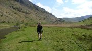
A descent across complex terrain (luckily with good visibility) into Langstrath, was followed by the day's sting in the tail, an unrelenting 550m slog up Ullscarth. We couldn't face losing too much height again after this, so rather than take the direct down-then-up route to the final control on Steel Fell, we went for a longer-but-gentler line, traversing the head of the valley around the aptly named "The Bog". All that remained was a pleasant (though knee-wrackingly steep) descent down the ridge to the campsite at Steel End.

Another fine site with the chance to chill out with some beers. But the forecast for the next day was poor, and the day expected to be long, so we were in our sleeping bags before dark.

Having been kept awake for half the night by the strengthening wind and rain, I managed of course to fall into a deep sleep moments before being woken by the alarm at 4.45am. One of the hardest parts of the day followed, namely getting out of a warm dry tent into a cold wet and windy outdoors. After a bit of packing and faffing we finally set off at 6.25.
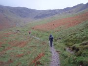
The first control was a pig – the summit of Helvellyn – made worse by the fact that the second control was by the side of Thirlmere, just a couple of miles along the shore from our start point! The ascent was warm and muggy (or as warm and muggy as it gets at 7am) but the summit was very, very cold, so we ran down as fast as we could. 1 hour 35 minutes up, 35 minutes down again, and we were back where we started.

The next path was visible directly across the lake, but to get there we had to walk all way round the shore. At least it was flat! Which is more than can be said for the ensuing 300m ascent up increasingly boggy ground to High Tove and across the watershed to Watendlath. There followed another of those bits that look simple on the map, but turn out not to be. Mainly in this case due to loss of concentration, I thought that every minor knoll and bump on Brund Fell was the summit, but as ever it turned out to be the steep craggy bit in the distance after all.

All the while the rain continued – it hardly stopped all day – while the wind gradually grew stronger.

Next down to Rosthwaite by a good direct line; feeling pleased with myself for finding it, I then let the side down with one of those brain waves that might work well, but rarely do.
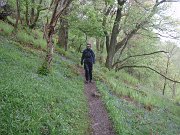
The next control was on Robinson, on the other side of Dale Head. Instead of taking the obvious steep path straight up to Dale Head, we decided instead to head for Honister Pass, and then contour up the apparently grassy hillside to the col just before Robinson. The reasoning being that the weather was pretty foul so staying as low as possible for as long as possible could only be a good thing, even though the route was quite a mile or two longer.

The first part of the plan went well, though Honister Pass looked like it had the potential to become a morgue (OMM joke). However, the hillside that the map showed as grassy turned out to be an unbroken slate slag heap, and it quickly became obvious that it would be slow or impossible to find a way across. So we headed up Dale Head anyway, and then compounded my mistake as I attempted to traverse round the top of the hill instead of going to the summit; unfortunately I'd mis-set my altimeter and we ended up trying to traverse some 50 metres too low. At least we weren't competing against anyone else, just against ourselves – if our aim was to beat other people then we'd have given in before we started!
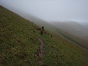
As expected, the weather on the ridge was 'exciting', and we had to fight to make any progress at all. So as soon as we reached the summit we fled as fast as possible down to the next control being at Newlands Hause. The end now started to feel close (even though it was still 6 miles away), as the last major ascent was out the way. A long traverse on sheep tracks above Sail Beck, up-and-over Sail Pass, then a final quick pull to the summit of Outerside was followed by a gentle descent back to Braithwaite and the finish.

All in all a truly excellent weekend (though it didn't always feel that way at the time!). Thanks as ever to Joe Faulkner and everyone else involved. As we battled through the rain on Monday morning I promised myself this would be the last time. But maybe I'll keep the May Day weekend free next year, just in case…

My photos are here.
Maps of our routes:
Day 1
Day 2
Day 3

Results and GL3D details

Vital Statistics. Distances were probably slightly longer than shown, and ascent figures slightly less:
Day 1. 24 miles, 8500 feet ascent, 8 hours 40 mins
Day 2. 21 miles, 8850 feet ascent, 9 hours 57 mins
Day 3. 27 miles, 9000 feet ascent, 9 hours 50 mins
AGM – not for another year …

Monday, November 10th, 2008

…do you have to sit around drinking beer listening to an ever dwindling committee plead poverty.

All went quite well this year despite being only Simon Fox and I sat at the top table. In a show of competence set to rival John Sargent's mad dancing skilz I managed to not nominate the only person ever to want to be on the committee! Sorry Richard – if I don't nominate him next year, make sure you do, and shoot me.

We tweaked the constitution a bit, chatted about the Peak Scar clean up (well done Pete for volunteering and, Gordon, Carmen and Simon C for their efforts log shifting on Sat), tried to enthuse people to go on walks which Richard has (despite the snubbing) volunteered to co-ordinate and presented the new calendar of meets.

We had a gallant attempt at deciphering the accounts – suffice to say we need to make the hut meets self sufficient. Some socials would be nice to complement the talks being co-ordinated by Cef, and Curries are recommended as popular – we live in hope.

2 dates of note: route setting at Oaklands Sat 29 Nov (with curry to follow ?) and Xmas meal Sat 20 Dec.

Please sir, I want some more…

Sunday, November 2nd, 2008

One weekend running around in foul weather wasn't enough, so at the crack of dawn on Sunday morning, Carmen and I headed off to Edale for the Dark & White Mini Mountain Marathon – a 3 hour score event. As forecast, the cloud was low, it was drizzling, and it was windy – ideal conditions in fact.

After a 5 minute warm up running through the village and fields, and it was steeply uphill to the first control, on the lower slopes of Kinder, where we reached the cloud base. An easy run on paths for a mile or so, then it was north west into the uncharted peat fields, heading for a control on the far side of the plateau. My navigation was spot on as usual, so we only wasted 15 minutes trying to work out where on earth we were once we reached the edge. Luckily, I guessed right, and we soon found the control.

Down the other side towards Snake Pass, steep heather slopes finally giving way to a good path. After following this to the next side valley, we gave up hope of another 30-pointer further down, and it was back up and over the top, this time without going wrong. A control near Nether Edge, then down towards civilisation, and a mad dash along public footpaths to pick up an extra control, arriving back in Edale with 90 seconds to spare.

150 points, which was enough to put us in 1st place out of 11 teams in the mixed pairs class, three cheers for us! The leader in the men's class somehow managed 268 points or so, which can't have been far off every control.

Somewhat disappointingly, there were no TV crews waiting at the finish, despite the biblical weather, and the fact that at that time almost half the competitors were unaccounted for.

The next event in the Dark and White league is on 7th December, somewhere in the northern Peak District.

Definitely not a day for the hills

Tuesday, October 28th, 2008

Approaching the startSo said Andy Mayhew's excellent Mountain Weather Forecast for last weekend, at ukweatherworld.co.uk. And in most people's view, he'd have been absolutely right.

But we and over 2000 others begged to differ, and so Alan, Rob, Pete B, Carmen, and I headed for Borrowdale to take part in this year's Original Mountain Marathon (OMM). The weather earlier in the week had been poor to say the least, with heavy rain and widespread flooding in the Lakes, and apparently on Thursday it was touch and go whether the event would go ahead, but in the end the all clear was issued.  

Saturday morningCarmen and I camped overnight at the event centre, Seathwaite Farm at the head of Borrowdale. The winds were strong, but not as strong as they were due to get later, when torrential rain and 110mph gusts were predicted. Our start time was 9.01, when the winds were picking up but the rain not yet falling. Carrying slightly more than usual due to the weather, we opted for a cautious route choice; we were doing the Long Score course, which gave us 6 hours (7 in a normal year) to visit as many controls as we could. Rather than doing as usual (getting over-optimistic, and ending up with a mad dash to finish in time), we decided to get a couple of high level controls to start, and then take the lowest route possible towards the mid camp (at Gatesgarth Farm near Buttermere) leaving plenty of time spare.

Near Styhead PassSetting off towards our first control, near Sprinkling Tarn, the winds soon asserted themselves, and making progress towards Styhead Pass became increasingly slow and tiring. After this, we quickly abandoned plans to head uphill to a high scoring control above the Corridor Route, and instead headed down towards Wasdale Head. A couple of good but easy controls on the lowest slopes of Kirkfell, and we headed up the path towards Black Sail Pass.

The 'missing' controlBy now, the rain was falling heavily and the winds increasing yet further, even when the wind was behind us it was sometimes hard to make much progress due to the effort needed to stay upright! After a brief detour at the pass where I started to lead us uphill instead of down (oops), we picked up another control before descending towards the upper reaches of Ennerdale. Or rather, we would have picked up another control, but it wasn't there! There was a marker post to show where it should be, and it matched the map, so we're convinced we were in the right place. Perhaps it had been blown or washed away.

The next problem was crossing the stream in the valley bottom, which by now was a raging torrent. We watched 2 people ahead of us link arms and cross together, the water was at waist height and they struggled before finally making it across, so we took about 1 nano-second to decide on a half mile detour to cross a bridge downstream. Even this was tricky, requiring a thigh-deep crossing of a side stream to reach the bridge.

We then followed another stream up to reach the col between Haystacks and Brandreth. This was another torrent, completely uncrossable until we got to the col, which was a shame as the path was on the other side! So we had to go up scree and heather on the left, nervously eyeing the drop to the water below. Uphill again, into the teeth of the storm, walking was by now becoming virtually impossible but we managed it somehow, and at lastmanaged to find a tricky control relatively easily.

Bridge crossing From here it should have been an easy descent down the old mine track to Buttermere. But first we had another river to cross, this one looked unfordable (2 people in front turned back), so another long detour up stream until it was shallow enough to wade – only thigh deep at this point, and 50 feet wide. Even following the mine track back down was slow and difficult, it was like walking down a river for most of the way, knee deep in places, with numerous stops to cross side-streams/waterfalls joining from the right.

We thought we had it bad until we passed the main bridge in the valley bottom – the bridge was deep under water with just the hand rails poking out the top, people were having to use these to haul themselves across, exciting stuff.

All that remained was a trot down to the midcamp where we arrived with 3 minutes to spare – only to be told that the event had been cancelled and we had to walk back over Honister Pass!

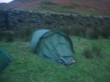
Our tent on Sunday morningTo cut a very long story short, the road was closed before we got going and so we ended up having a virtually sleepless night camped at Gatesgarth Farm in a tent that did its best to collapse, but somehow just about stayed up. The next morning we joined the procession of people walking over Honister Pass back to Seathwaite.

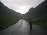
Approaching Honister PassSo in summary – definitely not a day for the hills, but it nevertheless managed to be one of the best, and certainly most memorable, days I've ever had in the mountains. My only regret is that the event was cancelled – Sunday was relatively dry and sunny, with only light gales!

Postscript.  Apparently there was another mountain marathon in the area at the same time, but it was very different. The one we were on, everybody was self-sufficient, and ran round in pairs, carrying tents, sleeping bags, spare clothes, and food for 2 days. Almost everyone got off the hill OK on Saturday, and the few who didn't spent a safe (but probably thoroughly unpleasant!) night camping in the hills before descending the next morning. A dozen or so had to be helped off by mountain rescue, mostly with minor injuries or mild hypothermia, everyone else got themselves down safely.
Descent from HonisterIn this other event, by contrast, 1700 ill-equipped runners were unaccounted for, and hundreds were trapped on the hills overnight. They were lucky to still be alive when they were finally rescued the next day. But you've probably heard about that one already…

Sorry about the poor quality of the pictures, it's hard to take good photos when you're being blown off your feet!

An appeal has been set up to collect money for the local mountain rescue teams – the majority of us didn't need them, but it's always good to know they're there!
http://www.justgiving.com/theomm08-mrtdonation

Llanberis

Tuesday, October 21st, 2008

The Mod start to the scrambleA return visit to the Chester MC hut just outside Llanberis, by the road on the way up to Cloggy. And once again, all plans of climbing there were dashed by rain, wind, and more rain.

Saturday dawned relatively bright, with blue sky and sunshine in between the clouds. A few of us went off to look at the Parson's Nose arete, near Crib Goch, and inevitably as we neared the end of the hour long approach walk, the last of the sun disappeared and the clag began to descend.

We considered the Diff start, and the scrambling start, and opted for the one in between, a Mod up the side of the slab. I led it, Carmen, Peri, and Peter climbed together on the rope, then Rob soloed behind to take the gear out. It felt rather precarious for the grade, but cold rock and a general air of dampness probably had something to do with it.

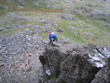
On the areteThe rope went away just before the hard bit (typical), which was the downclimb into the notch where the scramble comes in. The rest of the route was easier, but didn't always feel it due to wet rock and a cold wind – the rope nearly came out again a couple of times, but not quite. And the proper rain held off until a few metres from the top, which was nice.

Peri hadn't been to the summit before, so we headed upwards, soon joining the massed hoards who'd come up the tourist path next to the railway. The highlight was the group of 'lads' decked out in Bermuda shorts, plimsolls, and cans of lager, zig-zagging precariously up the path.

A quick pause at the top, with the horizintal rain continuing, and we decided to avoid the crowds by descending the top of the Snowdon Ranger path along the top of Cloggy (which was black and dripping), then cutting down to the valley and back to the hut.

On the way down we met Gordon and Maragaret on their way up, and they'd just passed Annie and other Margaret on their way down. Nobody met Simon and Debra, who'd got half way up a slippery scramble on Cloggy, thought better of it, and then walked up Snowdon with everybody else instead. It is rumoured that Donal and Mike went mountain biking, but we only have their word for this.

The happiness coach in actionMike kept us all entertained for the evening with his sparkling wit, and Mike and Rob between them kept us well fed. We then stole Annie's cake for pudding.

Mike manages to fill everyone with joySunday dawned wetter and windier than the day before, so nothing much was achieved, apart from a session at the climbing wall for a few of us, and lots of shopping for everyone else. Being a vegetarian, Mike didn't have enough strength to cycle uphill, so was last seen looking for someone to chauffeur him to the top so he could use gravity to get down again.

Things we did on a Blustery day…….

Monday, August 11th, 2008

Climbers on High NebAfter a load of Emails were sent whizzing around the internet the High Neb area of Stanage was finally decreed. So I set off with Kate, Debbie and Liz and from the other side of York Rob, Peri, Carmen and Simon were also getting mobile.

Driving down in the car I informed the Ladies that their first job of the day would be to guide us all to the Crow Chin area (I had provided four different guides that covered Stanage). After some debate… "where are we going ?…. is it in this book?……where are we parking?…… I can't read in the car…..", Debbie, Kate and Liz were fairly confident that they could find the place.

The weather did look a bit grey and cloudy as we drove across the Strines moor and up past Bamford edge. NB taking the short cut up past Bamford edge was a good idea as a local cycling club were on a training ride/race and the peleton was blocking traffic from overtaking.

On the walk in I texted Peri to find they were in Outside, Rob was trying to change the rope he had ordered from them (he didn't like the colour, you know that shade of pastel is so last year….). Following my "guides" we walked in on the bottom path and the top path, over shot slightly but we got there in the end.

The weather looked like it could drown us any minute so I decided to start on something nice and easy Kelly's Crack VDiff ** and just as I started up some small drops of rain started falling. As the crack was fairly sheltered it was very dry. Half way up the route Peri and Rob arrived grumbling about the walk in and the weather, they hid in the cave and had a coffee and waited for the rain to end. It didn't last long and it was the only small shower of the day. So now with three leaders available a major assault was launched on the cliff, of course we had to work around the other two small teams of climbers who were there but everyone was very friendly, even when Rob was dropping abseil ropes on people.

The weather did play pretty nicely, we had moments of bright sunshine and no wind but most of the time it was cloudy and very windy. People topping out on climbs were almost lifted over the edge.

Debbie on her first out door lead, Peri climbing the HS

Debbie on her first "trad" lead, Peri on October Slab HS **

We gently cajoled Liz, then Kate and Debbie into leading their first "outdoor trad" route on pre-placed gear that the more experienced members of the group had placed. We also oversaw them setting up solid belays at the end of the route so they could safely bring up the second

Of course Rob had a plan that he had not mentioned to the rest of us, he was up for soloing or leading everything under E4 at the crag (HVS 5B then a massive jump to a single E4). Have a look at Rob's climbs for the full list.

meanwhile elsewhere on Stanage the other YAC team were playing …

Declaring "bah humbug" to Crow chin both had their hit list of climbs for the day.

Carmen attacked Cosmic Crack (VS 4c **), X-Ray (HS 4b *), Cave Buttress (S 4b **), most of the things on her list. She also led Heather Crack (HVD *) and Overhanging Chimney (S **). Simon didn't get to anything on his hit list as they couldn't be bothered walking that far! He led Electron (VS 5a *), Typhoon (VS 4c **), Inaccessible Crack (VS 4c ***) and Straight Crack (HS 4b *).

Memorable incidents include Carmen almost blown over as she topped out on Cosmic Crack. Simon spending over an hour repeatedly climbing up to, down climbing from the crux of Electron, before eventually climbing to the ground, taping up his bleeding hands, eating some lunch, and then leading straight to the top! Carmen could possibly have exchanged some good Anglo Saxon expletives with Peri when she found out that she could not reach the crucial holds on the crux of Typhoon.

We had a great time at Crow chin, the ladies and I left at about 6:15. This allowed Rob and Peri to go and find Simon and Carmen for their lift home. Finding them at High Neb area Peri made short work of the classic High Neb Buttress VS 4c *** with just a little wibble, before heading home at 8.15

More photos …